Wednesday, March 28
Several watches and warnings were in effect for counties across Central Texas as strong storms moved throughout the area.
See the archived blog for details.
This weather blog has concluded and will not update unless weather patterns change.
BLOG
1:20 p.m. UPDATE
According to Albert Ramon, the heaviest rain is moving out of Central Texas. Houston is the next big metro area to be affected by severe weather. Southeast Texas is under a tornado watch until 9 p.m.
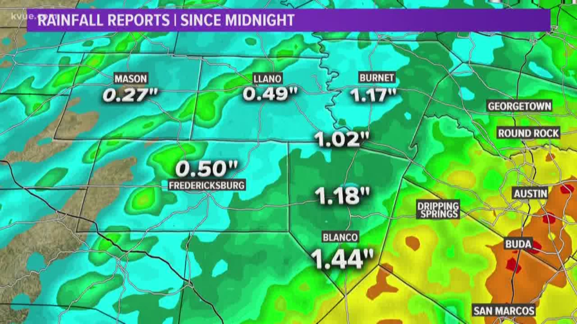
5.52 inches of rain fell at ABIA since midnight. Here's a look at some of the highest rainfall totals reported so far:
10:41 a.m. UPDATE:
Flash flood warning for Austin metro area until 1:30 p.m.
9:47 a.m. UPDATE:
A nasty storm is moving over San Antonio and has produced 1.25-inch hail.
Here's a hail chart to put things into perspective:
9:22 a.m. UPDATE:
A severe thunderstorm warning is in effect for Atascosa, Bexar and Medina counties, affecting Alamo Heights, Balcones Heights, Castle Hills and Cross Mountain, until 10:15 a.m.
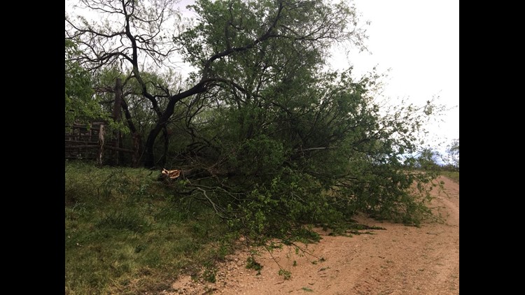
Storm damage in Central Texas after March storm
The storm has a history of heavy rain, lighting gusts up to 60 mph and could produce up to ping pong sized hail.
8:01 a.m. UPDATE:
Flood warning in effect for Onion Creek at U.S. 183.It's expected to crest just above flood stage at 174.5 feet. No structures will be impacted.
6:41 a.m. UPDATE:
The flash flood warning is in effect for Comal, Hays, Travis and Williamson County, affecting the cities of Dripping Springs, Buda, Hays, and Kyle, until 9:30 a.m.
6:30 UPDATE :
According to Erika Lopez, the 12-year rain record at ABIA was broken with 4.22 inches of rainfall recorded since midnight. The previous record of 1.86 was set in 2006.
Hays County, Travis County, Williamson County are under a flash flood warning until 6:45 a.m.
Burnet, Caldwell, Fayette, Hays, Lee, Milam, Travis and Williamson County are under a flash flood watch until 7:03 p.m. More showers and thunderstorms this evening could create conditions for flash flooding.
According to the national weather service, drivers should be cautious while the sky is dark because it will be harder to recognize flooded roadways. Currently, there are 60 crossings closed in Austin.
CLOSURES AND DELAYS
SCHOOLS
Lake Travis ISD said classes will go on as normal; however, due to weather conditions, portions of Bee Creek Road are closed. Buses will be rerouted accordingly. Expect transportation delays districtwide.
Texas State University said even with the heavy rainfall, there are no road closures, and classes will run as normal.
ROADS/ FLIGHTS/ POWER OUTAGES
GO HERE for information on the latest low water crossing closures in Austin.
GO HERE for information on Hays County low water crossing closures.
GO HERE for information on Bexar County low water crossing closures.
GO HERE for flight information at Austin-Bergstrom International Airport.
GO HERE to see the PEC outage maps.
GO HERE to see the Austin Energy outage map.
PREVIOUS DETAILS:
Strong and severe thunderstorms will be possible tonight as a Pacific cold front moves through the area. The main concern tonight will be from severe storms producing hail and strong winds. The risk area for severe thunderstorms includes most of the KVUE viewing area.


Scattered showers and isolated thunderstorms will remain in the forecast through the evening hours.

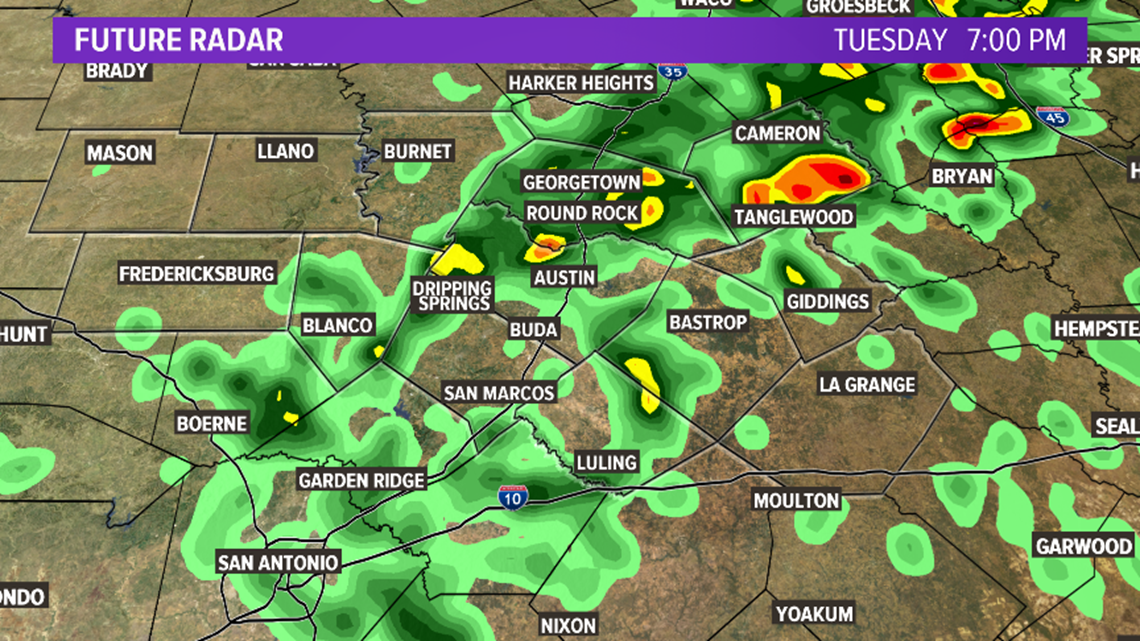
By midnight, a line of thunderstorms will approach the Hill Country. Some of these storms could be strong or severe.


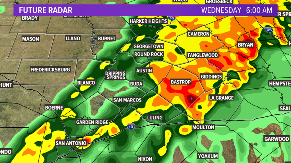
The line of storms is expected to moves across the IH-35 corridor by 2am Wednesday. Along with heavy rainfall, hail and strong winds will be possible with these thunderstorms.


By 6am Wednesday, the heaviest rainfall is expected mainly east of Austin.

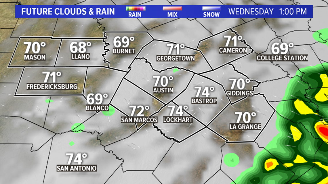
Most of the rain will exit the area by the early afternoon on Wednesday.

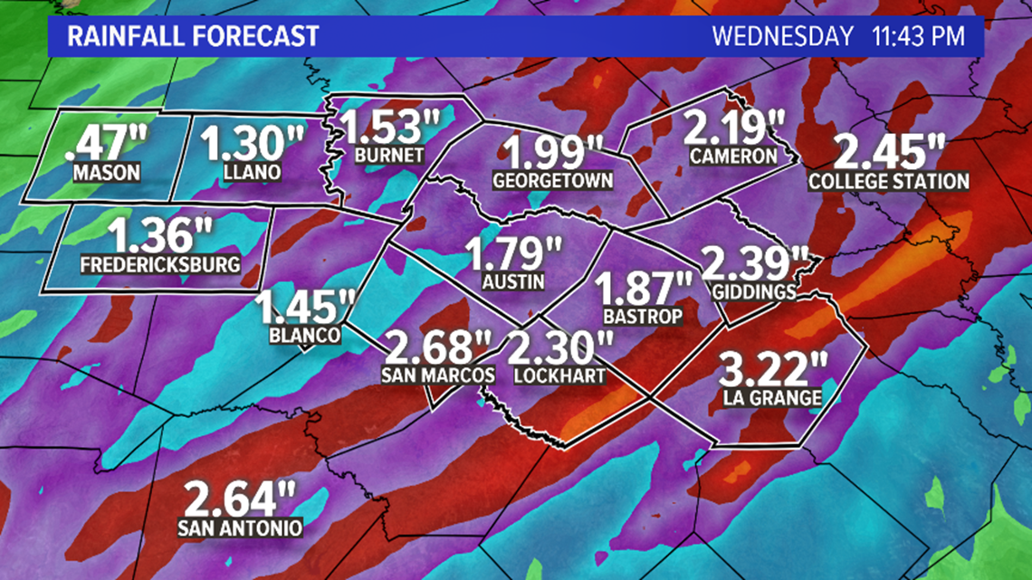
Rainfall amounts of one to two inches is expected, with isolated amounts of 3 to 4 inches possible.

