
AUSTIN, Texas — Austin’s floodplain covers about 10% of the city, the city’s floodplain management website shows.
That floodplain changes over time, partly due to development and capital improvement projects.
Austin’s Watershed Protection Department works to limit erosion and pollution and reduce flooding. The office launched “Rain to River: A Strategic Plan to Protect Austin's Creeks and Communities” in 2020.
The city will study the floodplain, update maps and improve regulations.
“We're not out to put more people in the floodplain,” Karl McArthur, Austin Watershed Protection engineer and project sponsor, said in a June 24, 2022 public meeting.
The Federal Emergency Management Agency (FEMA) updates insurance flood maps every five years. The KVUE Defenders found that more than half of the nation’s flood maps for insurance are outdated.
Travis County was last updated in 2008. Austin approved the latest map in 2019. It’s up to the communities to manage floodplain locations.
“We have a very dense population in Austin, a growing population. A lot of people moving here for the first time. A lot of people who maybe don't know that we are in the heart of flash flood alley. So there's a little bit of a safety aspect to it as well. You know, we want people to be informed and realize that we do have occasions like we had yesterday [Monday] from time to time here in Central Texas," Scott Prinsen, Austin flood early warning system program manager, said.
"It's just a fact of where we live. Californians earthquakes. Here, it's flooding. So we try to push that message out with, ‘Turn around, don't drown' and some of our other tools as well, atxfloods.com for example, to show the road closures around town. But yeah, it's a bit of a challenge."
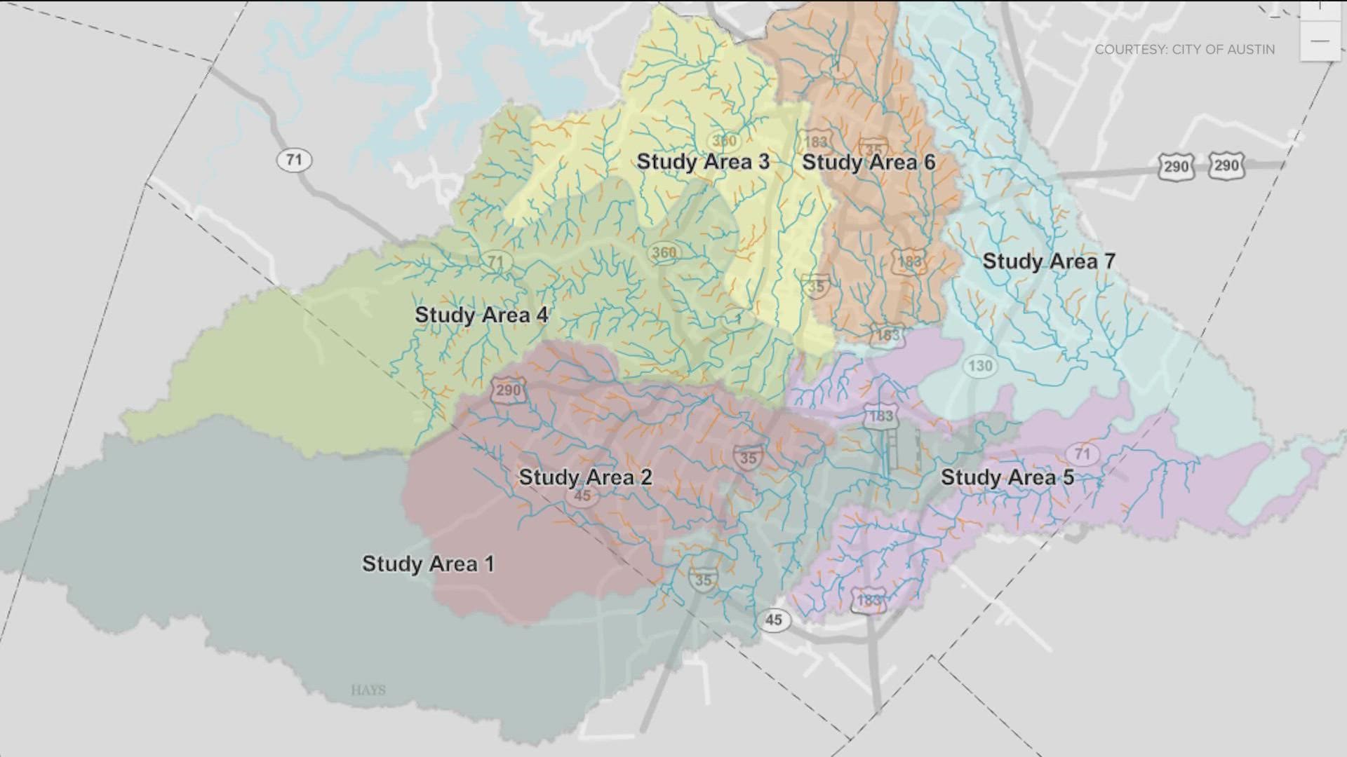
The watershed protection study will run until 2025. It separates the city into seven areas.
So far, the city completed 60% for area one and 4% for area two.
“These creeks like we saw yesterday [Monday], go from zero flow for many, many, many months like we saw recently to suddenly having— in the case of Shoal Creek, near 12th [street], 16 feet of water which that came up at a very short period of time in a span of about maybe 15 minutes or less. You know, that's a lot of water,” Prinsen said.
These studies have a real impact on homeowners.
The city bought hundreds of homes in the Onion Creek floodplain area. The latest report shows 815 properties purchased between 1999 and 2021. The city paid $144 million for the Lower Onion area alone.
The city wants your input for its water protection plan while the watershed protection department has an online community survey. It will be open through the fall.
Also, FEMA documents are available to help prepare for floods.
PEOPLE ARE ALSO READING: