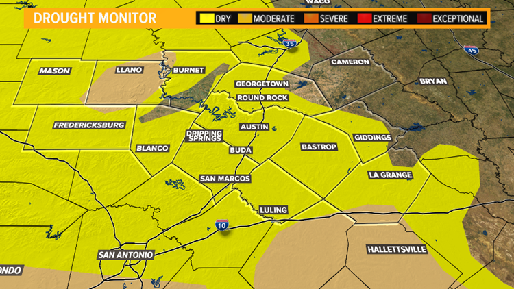
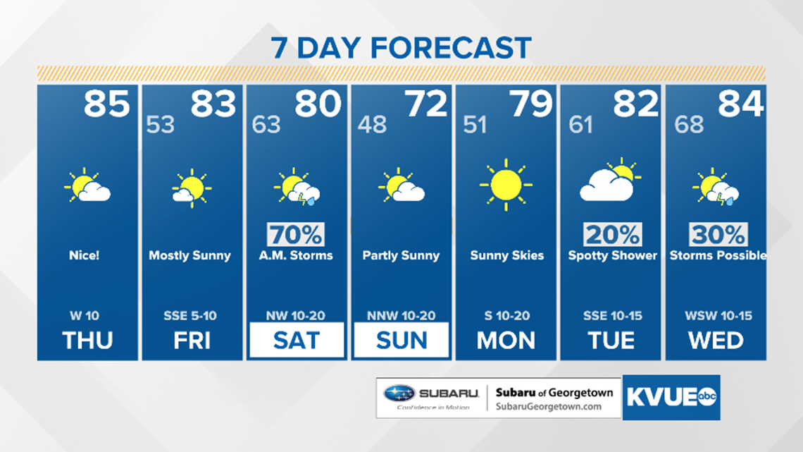
AUSTIN, Texas — In the wake of Thursday morning's Pacific cold front, dry and partly sunny conditions are expected to persist across the region.

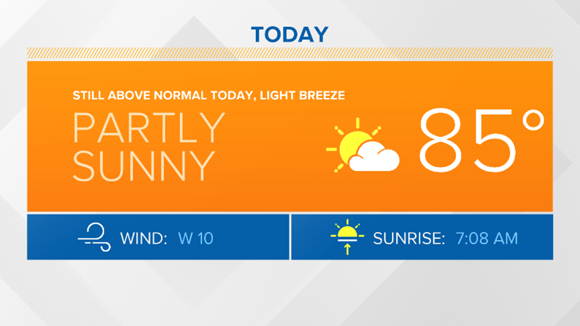
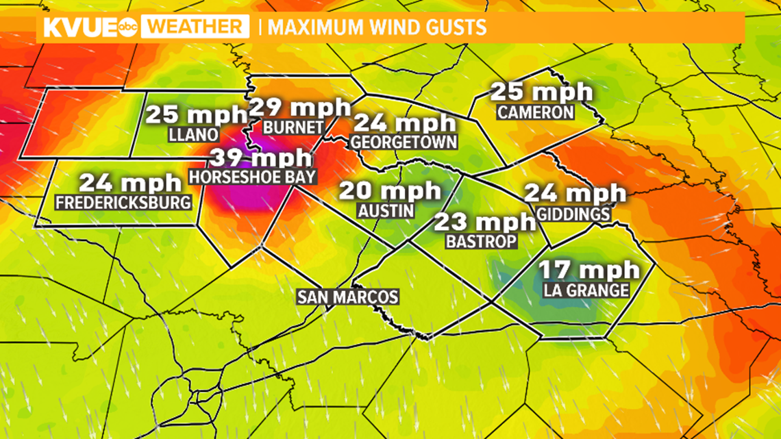
Dry winds behind the cold front bring an elevated to near critical fire weather risk along and west of the IH-35 corridor as peak gusts in some areas have exceeded 30 to 40 mph.

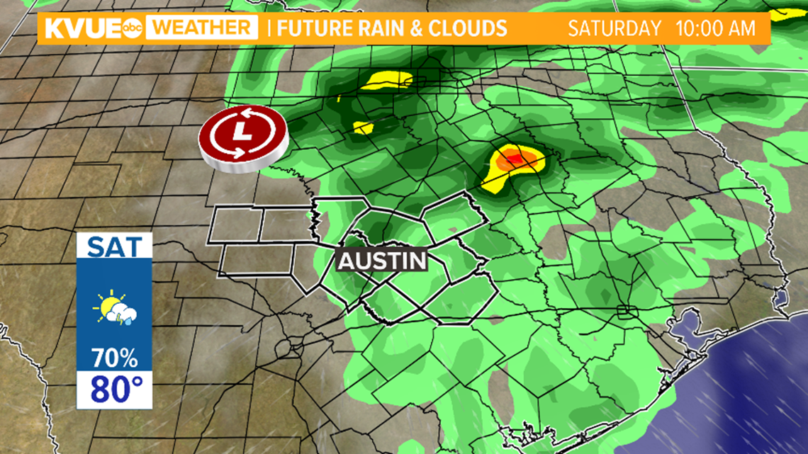
Rain chances are expected to increase as we move into the weekend. Our next weather maker enters the area on Saturday as an area of low pressure will bring rain chances ranging from 1 to 1.5 inches in some areas.
RELATED:
Most of the area should begin to dry out with a few areas still receiving light showers in the afternoon and evening on Saturday.
For the latest weather changes, please stay tuned to the KVUE Storm Team on-air and online.
PEOPLE ARE ALSO READING: