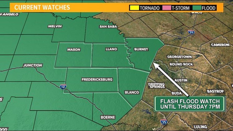
Central Texas — The flash flooding threat continues as a flash flood watch remains in effect through Thursday evening for the Hill Country. There is still a lot of moisture left, which will lead to continued rainfall for parts of central Texas. The rainfall could be heavy at times which will lead to runoff and continue to pose a flood threat across the Guadalupe, Llano and Colorado River basins.


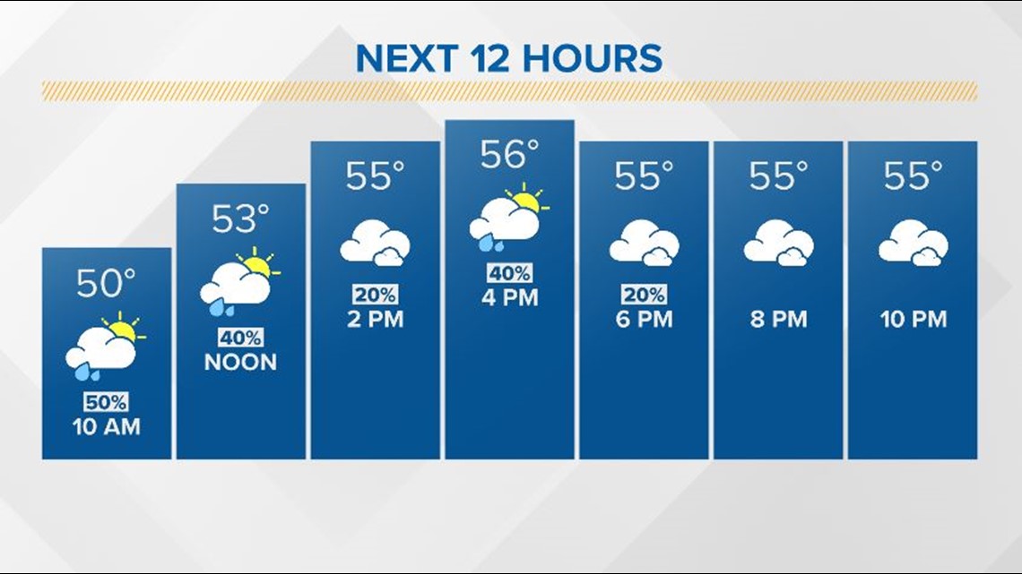
Although rain chances don't seem impressive Wednesday, the ground is already so saturated that any rain just adds to the flash flood and river flood risk.

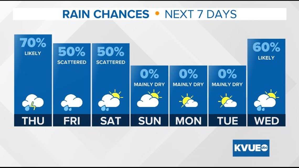
Rain chances increase significantly Thursday. This is when we could have periods of heavy rain again for central Texas.

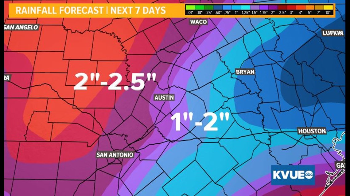
An additional 1 to 2 inches of rain is possible along and east of I-35. West of I-35 is our greatest concern with 2"+ inches of rain possible by the end of the week.

For all of the latest updates on these flooding concerns, be sure to keep track on KVUE ABC, KVUE.com, and with the KVUE Weather Team on social media.

