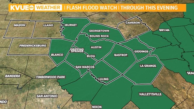
CENTRAL TEXAS — Due to ongoing rain, the saturated ground and rain in the forecast, a Flash Flood Watch has been issued through 9 p.m. Wednesday night.
Two to three inches of rain is expected through Thursday morning. This brings a flash flooding threat along roadways, underpasses and low lying areas as well as small creeks. Always remember to turn around, don't drown!
By 11 a.m. Wednesday, about 80 low water crossings were closed in the Austin area. Click here to check on the status of low water crossings.

Although we have seen minimal impacts so far, the freezing rain threat will remain in place for parts of the Hill Country through about midday Wednesday. If accumulation does occur, it will be light. Up to 1/10" possible.
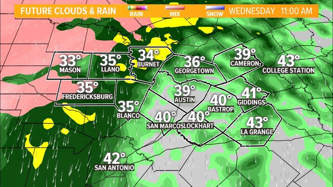
By this afternoon, temperatures will be too warm for any frozen precipitation, but rain showers will become widespread with moderate to heavy showers at times. This is when the possibility for some minor flooding will begin especially with saturated soils already in place from recent rain events.
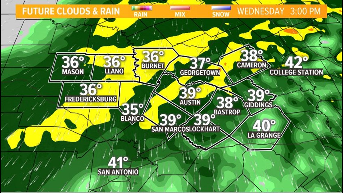
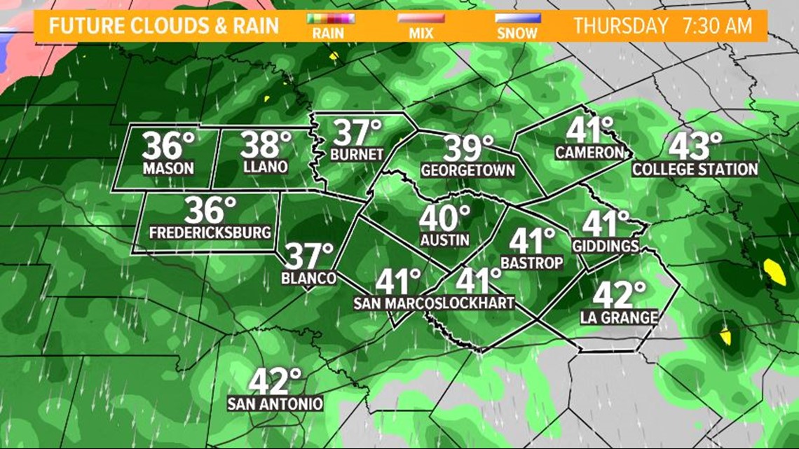
Showers will be ongoing through midday Thursday. By this time, we could see numerous closures of low water crossings, and elevated water levels in local creeks and streams. Keep this in mind for Thursday morning's commute!
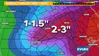
Expected rain totals will range from 2 to 3 inches along and east of Highway 281. We can expect 1 to 1.5 inches across the Hill Country.

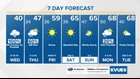
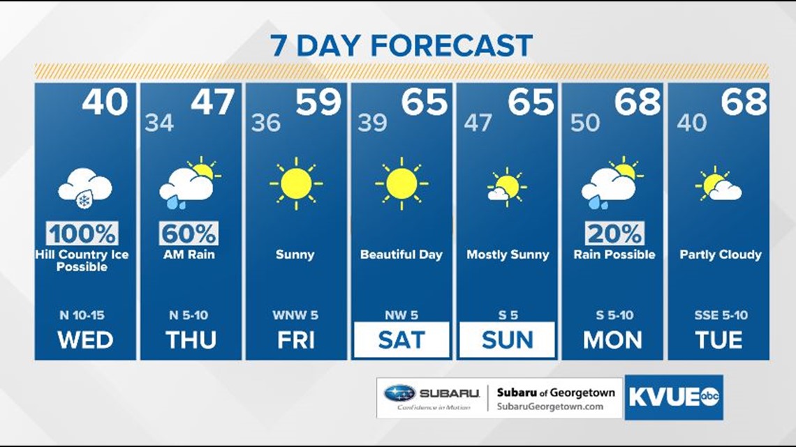
Rain chances will clear out by Thursday afternoon allowing for sunshine to return just in time for the first full weekend of 2019!
Stay up to date with KVUE as the forecast becomes clearer in the days to come. Download KVUE's app to stay up to date.