CENTRAL TEXAS — Note: This blog is no longer being updated as of Wednesday, Oct. 18. Stay up to date with the latest weather coverage, here.
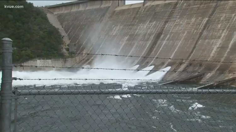
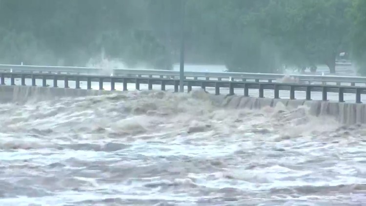
Four floodgates are currently open at Mansfield Dam on Lake Travis and officials said Wednesday afternoon, and they expect that four more are likely to open within the next 24 hours.
The most floodgates ever opened on Mansfield Dam was six in 1957. Five were opened in 1991. Mansfield Dam has 24 floodgates total.
The Lower Colorado River Authority said they encourage everyone to take immediate action to protect people and property on Lake Travis, on Lake Austin, on Lady Bird Lake and further downstream.
People visited Mansfield Dam on Wednesday to try to keep an eye on the floodgates. Several people found it hard to imagine what eight floodgates would look like and what that would mean for the rest of Austin.
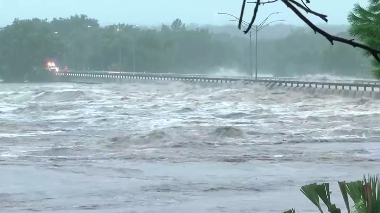
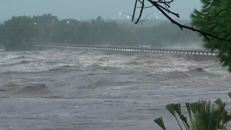
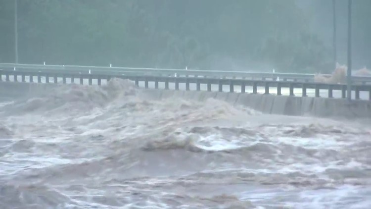
“Right now the low water crossing bridge a little bit downstream is covered and that’s with four open. Now with eight it kind of makes me worry about the people that live down the river you know what’s going to happen," said Veronica Ramirez, who visited Mansfield Dam.
"This is a historic flood," the LCRA said Wednesday.
In the past week, the LCRA said Lake Travis has captured more water than the City of Austin uses in four years.
When asked if people should evacuate their Lake Austin homes, LCRA said they should "take precautions."
According to KVUE meteorologists, Lake Travis is 143 percent full. The maximum height Lake Travis can reach is 714 feet before the water goes over the Mansfield Dam spillway. The closest Lake Travis has been to the maximum height was in 1991 when it reached 710 feet. The water has never in recorded history reached 714 feet.
KVUE meteorologist Erika Lopez said the lake began rising rapidly due to filtering of floodwaters from the Llano River. Floodgate operations at Mansfield Dam have the potential to change with more rain in the forecast for the Austin-area, Chief Meteorologist Albert Ramon said.
Sometime after 6 a.m. Tuesday, the Llano River crested at 39.9 feet: more than 10 feet above the flood stage. That's the highest height the river has been since 1997 and is the second highest crest in recorded history. The highest crest for the Llano River was in 1935 at 41.5 feet. Wednesday evening, the Llano River fell below flood stage for the first time since Monday, Oct. 16, Chief Meteorologist Albert Ramon said. But with more rain in the forecast for the Hill Country, Llano County officials fear the river could rise again. As a result, this could create more problems for Lake Travis.
RELATED:
NEED TO KNOW
The National Weather Service said early Wednesday morning the Colorado River was continuing to rise rapidly upstream from Lake Travis and is producing flash flooding along the lower shorelines of the lake.
RELATED:
The locations at risk for flooding include Lakeway, Hudson Bend, Mansfield Dam, Briarcliff, Point Venture and Volente. Meteorologists warn that roadways that connect these areas could be impacted by rising waters. High waters could also move into homes on the lowest shores of the lake.
Lake Buchanan is currently 98 percent full. Eight gates are open there and they may have to open more. That water will pass through Inks, LBJ and Marble Falls lakes into Lake Travis.
Those living downstream from Lake Travis are also asked to take precautions as the lake continues to rise.
The NWS warns that residents in the impacted area should move to higher ground.
As of 5 a.m., the Llano River is out of the "major" flood stage and has transitioned into the "moderate" flood stage. It's expected to be completely out of the flood stage by Thursday night.
In contrast, weather authorities said when the Llano River reached major flood stage at 38 feet Tuesday, homes in the water's path were capable of being "severely damaged and the lowest mobile homes destroyed in water up to six feet, some washing downstream." While covering the flooding in the Hill Country, KVUE captured video of decks, boats and large structures washing down the Starcke Dam in Marble Falls.
PHOTOS: Llano River floods 2900 bridge in Kingsland
The FM 2900 bridge in Kingsland washed away in the flood waters, according to transportation officials. It was located in an area of town emergency management officials warned would be severely affected by flooding. Authorities said many downstream homes in Marble Falls were also at risk for flooding.
Residents who live in homes along the Llano River are still asked to keep away from their homes as of Wednesday morning.
At 12:15 p.m. Wednesday, the Granite Shoals Police Department reported that the water in Lake LBJ was lower than normal and appeared to be stabilizing. Police said all areas of town were accessible for individuals who wanted to return home and assess damages to their property. If you would like large debris such as watercraft removed from your property, call the non-emergency number at 830-693-3611. Officials said the Granite Shoals water supply was not impacted by the floods.
SHELTERS OPEN FOR EVACUEES
Lago Vista evacuees can visit the Lago Vista High School Performing Arts Center for help. It's been set up as a temporary shelter.
If you live in Llano County, two shelters are open for people. The Llano County Office of Emergency Management said the John Kuykendall Arena & Events Center at 2200 W Ranch Road 152 and Lutie Watkins Memorial United Methodist Church at 800 Wright St.are both taking in evacuees.
Llano County Office of Emergency Management said shelters are being set up at the 1st Baptist Church and Inmans Kitchen in Llano. The Kingsland Community Center is also taking in evacuees.
Llano High School opened at 9:30 a.m. Tuesday for evacuees.
If you need to be evacuated, officials recommend contacting the Llano Police Department.
Granite Shoals evacuees are asked to head to the 1st Baptist Church, located at 505 south Phillips Ranch Road.
In Meadowlakes, evacuees can seek shelter at the City of Meadowlakes City Hall. Shelters in place are also available at First Baptist Church Marble Falls and the Burnet Community Center. The City of Meadowlakes and Pecan Valley are not accessible at this time.
The flood response shelter located at Marble Falls Middle School is now closed. Community members can refer to the City of Marble Falls Emergency Alert Center for shelter and residential updates.
PREVIOUS WEATHER BLOG:
Wednesday
7:30 p.m.: Lake Travis has reached 135 percent full.
6:00 p.m.: Lake Travis has reached 134 percent full.
5:00 p.m.: Lake Travis has reached 133 percent full.
4:30 p.m.: Llano County officials gave flood updates during a press conference. Officials said the family of the woman who was found along the Llano River has been notified, but they did not identify her because her death is still being investigated. Officials said since the Llano County and Kingsland water systems were compromised during the flooding, they will be handing out water at points of distribution. Kingsland residents can pick up water bottles at the community center and Llano County residents can pick up water at the junior high school located on Highway 71.
3:45 p.m.: Lake Travis sits at its sixth-highest height in history. Lake Travis could reach the No. 1 spot by Friday.
3:30 p.m.: A Flash Flood Watch has been issued for Williamson, Hays and Travis counties until 7 p.m. Thursday.
1:30 p.m.: Four floodgates have opened at Mansfield Dam at Lake Travis, and at a press conference, LCRA said they are currently projecting that four more floodgates will need to open at the dam in the next 24 hours. They encourage everyone to take immediate action to protect people and property on Lake Travis, on Lake Austin, on Lady Bird Lake and further downstream. Water from Lake Travis will reach Bastrop in one day and it will take five days to get to the Gulf.
11 a.m.: Lake Travis has reached 131 percent.
10:15 a.m.: The first confirmed death resulted from the Llano flooding. A woman's body was found at a low water crossing in Llano, officials said at a press briefing Wednesday morning. Officials are advising residents in Llano to stay in their homes and to avoid the roadways due to flooding and debris.
8:10 a.m.: A flash flood warning has expired for parts of Burnet and Travis counties due to a decline in the rate of the water rising over the last several hours, according to the National Weather Service. Burnet County
8 a.m.: San Gabriel Park has reopened, however, Lower Park Road remains closed, Georgetown police said. Blue Hole will remain closed until further notice, the department said.
7:35 a.m.: A mandatory evacuation was issued for residents of The Island, a condominium along the lake, in Lago Vista. City authorities said the power would be shut off as a safety precaution. People who live in low water areas were told to be aware of the voluntary evacuation procedures. Lago Vista High School's Performing Arts Center is open to evacuees as a temporary evacuation location.
7:14 a.m.: Lake Travis is 129 percent full and is expected to rise to 700 feet by mid-day. Floodgate operations at Mansfield Dam could change with more rain expected in the forecast, Chief Meteorologist Albert Ramon said.
6:30 a.m.: Lake Travis is 128 percent full at 695.81 feet, according to Meteorologist Erika Lopez.
5:11 a.m.: Flash flood warning extended for Travis and Burnet counties until 8 a.m.
5 a.m.: Flash flood warning for Lake Travis and Burnet County expires.
3:26 a.m.: Lake Travis is 126 percent full. It's the highest it has been since June 2016.
SCHOOL, BUSINESS CLOSINGS
All schools and businesses that were previously closed due to the flooding are back on their regular schedules Thursday.
SCHOOL, BUSINESS DELAYS
The following schools and businesses are delayed Thursday:
- Llano ISD will have a two-hour delay. Buses will also run on a two-hour delay and no breakfast will be served.
ROAD CLOSURES
Here are the updated road closures for Wednesday, Oct. 17.
The following roads are closed in Travis County:
- 600 block of Spicewood Springs Road -- west of Loop 360 near the Arboretum
The following roads are closed in Marble Falls:
- 400 - 700 Blk Avenue T (Between 4th St. & 7th St.)
- 100 Blk S Ave N (Huber) (Between Yett St & Backbone St)
- 1400 Blk Nature Heights Dr (Between US-281 & Commerce St.)
- 300 BLOCK CR 122 AT WILLIAMS CREEK
- 1500 Blk Resource Pkwy (Between US Highway 281 & W Innovation Loop)
The following roads are closed in Kingsland:
- Kingsland Slab CR 307/RR 3404
The following roads are closed near Llano
- CR 152 -- west of Llano
- CR 2241 --east of Llano
The following roads are closed in Williamson County:
- Johnson Park Bridge (Between S Yett St. & Johnson St.)
- CR 123 at Brushy Creek
- Harrell Pkwy at Old Settlers Park
- Summit St at Brushy Creek/Memorial Park
- Brushy Creek Road / Brushy Bend Drive
- CR 177 at Brushy Creek
- 805 Cedar Park Drive
- Ridgmar Road at Brushy Creek
- CR 177 at Brushy Creek
- Blue Hole Park Pedestrian Bridge
- CR 100 at San Gabriel River (bridge)
By 7 a.m. Wednesday, ATXFloods.com showed that 153 crossings were closed across Central Texas.
Click here for the flood operations report from LCRA.
Click here for more information on water levels being released from various dams compared to previous days.
Click here for historical water information from Lake Travis.
This is a breaking news story. KVUE will update this story as more information becomes available.
RELATED:


