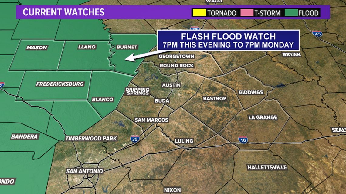
Coldest air in 10 months. — A strong cold front will move through the area tonight pushing in the coldest air since February. Showers and storms will be likely overnight as the front moves through. A few storms could be strong, but the greatest risk for severe weather will be southwest of Austin. Heavy rainfall could produce flash flooding, so a Flash Flood Watch will be posted for parts of the Hill Country.


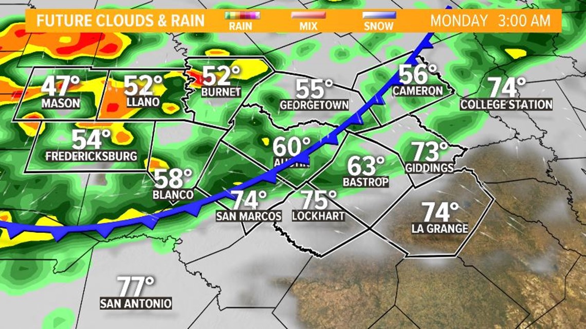
The front will be moving into the Hill Country by midnight.


3 a.m. | As the cold front approaches Austin, widespread showers and storms will linger behind the front, with lows already in the 40s for parts of the Hill Country. Strong thunderstorms will be possible, but mainly along and west of Interstate 35 at this time.


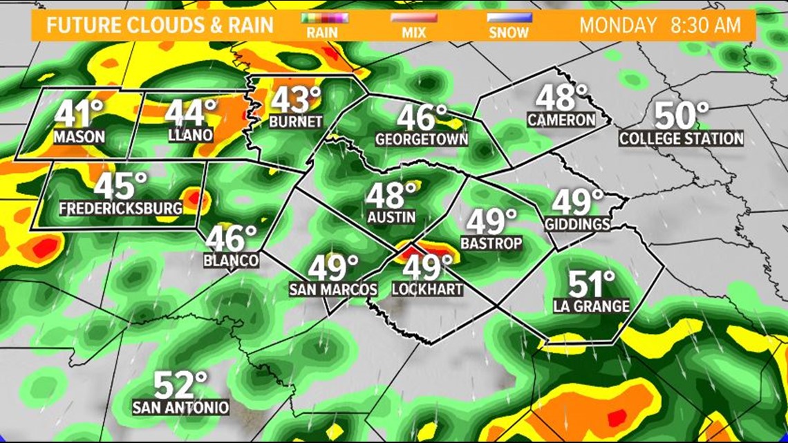
8 a.m. | Rush hour Monday morning will be cold, wet and windy. The cold front should be south of our region by many drivers' morning commutes, but showers and storms with heavy downpours will linger. The severe threat should be done by this time. However, lows will be in the 40s for all of Central Texas. Brrrr!


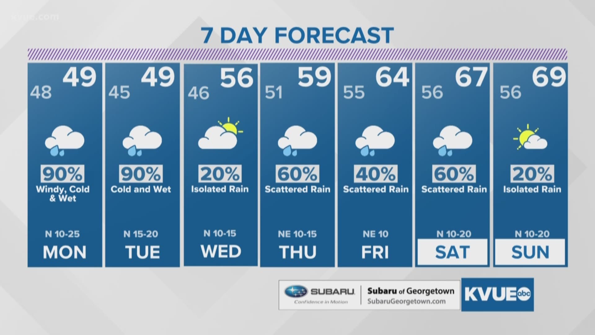
Another cold & wet day is expected Tuesday. Click HERE for the 7 day forecast.

