AUSTIN — The remnants of Tropical Storm Sergio will bring wet conditions for the start of the weekend, but winter-like temperatures will follow.
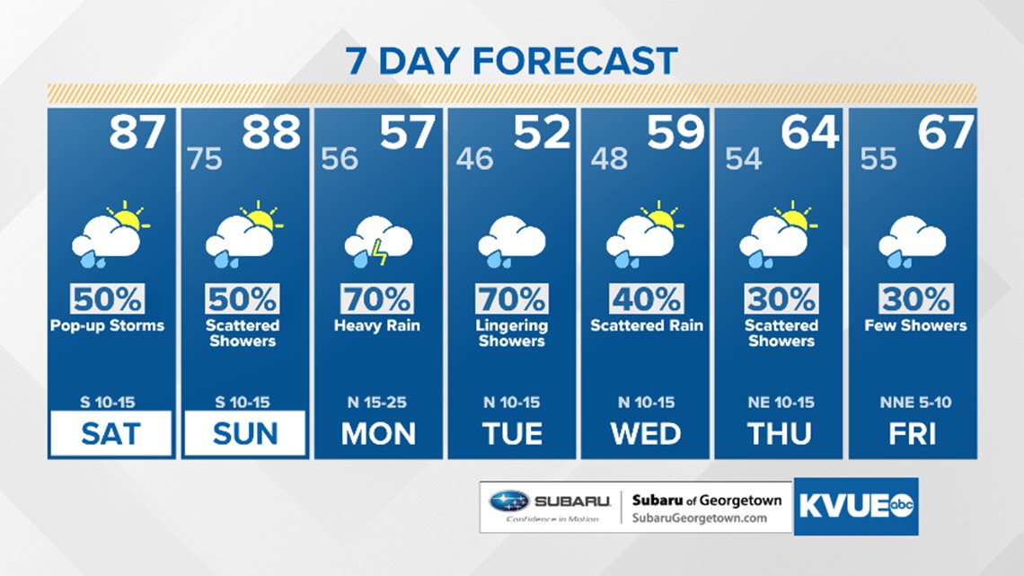
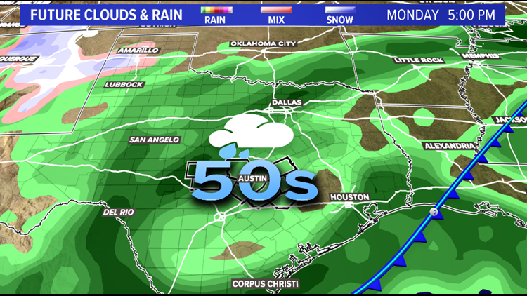
The next cold front will push through Austin late Sunday evening into early Monday morning. This pattern will set the stage for one of the most dramatic cool downs we've experienced in 2018. Showers and storms will become more numerous as the front approaches with gusty winds likely for early Monday.
The front will dive south and east across the Austin metro bringing with it bouts of moderate to heavy showers. We have been able to put a sizable dint in the drought monitor. With that said, the surplus of rains from September and the beginning of October could yield itself to bring some pockets of isolated to scattered flooding. Low water crossings and some primary and secondary roadways could be hampered especially Monday and Tuesday. Rivers, streams, and lakes could also experience rising. Daytime highs for the start of the work week struggle to exit the 50s.
Some models even suggest morning lows for Hill Country in the 40s during Tuesday and Wednesday morning. Just to put that into perspective, average highs in the middle of January for Austin are in the low 60s. Average lows during that time are near 40 degrees.
Here's a look at our forecast for the next seven days.


