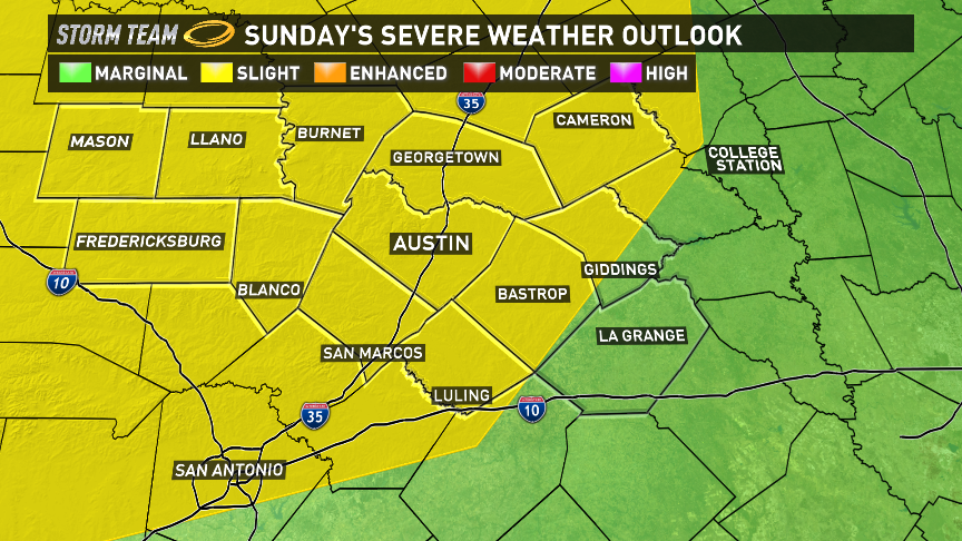
The end of May is still the heart of severe weather season in central Texas and another chance for big storms will rumble in Sunday night. This does not appear to be a large outbreak, but several areas will experience turbulent weather.
The main energy for the next round will come from an elongated front over the Rockies that will slowly move towards the Plains by Sunday afternoon.
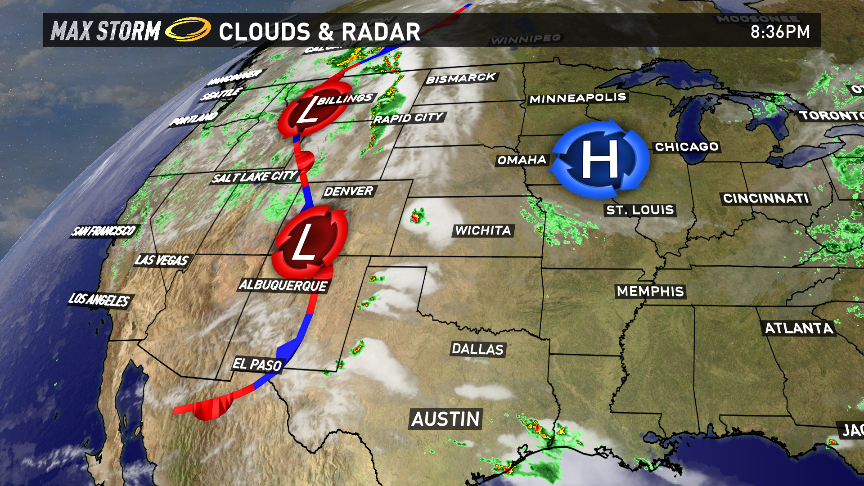
Along and ahead of the front, there is enough instability and moisture in play for thunderstorms to erupt. Some will be strong to severe. Due to that potential, the Storm Prediction Center, based in Norman, Oklahoma highlighted areas along and east of the Rockies under a slight risk for severe weather (in the yellow shading).
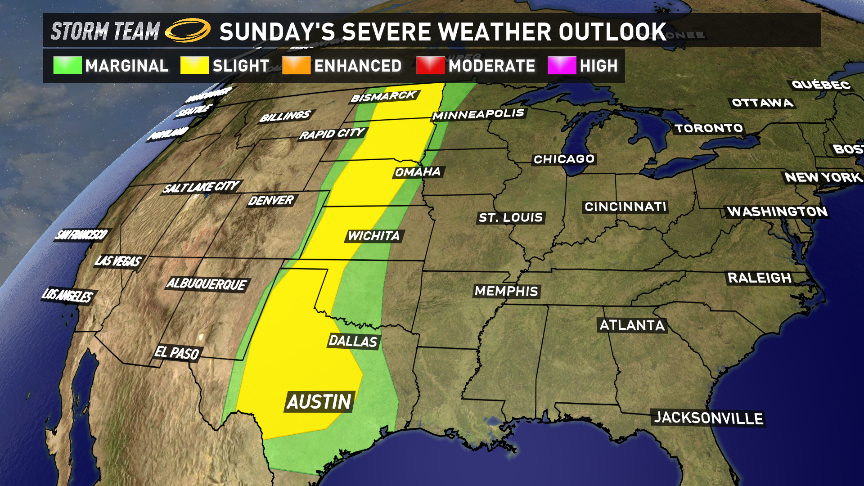
This area extends from North Dakota all the way down to all of central Texas. While showers and a brief thunderstorm will be possible during the day on Sunday, the highest threat for any severe storms will be in the evening.
The next several images are computer model data indicating where storms could form. Don't take this information as an "exact" forecast, but more as guidance, or a heads up. The forecast intensity and timing can change, but here is the latest thinking.
First signs of strong storms will arrive in the Hill Country around sunset Sunday evening.
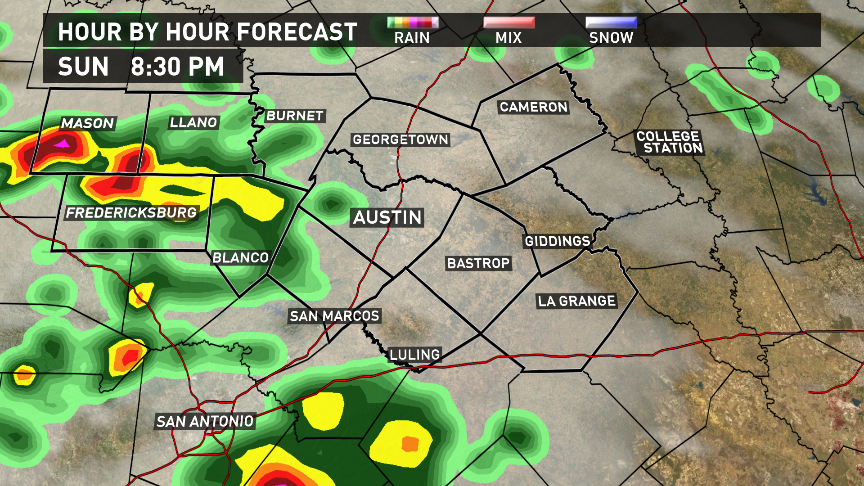
Storms will continue to roll across the Hill County towards Highway 281 and eventually closer to the metro by 10pm.
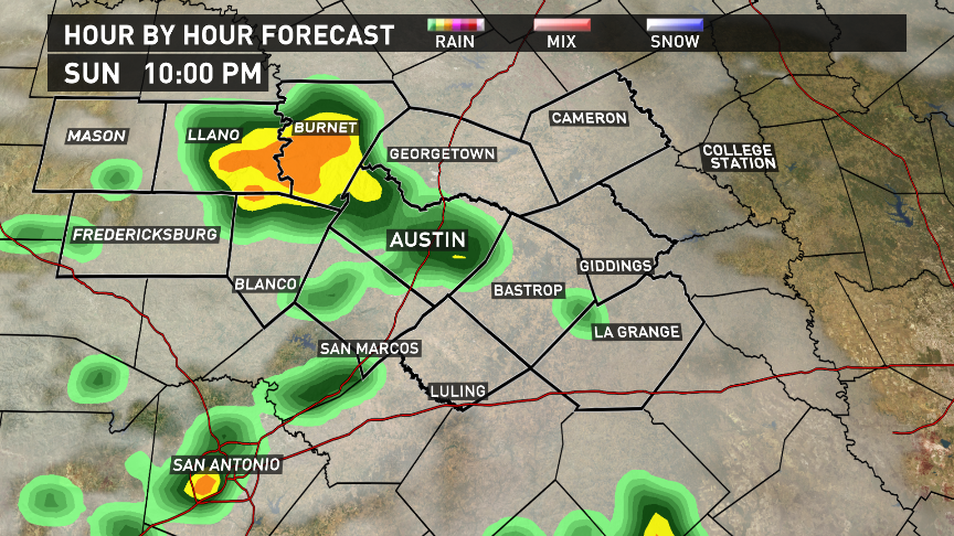
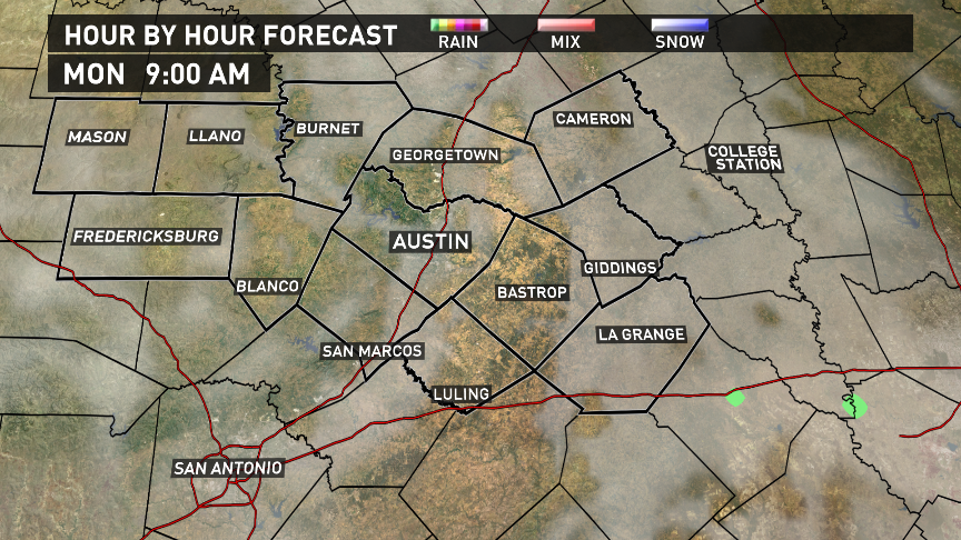
Past midnight, the storms will begin to wane and the good news is that the morning commute on Monday should be dry.
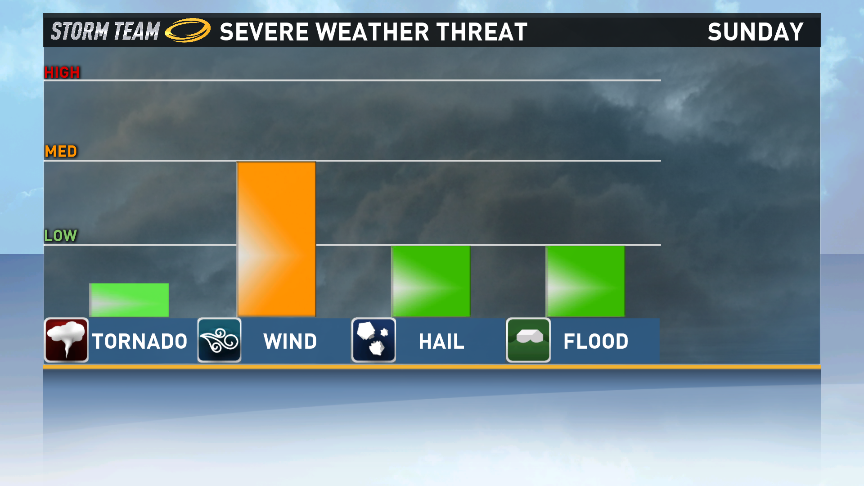
Most areas will pick up around 0.25 - 0.50 inches of rain, but some of the strongest storms can produce a quick 1-2 inches. However, this will be in isolated locations. Widespread flooding will not be a concern, and the tornado threat will be very small with this event. Small hail will be possible, but aside from heavy rain and lightning, the highest threat will come from gusty straight line winds. Wind gusts could be upwards of 50mph or stronger in a few cases.
Overall, this will not be a big outbreak and as new information comes into the KVUE Storm Center, we will keep you up to date with the latest.

