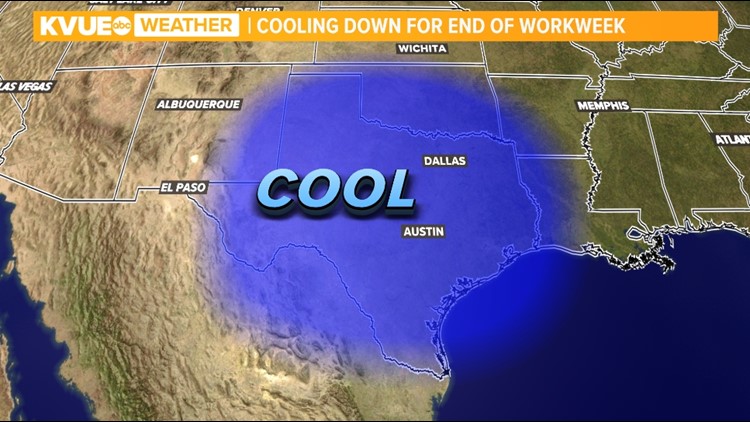
AUSTIN, Texas — A strong cold front moved through Texas Wednesday evening into early Thursday morning.
The most noticeable impacts from the cold front were the strong winds and the cooler temperatures that settled in. High temperatures ranged from 10 to 20 degrees cooler through the day Thursday.

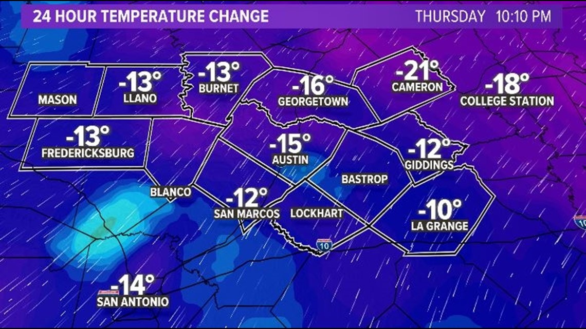
The decreasing winds will be an important factor in Thursday night's forecast. Light winds paired with clearing skies will allow for radiational cooling in Central Texas. This will allow for temperatures to drop like a rock Thursday night and, by Friday morning, a few of our locations in the Hill Country will dip to around 32 degrees. The areas favored for freezing temperatures are rural, low-lying areas.

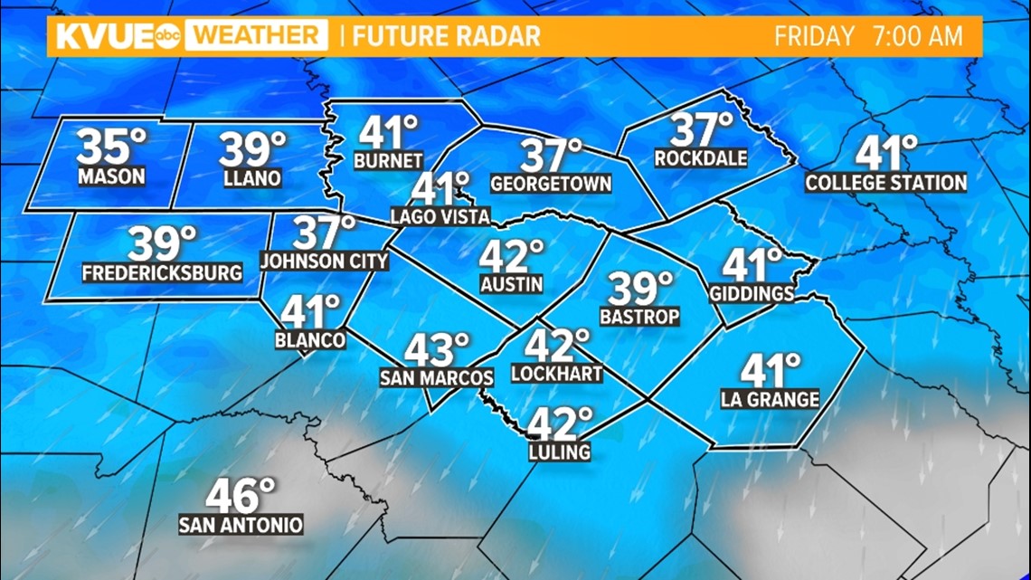
This cold front delivering a light freeze to some areas is a good reminder that it's that time of the year when we have to keep an eye out for freezing temperatures.
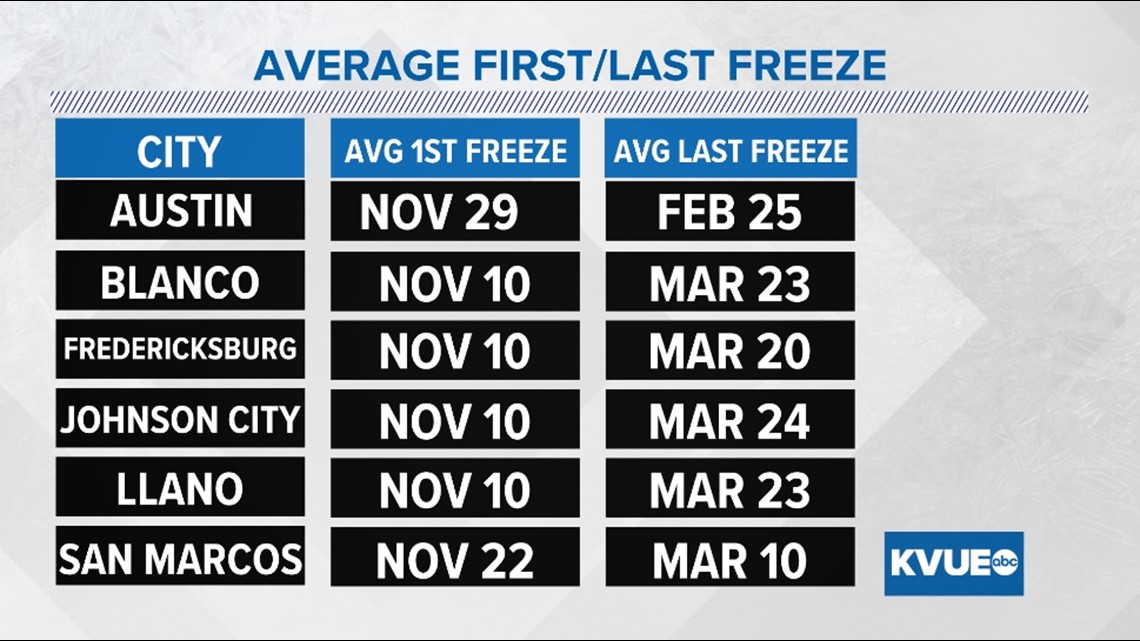
Over the coming weeks, many areas will see the first freeze of the season. The average date of the first freeze at Austin's Camp Mabry is Nov. 29, while the average date of the last freeze is Feb. 25. The earliest first freeze on record was Oct. 26, 1924, and the latest last freeze was on April 9, 1914.
Here are the average first and last freeze dates for other locations across Central Texas:

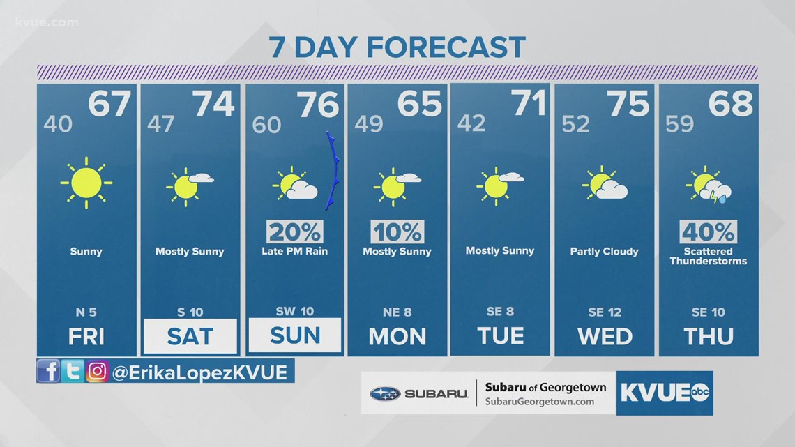
The last recorded freezing temperature in Austin was on Feb. 20, when the temperature dipped to 26 degrees. Take a look at the latest 7-day forecast here.

Stay with KVUE on YouTube, Facebook, Twitter and Instagram, and download the KVUE News app so you can stay ahead of the weather: kvue.com/app.


