AUSTIN, Texas — Central Texas is no stranger to winter snaps, and our strongest cooldown of the season so far has arrived. Now that the cold has made it to our area, let's break down how long it is expected to last.
More on KVUE's Freeze Coverage:
Widespread hard freeze and dangerous wind chills for the area
A strong push of cold air moved in behind a cold front on Saturday evening. Some locations finally reached above freezing on Tuesday afternoon, but another widespread hard freeze is expected Tuesday night through Wednesday morning. Some forecast models show our coldest temperatures of this arctic blast could occur overnight as lows drop into the teens and possibly single digits for the Hill Country.

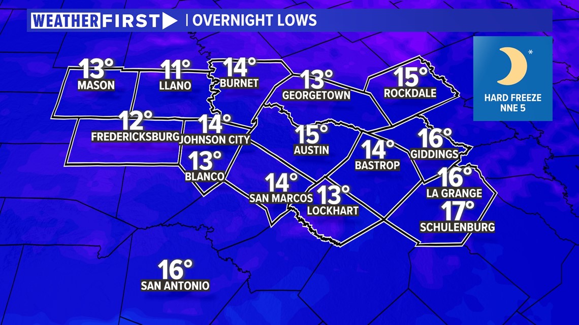
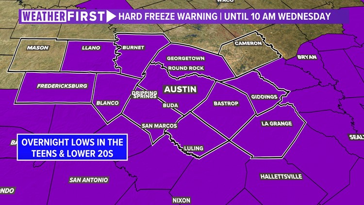
A Hard Freeze Warning is in effect for most of Central Texas until 10 a.m. Wednesday due to overnight lows in the teens and lower 20s. A Wind Chill Advisory is also in effect for most of the area until 10 a.m. Wednesday due to the potential for wind chills near 0.
Wintry precipitation has ended
While some areas have seen some reports of a light glaze of ice on elevated surfaces, as well as numerous reports of accidents as a result of the icing, we now have the wintry precipitation in the rear-view mirror and there could even be some sublimation – the act of winds causing the ice to evaporate into the atmosphere without melting – taking place during the late afternoon Tuesday into the evening.
We do not currently have any additional wintry precipitation in the forecast.

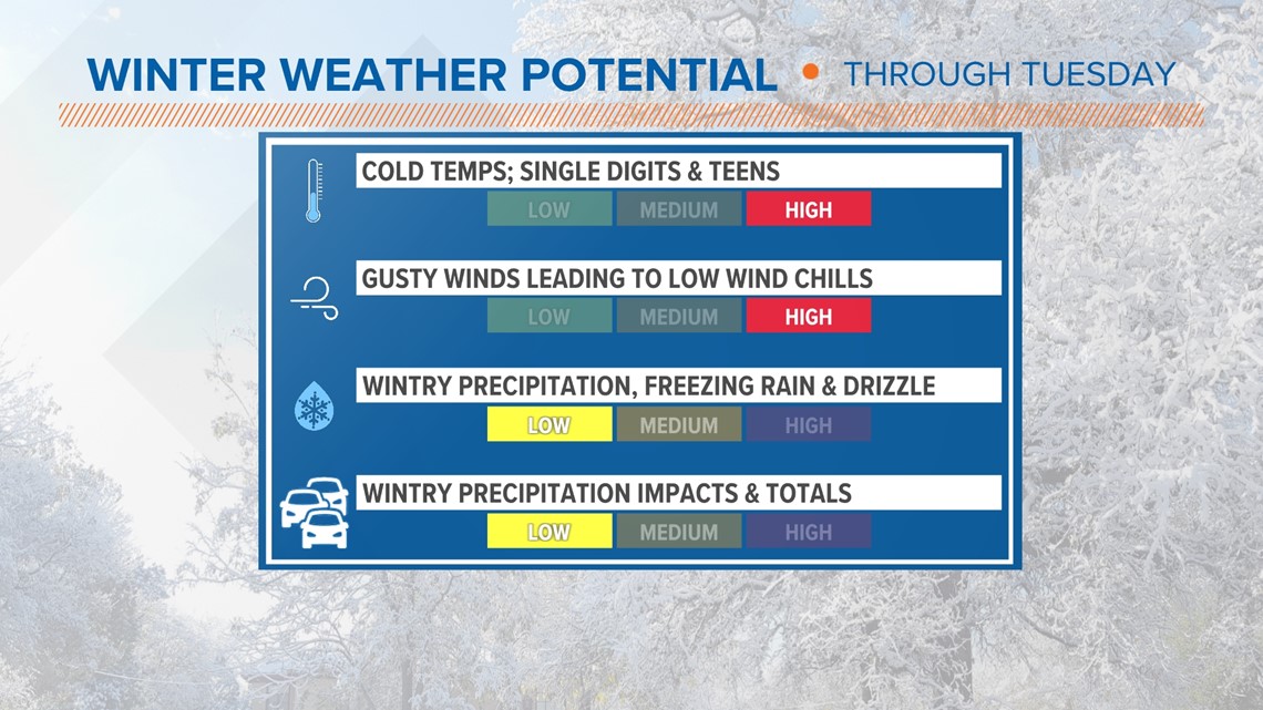
The bottom line
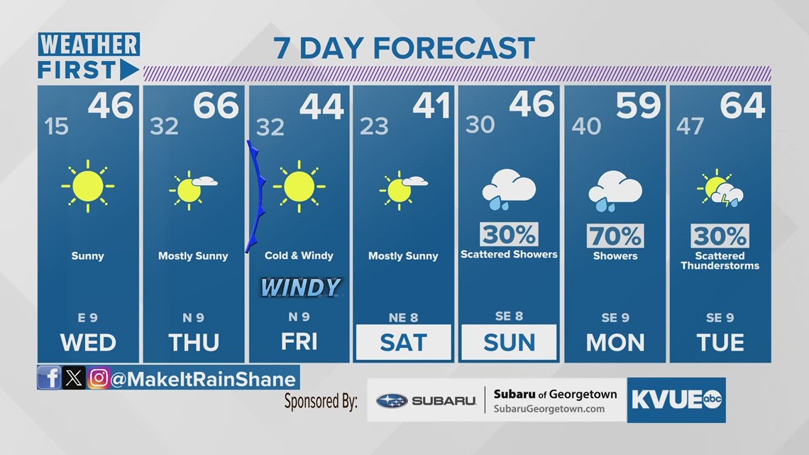
We have almost made it to the end of this round of dangerously cold conditions with one more night of a widespread hard freeze in the forecast. All of Central Texas will safely make it above freezing for Wednesday afternoon. Another arctic front arrives late Thursday, but it will not be as strong as the previous front and it will not bring an ice risk.
The KVUE Weather Team will continue to monitor the forecast closely and provide updates on air and online. In the meantime, here is a look at your extended forecast:

