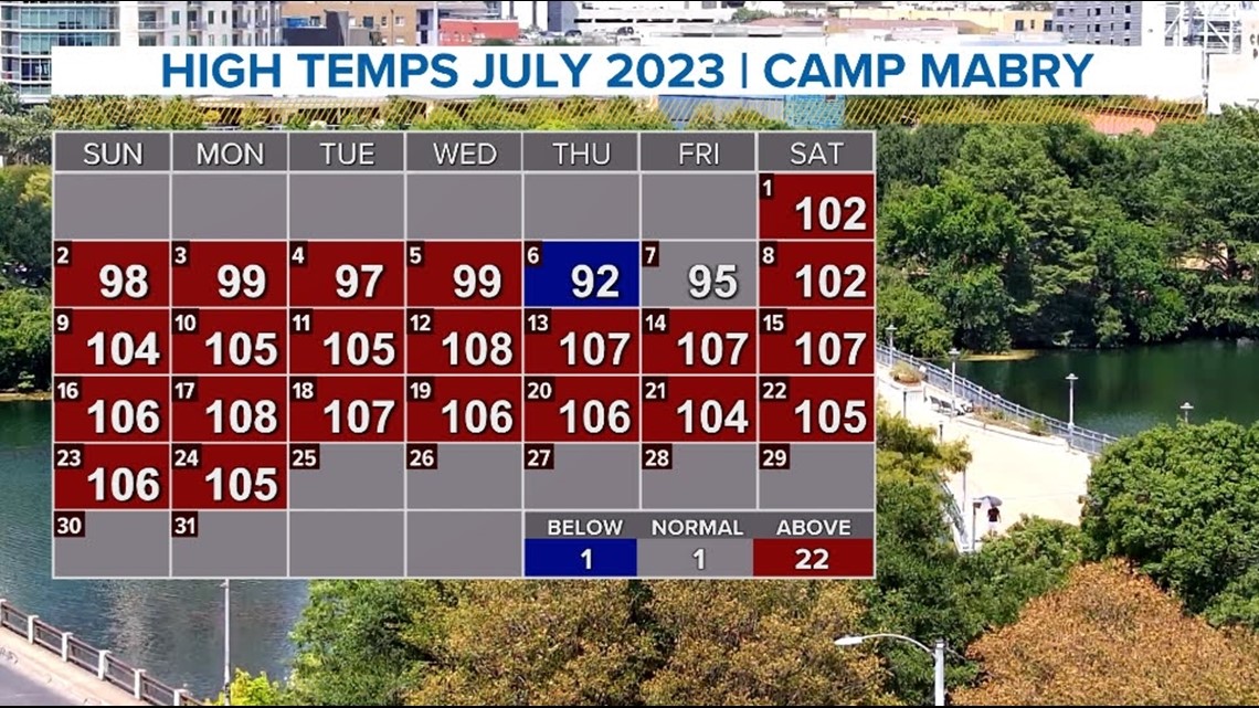
AUSTIN, Texas — We're reaching the tail end of July now – a month plagued by extreme, record-breaking heat and almost no rain. So will August be different, or the same?
The National Oceanic and Atmospheric Association (NOAA) put out its official forecast for the month of August on June 20.

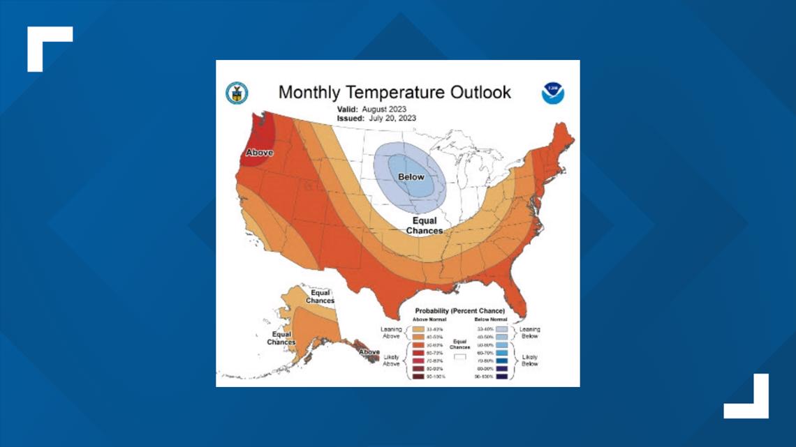
It shows that temperature-wise, the area of Central Texas is likely to stay above average throughout the next 30 days. The confidence rate is not 100%, but about 50% to 60% likelihood. This shouldn't be a big surprise to most Austinites, after experiencing the hottest July on record.

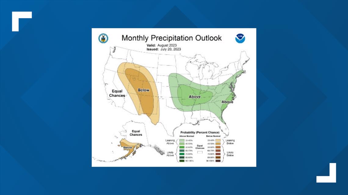
The majority of the Texas population was probably hoping for a better rain forecast. However, Austin remains in the blank space, which on this map means that there is a 33% chance of either below- or above-average rainfall. But we will probably experience a more average August in regards to precipitation.
According to Camp Mabry and Austin-Bergstrom International Airport records, averages for August precipitation are 2.14 inches and 2.34 inches. July's mean is lower, trending to below 2 inches. In July 2023, both stations picked up a combined 0.20 inches of precipitation, well below average.

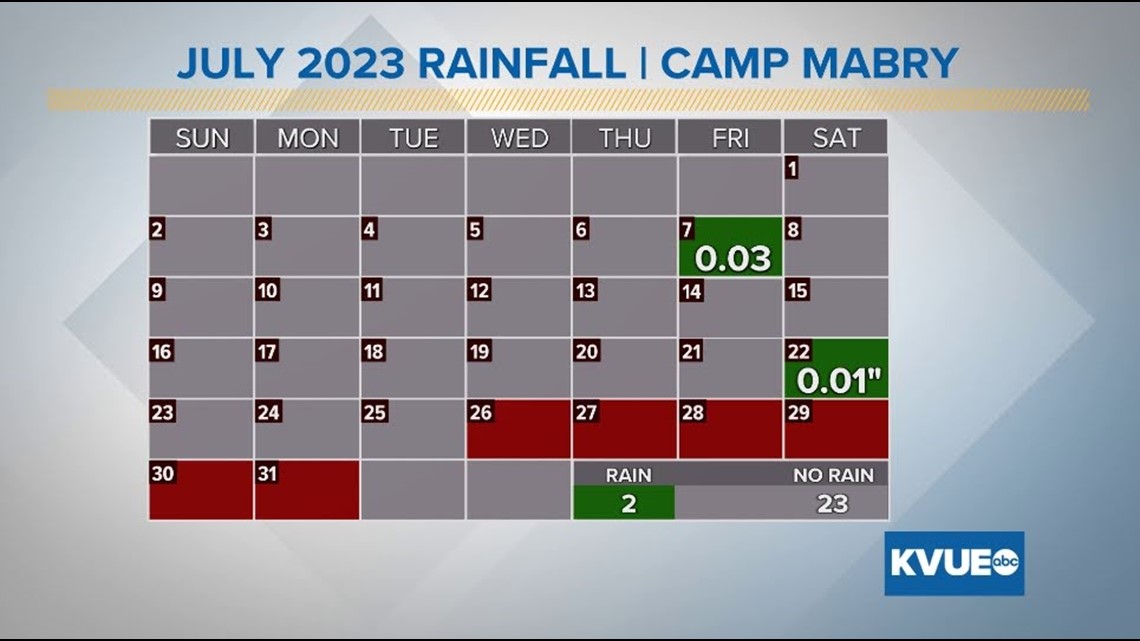
Technically, there are still a few days left in the month. But currently, there is no significant rain forecast through that 6-day period.

While we are expecting another hot and dry month, don't get too down because August is known to have a wide range of variability. August is usually when hurricane season begins its incline towards peak season.

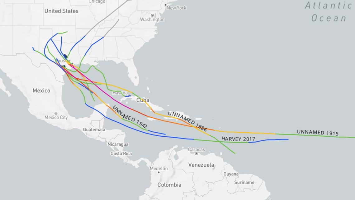
Above is a map of all the hurricanes or tropical storms to have affected Central Texas. The tracks of all of these storms begin in the southern Caribbean or central Gulf of Mexico, with most beginning their formation within the first two or three weeks of August.
This doesn't guarantee that Austinites will feel the effects of a tropical system in mid-August, but the KVUE Weather team will be closely tracking storms that are able to organize out of such regions.


