AUSTIN, Texas — Editor's note: This blog is no longer being updated. Click here for the latest weather updates.
Austin reached a high temperature of 88 degrees on Thursday. It wasn't a record, but it was easily our warmest day so far of 2024 and was the warmest temperature since Oct. 27. Our forecast stays warmer than average for this weekend, but there will be a slight cooldown compared to our recent warmth.
A weak cold front pushed through Central Texas on Thursday evening. Behind it, after a cool start Friday morning, we still had a warmer-than-average Friday afternoon, with highs getting to the mid- to upper 70s areawide.
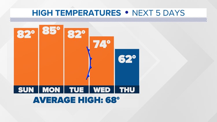
A quick warming trend resumed this weekend. Expect highs in the lower 80s on Sunday, which is similar to Saturday's high of 81. We should be even warmer to start the new workweek.


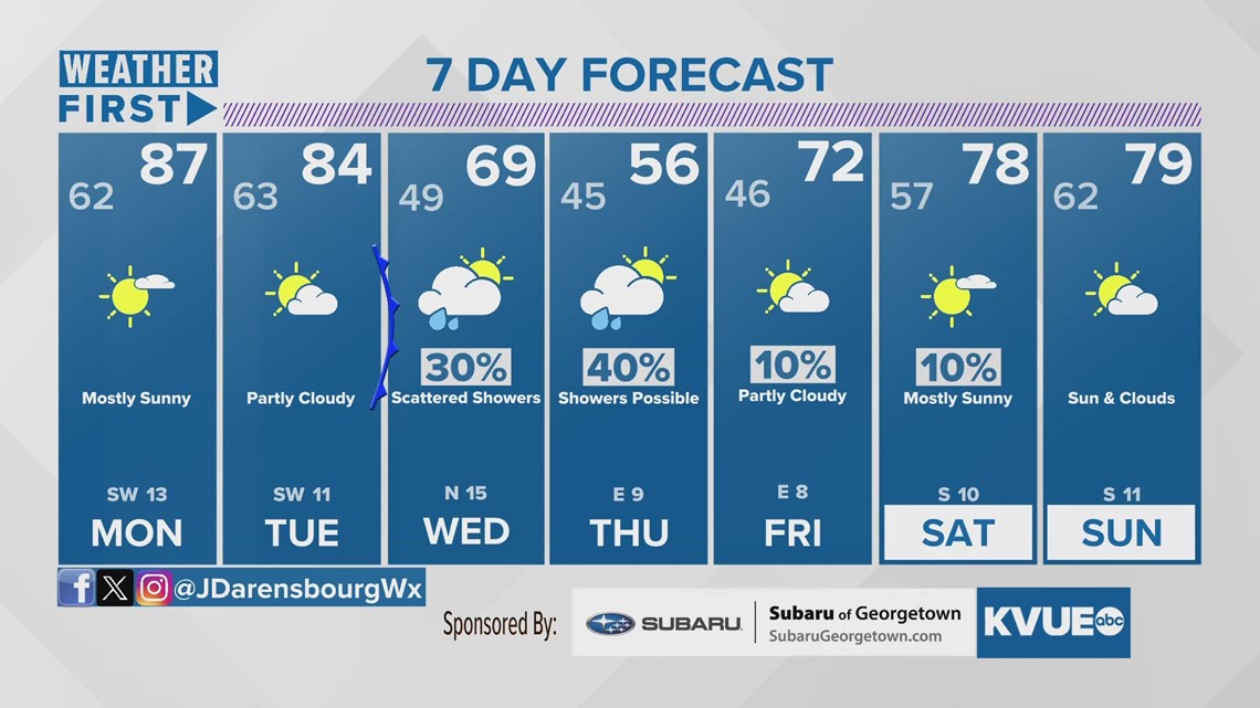
After a very warm start to the week, we will then have the potential for our next cold front around Wednesday. The details are still a little fuzzy, but it's possible this could bring at least small rain chances to our forecast on Wednesday and Thursday.
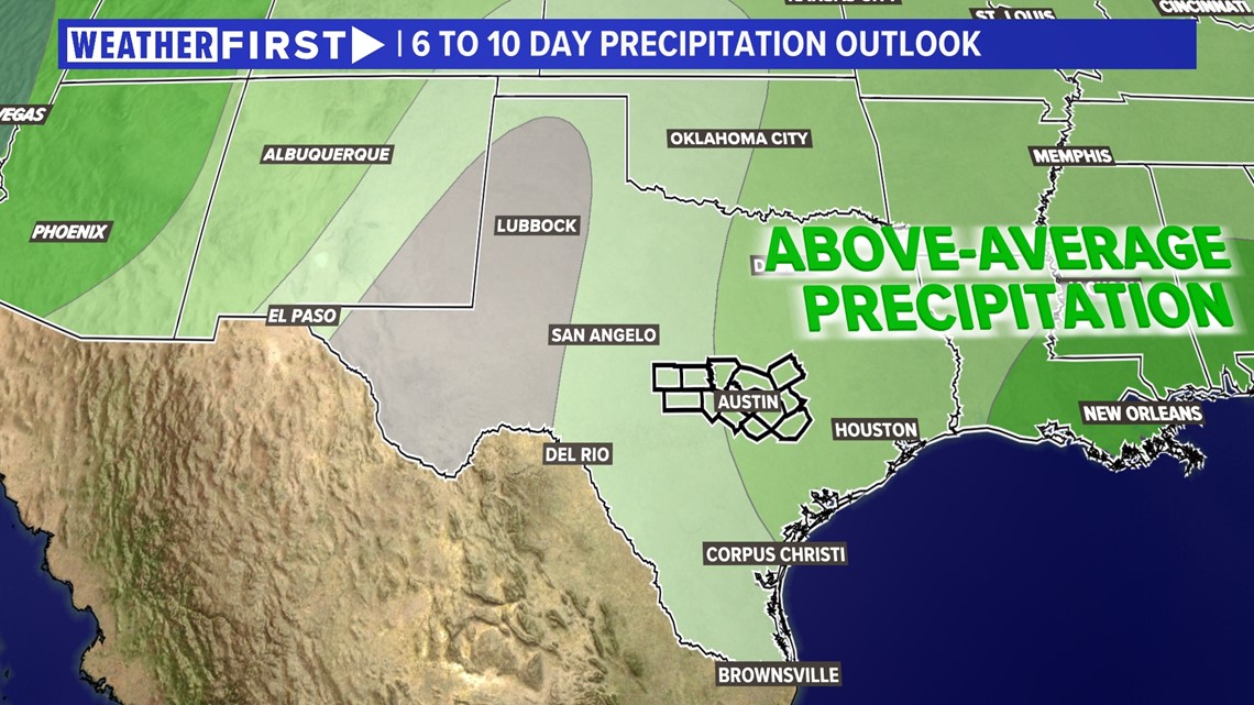
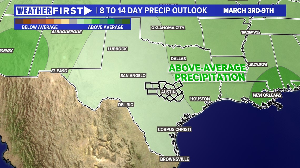
The Climate Prediction Center is picking up on this with a slight chance for above-average rainfall during this timeframe, and a better chance during the next eight to 14 days.


In addition to the rain potential, this front could also have a more meaningful impact on our temperatures. Highs by Wednesday will be in the low 70s, and we could actually drop a little below average for this time of the year by Thursday.
The KVUE Weather Team will continue to closely monitor this developing forecast.
In the meantime, the extended forecast can be found below:


