AUSTIN, Texas — The forecast this week is calling for a significant rain. The Austin area has already experienced a portion of that.
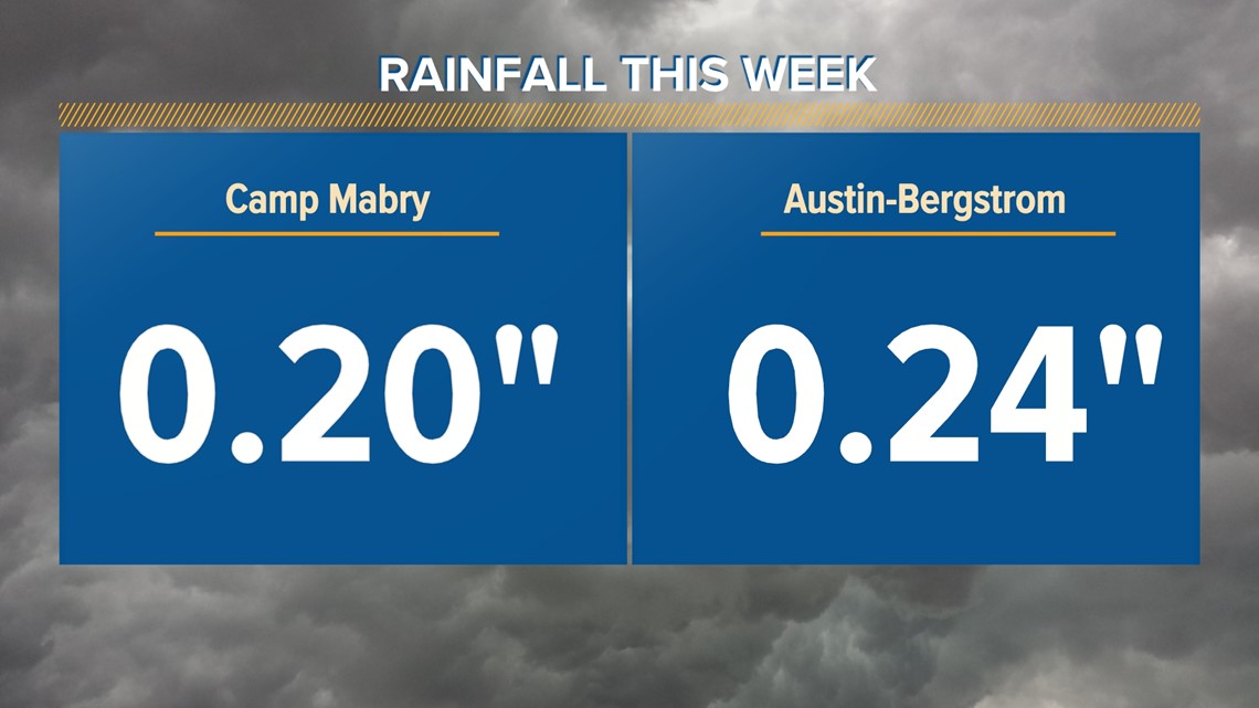
Here are the current standings for the region:


Usually, Austin's main weather stations – Camp Mabry and the airport – are the best representations of precipitation in our area. But so far this week, that is not the case.


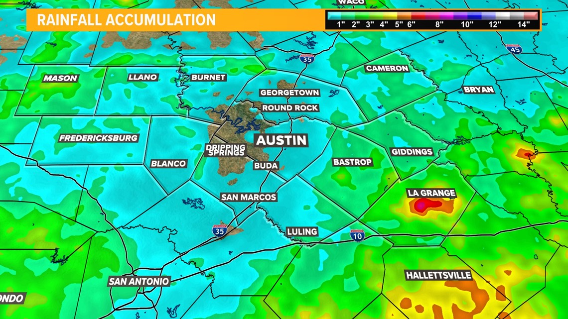
The above map shows radar estimated rainfall totals since Sunday, May 7. There is a sizable hole throughout western Travis and Hays counties.
However, a few spots have seen impressive rainfall totals, especially in the Coastal Plains. The large accumulations in Fayette County were due to a stationary storm on Monday.
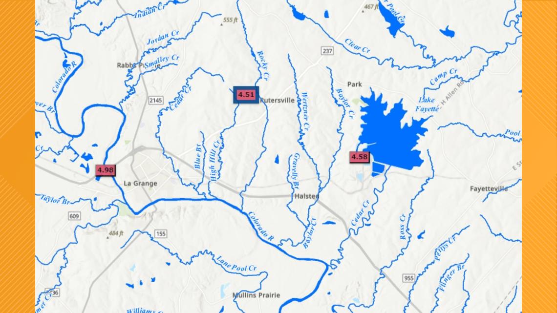
The official recording at the Fayette County Regional Airport in La Grange is 1.12 inches since Sunday. The Lower Colorado River Authority (LCRA) rain gauges surrounding La Grange recorded near 5 inches of precipitation this week.


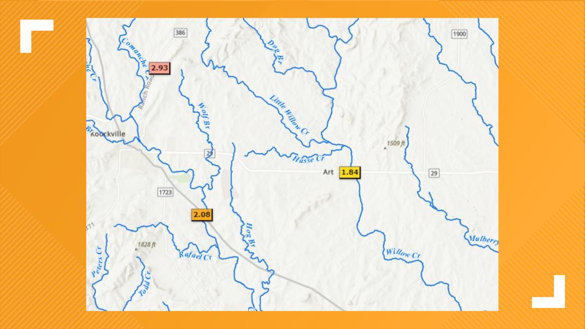
Further off in the Hill Country, Mason County also retrieved a few discernable totals. The National Weather Service reported 2.15 inches of rainfall at their Mason Office. The LCRA reported similar totals.


Our next major round of rain comes in late Friday and Saturday and could add 3 to 6" in the viewing area, with totals up to 10" in isolated locations. See the most recent forecast.


