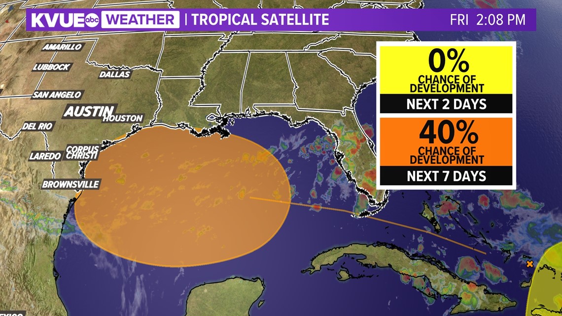
AUSTIN, Texas — The 2023 summer has been a historic one in terms of heat and dryness for Central Texas. As we continue to look for any sign of rain or a cooldown, we are now turning our attention to the Gulf of Mexico, where tropical development is now a possibility early next week.
The National Hurricane Center has officially tagged the Gulf for a 40% chance of tropical development over the next seven days. Nothing is imminent and, for now, the odds are low but somewhat increasing, but the bottom line is we'll need to keep a close eye on things.

So, what does this mean for Central Texas and could it bring us rain? Yes, it could, but we're still a long way from locking in rain chances to our forecast. Let's talk about the overall weather pattern.
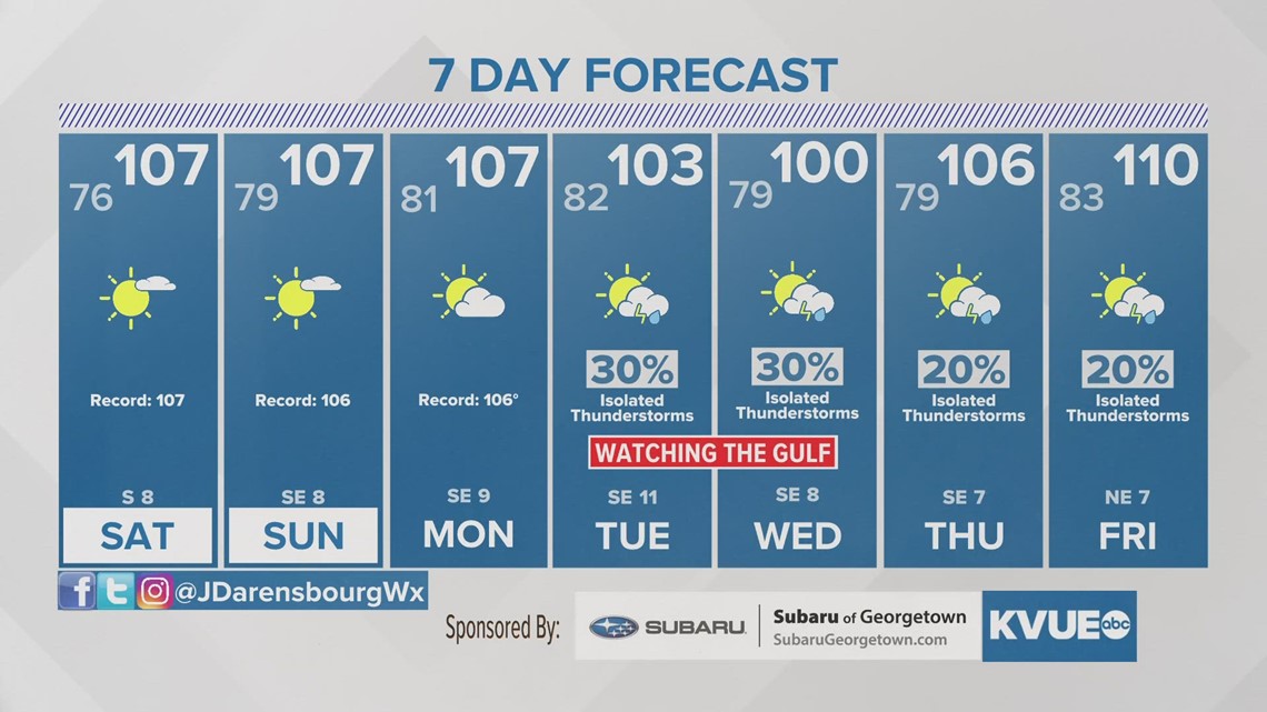
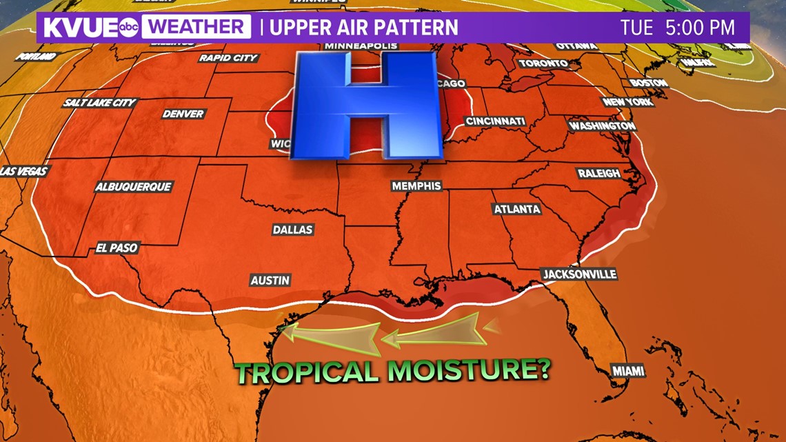
A very strong ridge of high pressure, or the "heat dome," will be strengthening north of the Lone Star State through this weekend. This is going to bring us another round of scorching hot high temperatures, which will be 105 to 109 each afternoon.
However, by early next week, we are seeing signs of the high pressure shifting far enough to the north that the door could be open for a tropical system to develop in the Gulf and then move westward towards the Texas coast.

Even if the a formal tropical system does not develop, we would be appreciative for just some high rain chances. This is a possibility for Tuesday and Wednesday if a tropical system does in fact move our way.
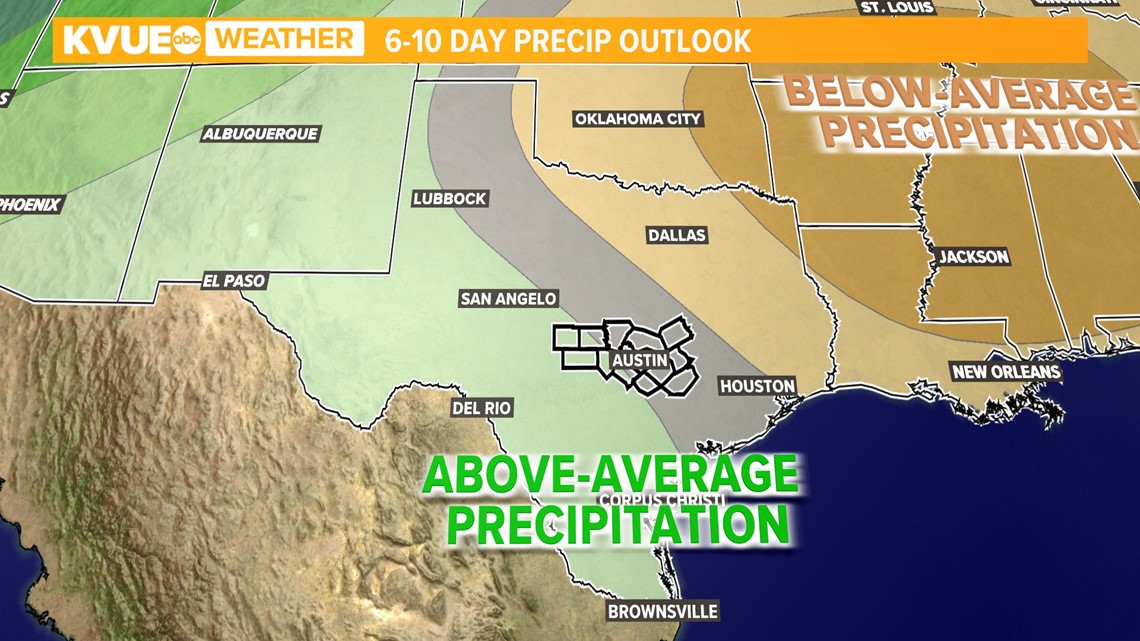
However, for now, we are keeping rain chances very low and isolated in the 7-day forecast until we have a better understanding of if this system will develop and where it could track. As of now, it looks like South Texas could be positioned better than Central Texas to receive rain from this system. This is where the Climate Prediction Center has the highest likelihood of above-average precipitation on its 6- to 10-day outlook.
However, here in Central Texas, we are also highlighted for rain potential. We will continue to closely monitor this in the coming days, but for now, we advise to keep the hope for rain and cooler weather relatively low.

So, what does the climatology say for tropical development during this part of the year? At this point in hurricane season, between the second week of August and the first week of September, tropical systems start to become more commonplace.

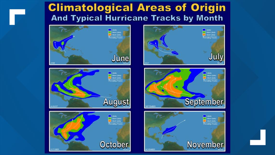
The main origin and track of August and September tropical disturbances come from the eastern Caribbean or southern Gulf and traverse toward the Gulf or Atlantic Coast. So, even if we miss this chance for rain, it's expected that another chance could soon be knocking at our doorstep.
In addition to the potential for rain, this system could also help break our triple-digit heat streak. Our current forecast calls for afternoon highs around 100 degrees on both Tuesday and Wednesday, but some forecast models hint at temperatures in Austin dropping into the upper 90s.
The KVUE Storm Team will continue to watch this tropical wave through the weekend and provide further updates.