AUSTIN, Texas — Austin-Camp Mabry recorded a record 3.73 inches of rainfall on Monday. This was the fifth highest August rain total on record. The last time we received more rainfall than this in a single day at the site was August 26, 2017 when a total of 5.08" was measured.
The excessive rainfall in the metro caused some flooding issues, especially around Shoal Creek, which crested at over 16 feet Monday before falling back below flood stage as of Tuesday morning.
A Flood Watch was in effect through 1 p.m. Wednesday, but it has been canceled as of 11:25 a.m. Tuesday.
So, are we done with the rainfall? Not quite yet.
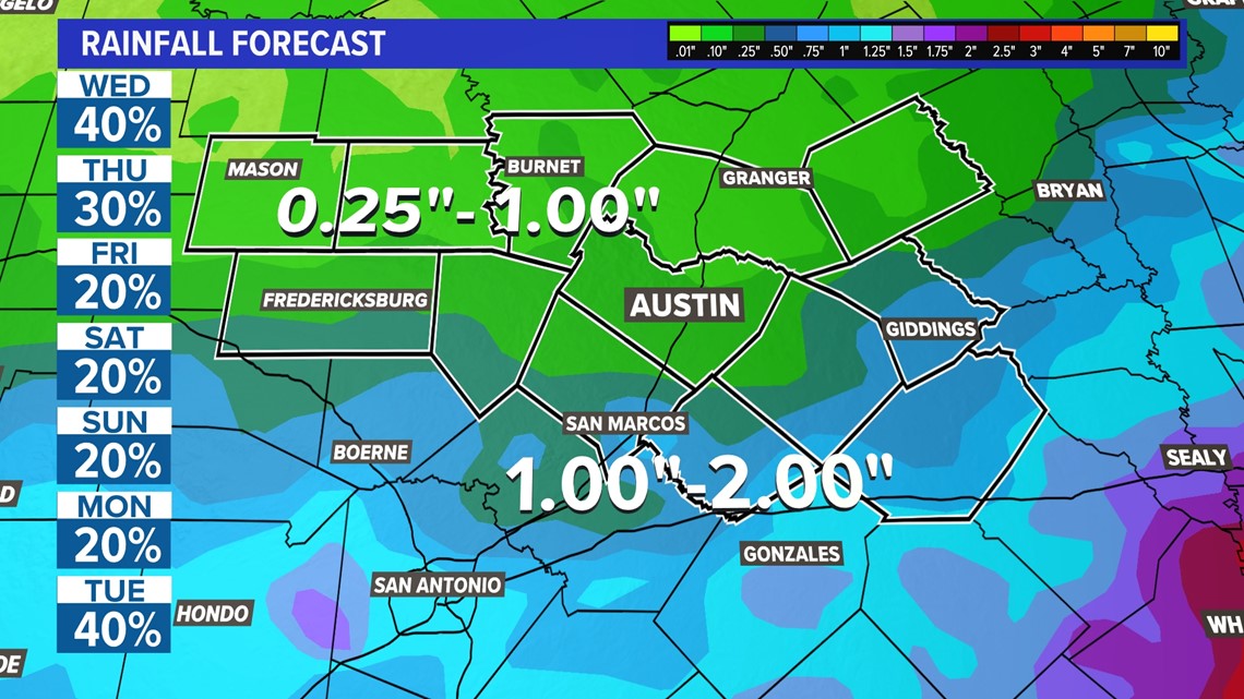
Not everybody will see rain, but a few heavier downpours could still drop another one to two inches of rainfall in some locations over the course of the week. If this syncs up with areas that are already saturated from Monday, there could be some more minor flooding concerns.
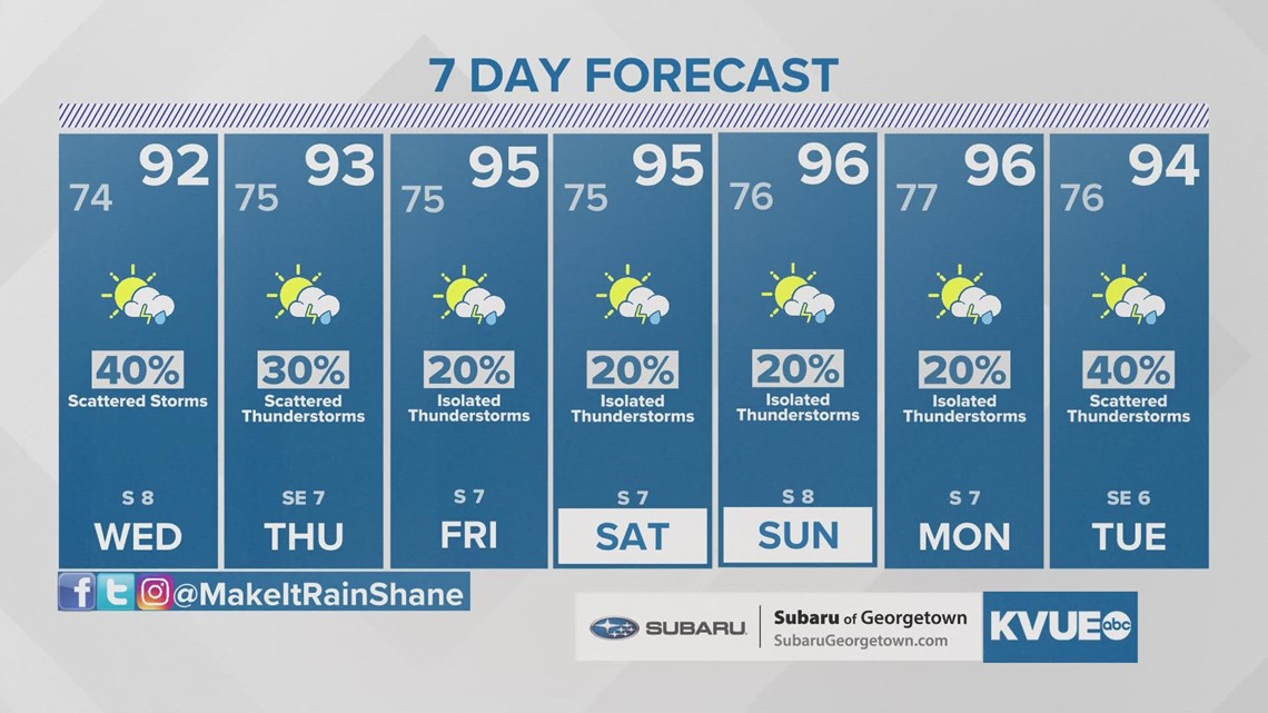
Rain chances will gradually decrease each day through the back half of the week, but we'll still have some scattered downpours and storms around, especially on Wednesday.
Seven-day rainfall totals could still be up to one to two inches or more for scattered spots south and southeast of Austin, but not everybody will see these totals. Lesser totals between a quarter-inch and one inch will be possible for the metro and northern Hill Country.


The forecast looks hotter and mainly dry by the upcoming weekend as afternoon highs return to the mid or even upper 90s. As we head into next week, forecast models hint at the possibility of additional scattered showers and storms on Tuesday.
The KVUE Weather team will continue to monitor this developing forecast.
In the meantime, the extended forecast can be found below:


PEOPLE ARE ALSO READING:


