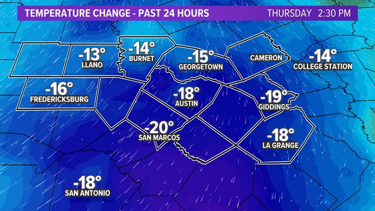
AUSTIN, Texas — Our first fall cold front of the season moved through Central Texas Thursday morning. A second front then brings another shot of cooler air for this weekend. Let's walk through the timeline.
Thursday evening
After early morning showers, we quickly trend drier with just isolated late showers by the late afternoon and evening on Thursday.
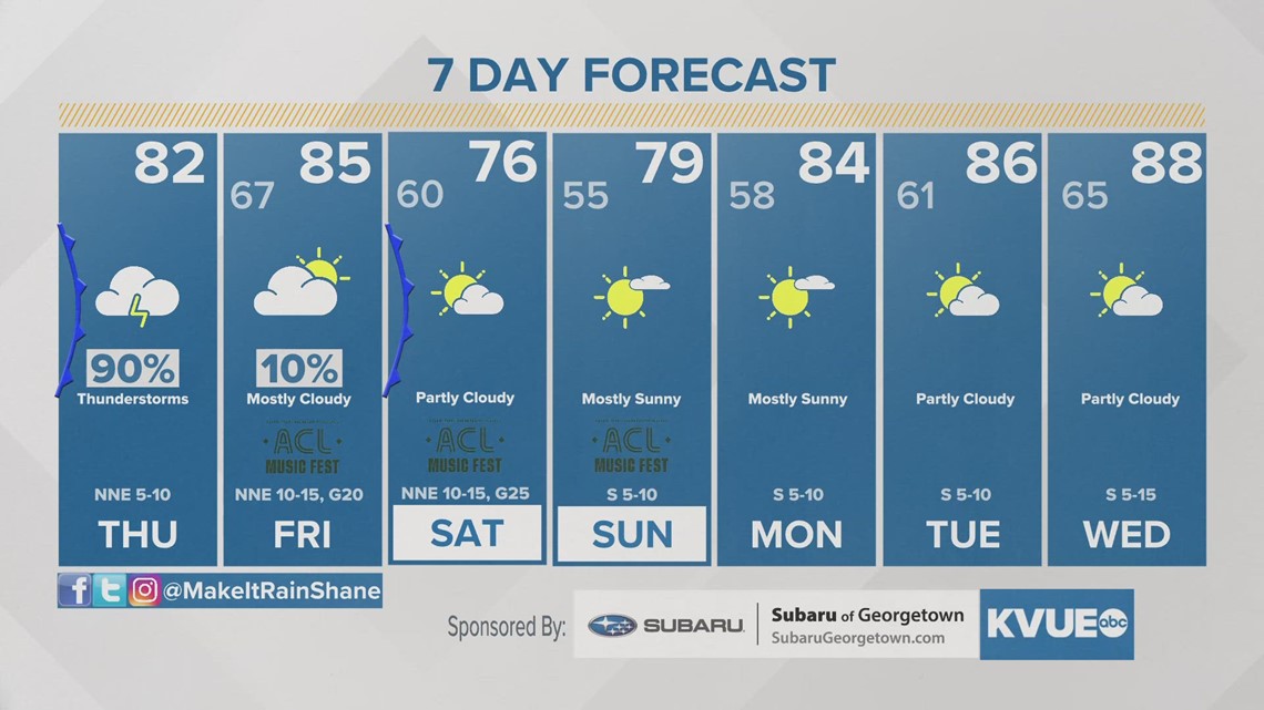
It continues to look like nearly all of the rain will be over by this weekend in time for Weekend 1 of the Austin City Limits Music Festival. But depending on how slow the front is to clear our area, it's possible we could still have some muddy conditions, especially on Friday!
The latest forecast models show the front clearing through Central Texas quickly, leaving us with drier conditions over the weekend. We currently expect a 10% chance of rain on Friday morning, and then Saturday and Sunday will be completely dry.
Rainfall: Beneficial rain, but keeping an eye on flood potential
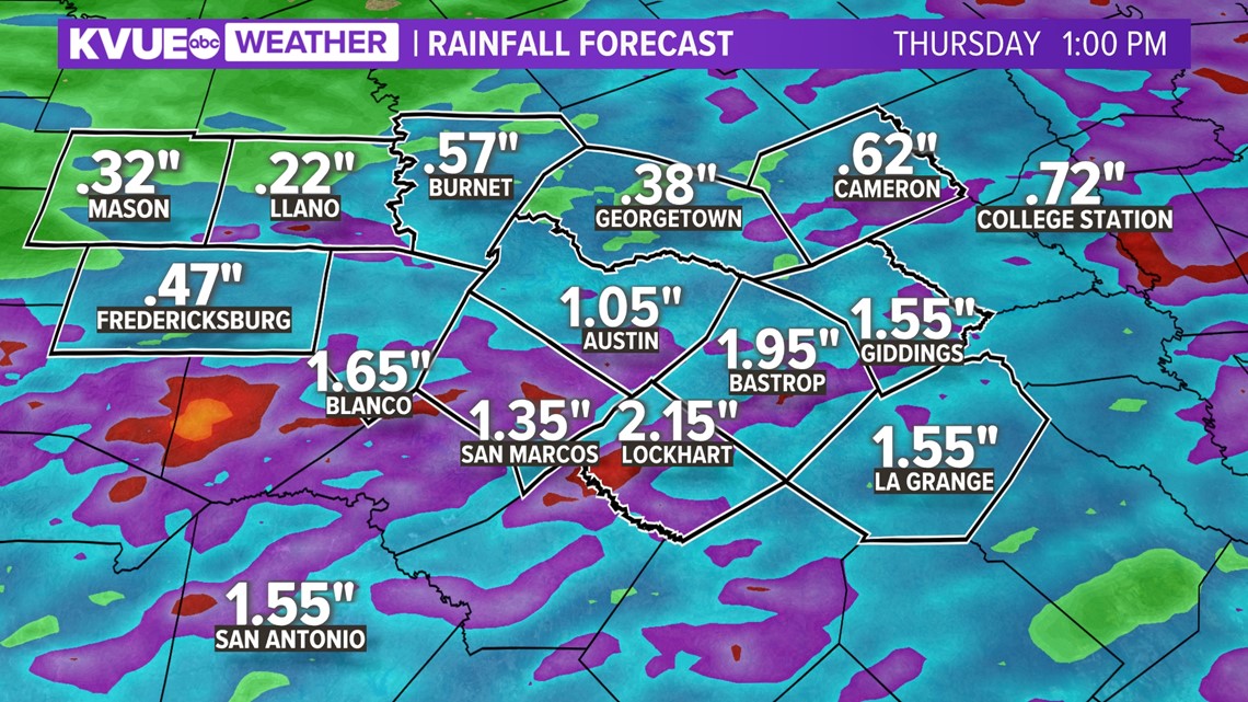
We desperately need the rain, and we are happy to report most areas could receive some beneficial rainfall over the next seven days. We expect most locations to pick up between a half-inch and one-and-a-half inches of rainfall with locally higher amounts.

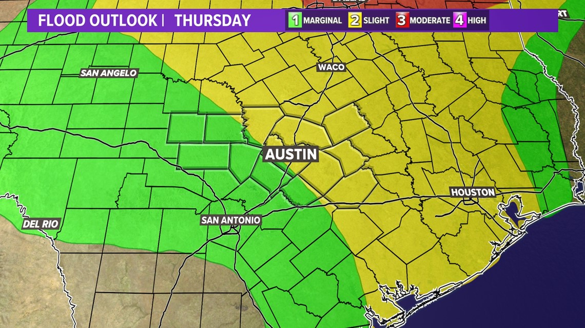
We will also need to keep an eye out for some localized flooding, especially east of Interstate 35. The Weather Prediction Center currently includes much of Central Texas in the "slight" – level 2 of 4 – risk for flash flooding for Thursday. This has decreased over the past day or so.

Temperatures: Feeling more like fall behind the front
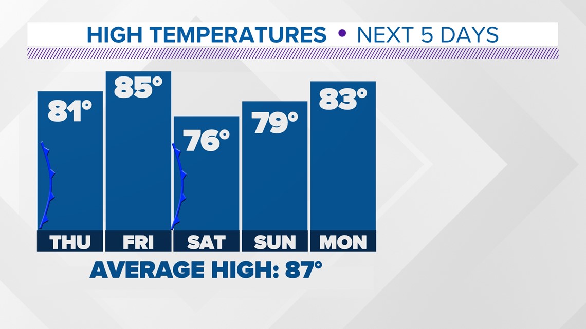
You won't need the heavy winter coat, but this front will bring us our first taste of fall for the season. High temperatures will drop to the low 80s for Thursday and Friday, and then a secondary push of cool air drops highs into the 70s for this weekend!
Morning will also be chillier in the 50s and maybe even 40s for parts of the Hill Country!

The KVUE Weather Team will continue to closely monitor this developing forecast.
In the meantime, here's a look at your 7-day forecast:

