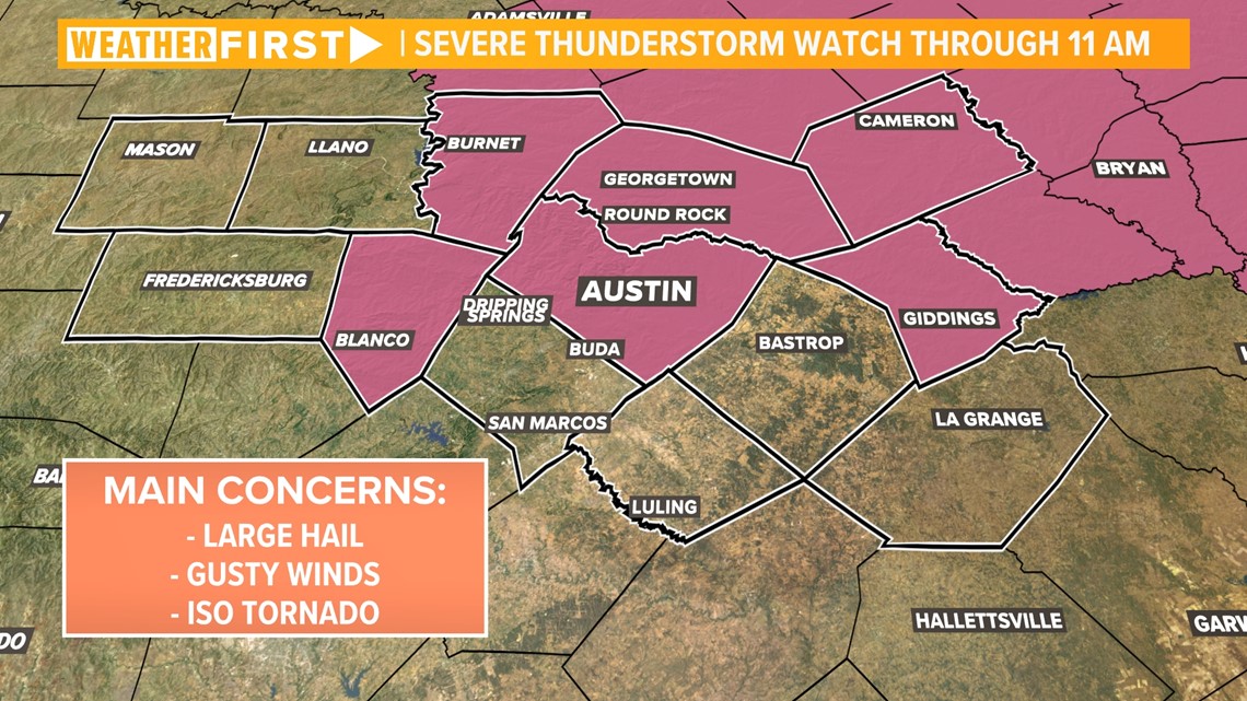
AUSTIN, Texas — *A Tornado Warning has been issued for Fayette County until 9:30 a.m. A Severe Thunderstorm Watch is in place for Burnet, Blanco, Williamson, Travis, Milam, and Lee counties until 11 a.m.*
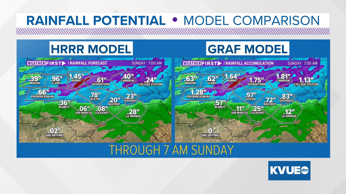
Rain is on the way for Central Texas! The great part about this forecast is that, unlike our past several systems, the highest rain totals this weekend will likely be across the Hill Country. These are the spots that need the rain the most due to ongoing drought, and this is also where rain can funnel into our highland lake system.
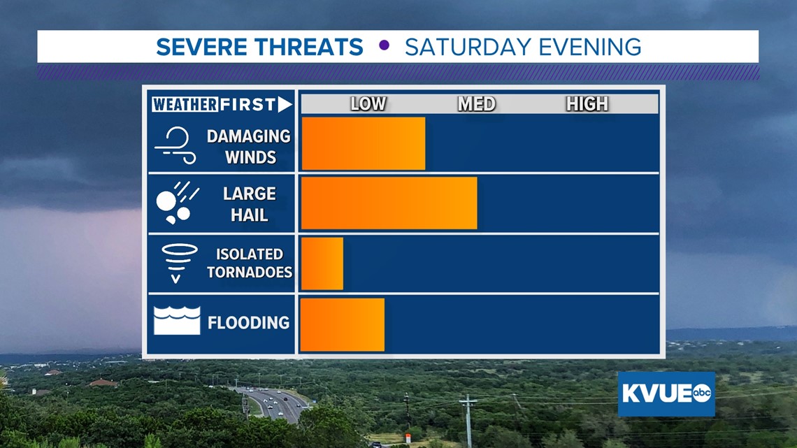
We're tracking the potential for strong storms overnight into early Sunday morning, and as such, all of Central Texas has been placed under a "slight" - level 2 out of 5 - risk for severe weather Saturday through early Sunday morning. The main concerns will be isolated storms containing large hail, especially since most of Central Texas is in the "hatched" area for significant hail. Isolated tornadoes cannot be ruled out. In fact, portions of the Hill Country are already under a severe thunderstorm watch until 4 a.m. for that hail threat.


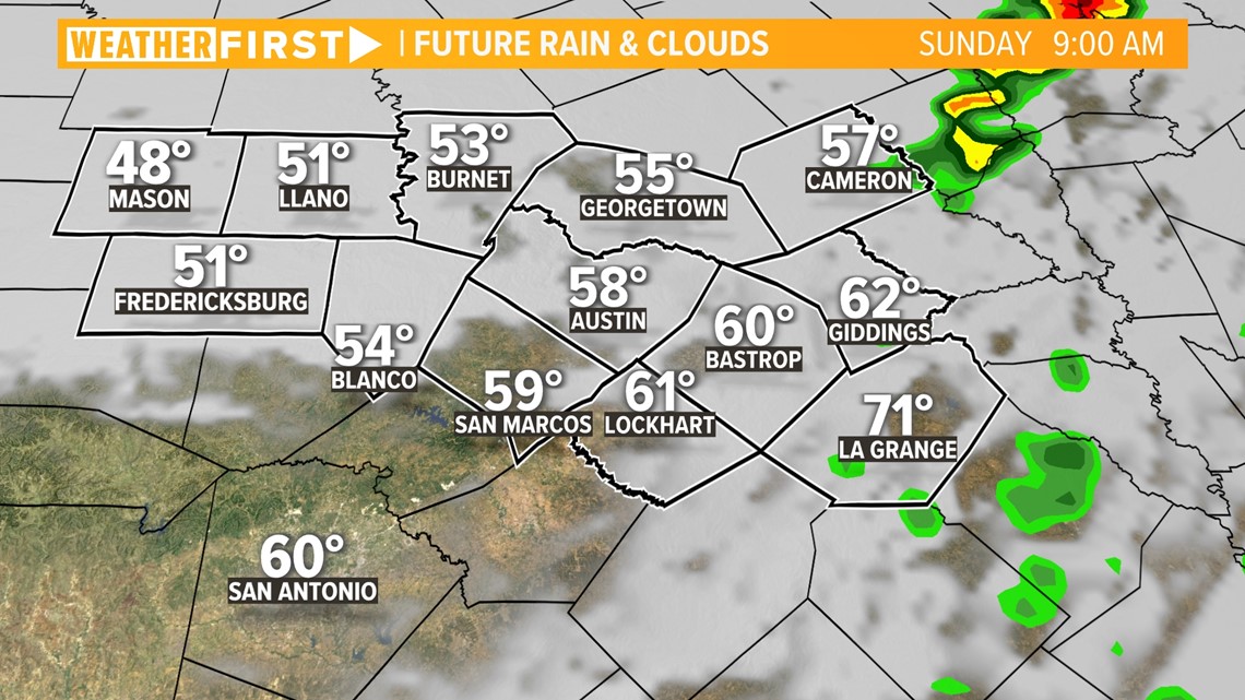
After a quick lull Saturday evening, there will be another shot at rain early Sunday morning as a broken line of rain and storms forms along a cold front.
Most if not all of the rain is likely over by Sunday afternoon, and breezy weather will take hold.

As we move through the rest of Saturday and Sunday, an additional inch is possible for the northern counties. Rain totals for the majority of Central Texas will be closer to a tenth or quarter of an inch (.10-.25").

This forecast will be subject to change in the coming days.
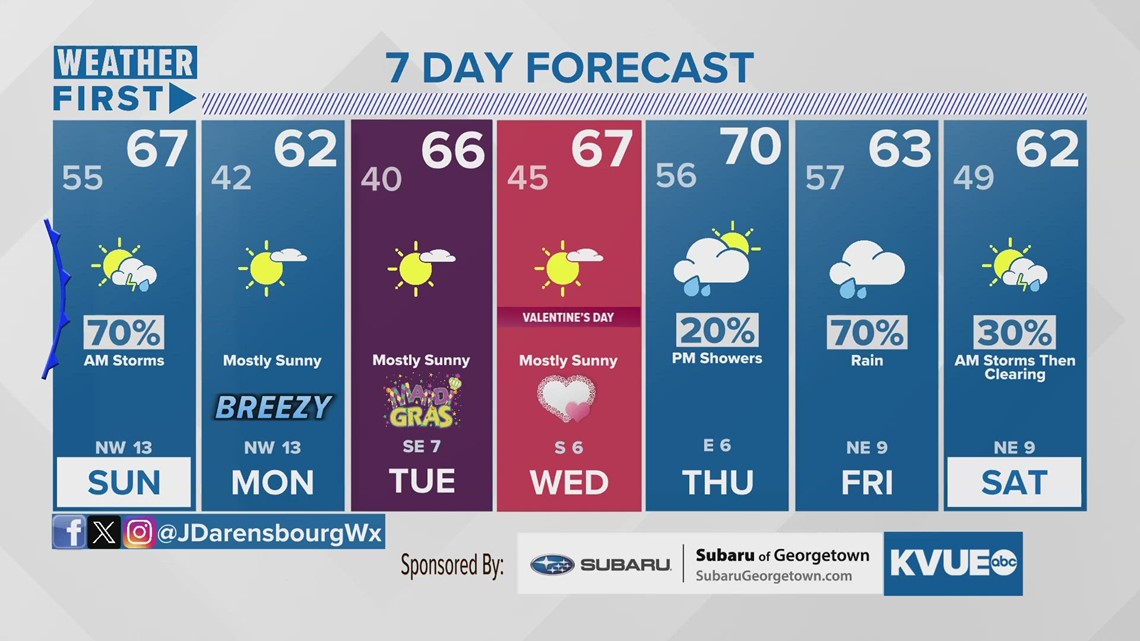
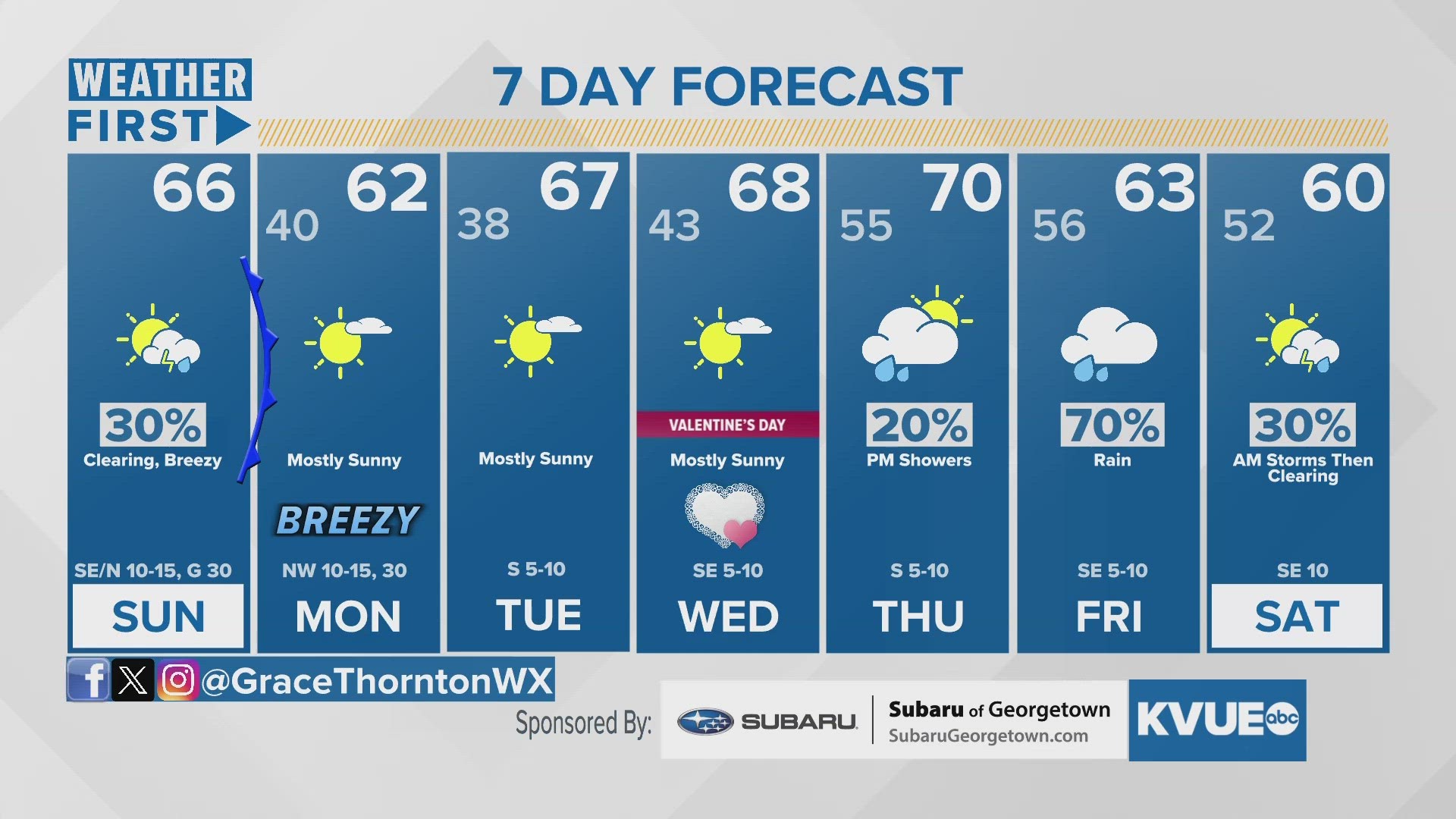
In the meantime, here is our most recent 7-day forecast.