AUSTIN, Texas — With a three-year La Niña weather pattern in the rear view mirror, we're now looking ahead to our first El Niño winter since 2019.
The past three winters have each brought some sort of snow or ice impacts to Central Texas, but what will this winter hold? Let's dive in to the numbers to find out.
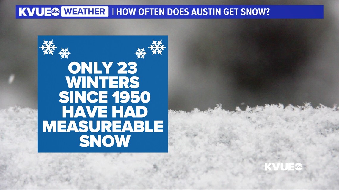
Let's start with the baseline. Despite the fact that the previous three winters have been active for winter weather, we know that snow is generally pretty infrequent here in Central Texas. Dating back to 1950, only 23 winters have brought measurable snowfall to Austin. So, essentially, only about one in every three winters brings measurable snowfall.


Now let's get into the impact of El Niño. El Niño tends to favor a more active Pacific jet stream over Texas. This tilts the odds towards wetter than average and cooler than average weather, especially during the fall and winter months. However, cool and rainy does not always mean snow or ice.
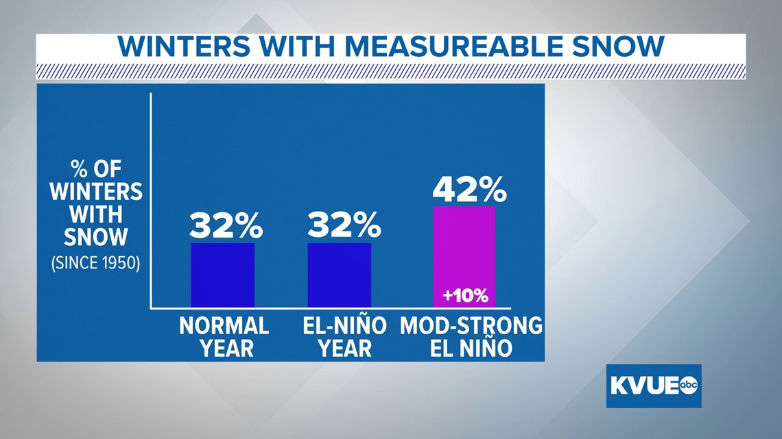
In fact, when you single out the El Niño winters that have happened since 1950, you will find that eight of the 25 brought measurable snow to Austin. This means that the odds of snow during any El Niño year is nearly exactly the same as either a neutral or La Niña year. However, that's not the whole story.
Let’s look at some of the biggest snowfall events since 1950 and whether or not they happened during El Niño years.
We start with the winter storm of 2021. This was one of the biggest winter storms in Austin's history, and it happened during a La Niña year. However, in February of 1966, it snowed a half foot during an El Niño year. Then in February of 1964, it snowed 4 inches, also during an El Niño. Beyond that, it snowed 3.9 inches in February of 1985, during a La Niña year.
So for the four most significant snow storms since 1950, it was half and half, El Niño vs. La Niña.


So we’re still not arriving at much of correlation here with regards to snowfall, but let’s go a little farther. This year is not just any El Niño year. This year, we are expecting a moderate to even strong El Niño. The strength of the El Niño is determined by the extent to which the sea surface temperatures in the East-Central tropical Pacific are warmer than average.
When you single out moderate to strong El Niño years, you find that five of the 12 years produced measurable snow, or 42%. So there does appear to be a more noticeable correlation in stronger El Niño years and measurable snowfall compared to just El Niño years in general.
Essentially, the odds of snow go up about 10% during a moderate to strong El Niño year like this one.


As we know, snow is not the only type of winter precipitation. We still have sleet and freezing rain. Let’s focus on freezing rain, which, unfortunately, has not been tracked in the same detail as rain and snowfall over the years.
What we can do is look back to the last five significant icing events for Central Texas. The last two, this past winter and the winter storm of 2021, both happened during La Niña. But prior to that, three of the last five happened during El Niño years. So these icing events do slightly favor El Niño years.


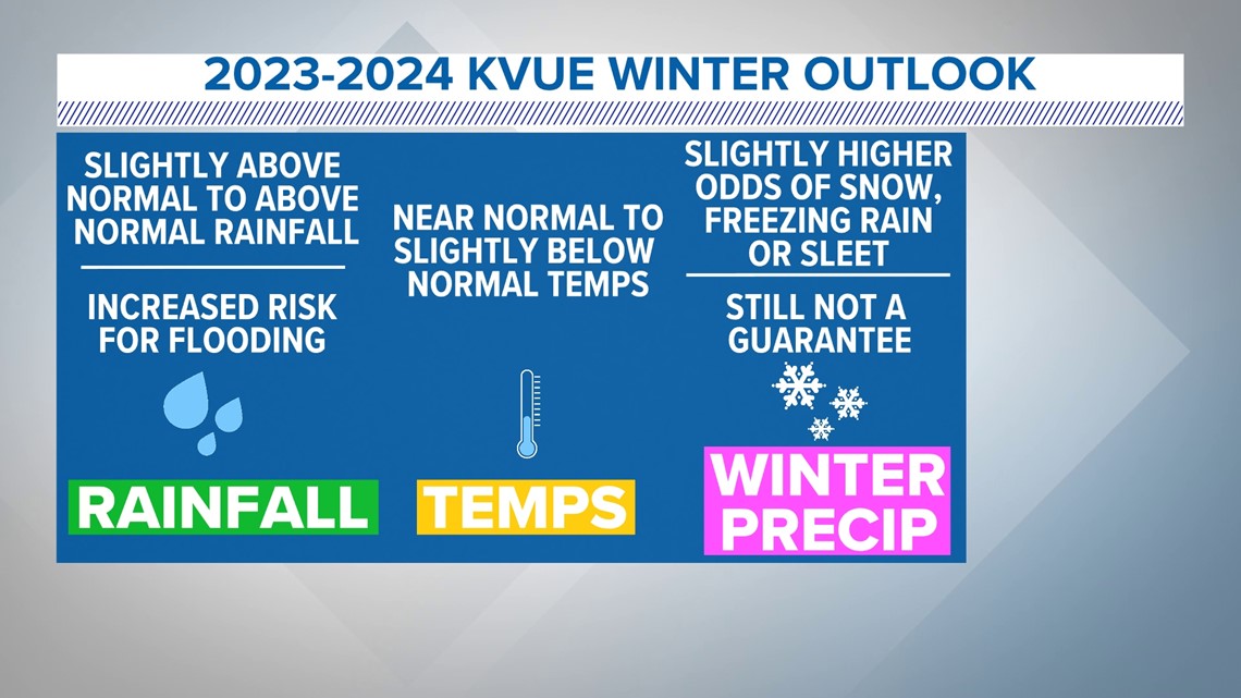
In summary, any part of a seasonal forecast is tricky, but this is the trickiest part overall. We do expect wetter than average conditions and temperatures that will be near to perhaps slightly below normal. However, as we have seen, El Niño conditions in general don’t necessarily make snow or freezing rain any more likely.
However, a moderate to strong El Niño, which is what we are expecting, does appear to make snowfall a little more likely and, in general, our past significant icing events do slightly favor El Niño conditions. So we’ll say this winter is certainly not guaranteed to have winter precipitation, but there is a slightly higher than normal chance for us to see snow, freezing rain or sleet.


Stick with the KVUE Weather Team through this winter as we monitor the forecast.

