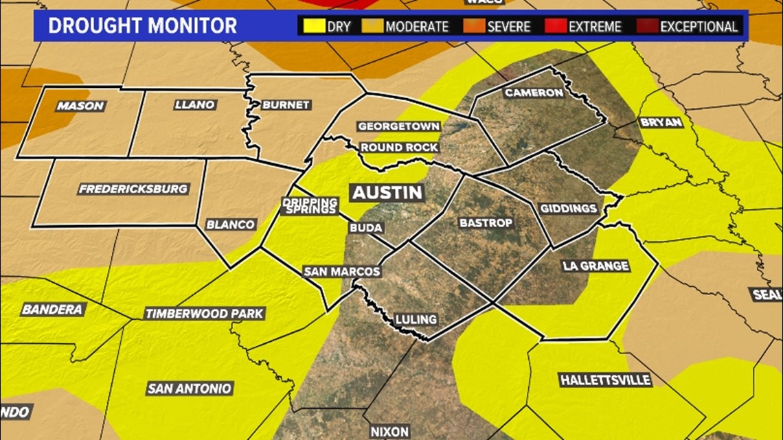
AUSTIN, Texas — The drought continues to worsen over parts of Central Texas. Abnormally dry conditions have crept into the Interstate 35 corridor and across parts of the Coastal Plains.
Even moderate drought conditions have snuck into northwestern Travis County and western Williamson County. The western parts of Mason County are in severe drought conditions. It goes without saying: we need rain!

A look at the rain chances this upcoming week
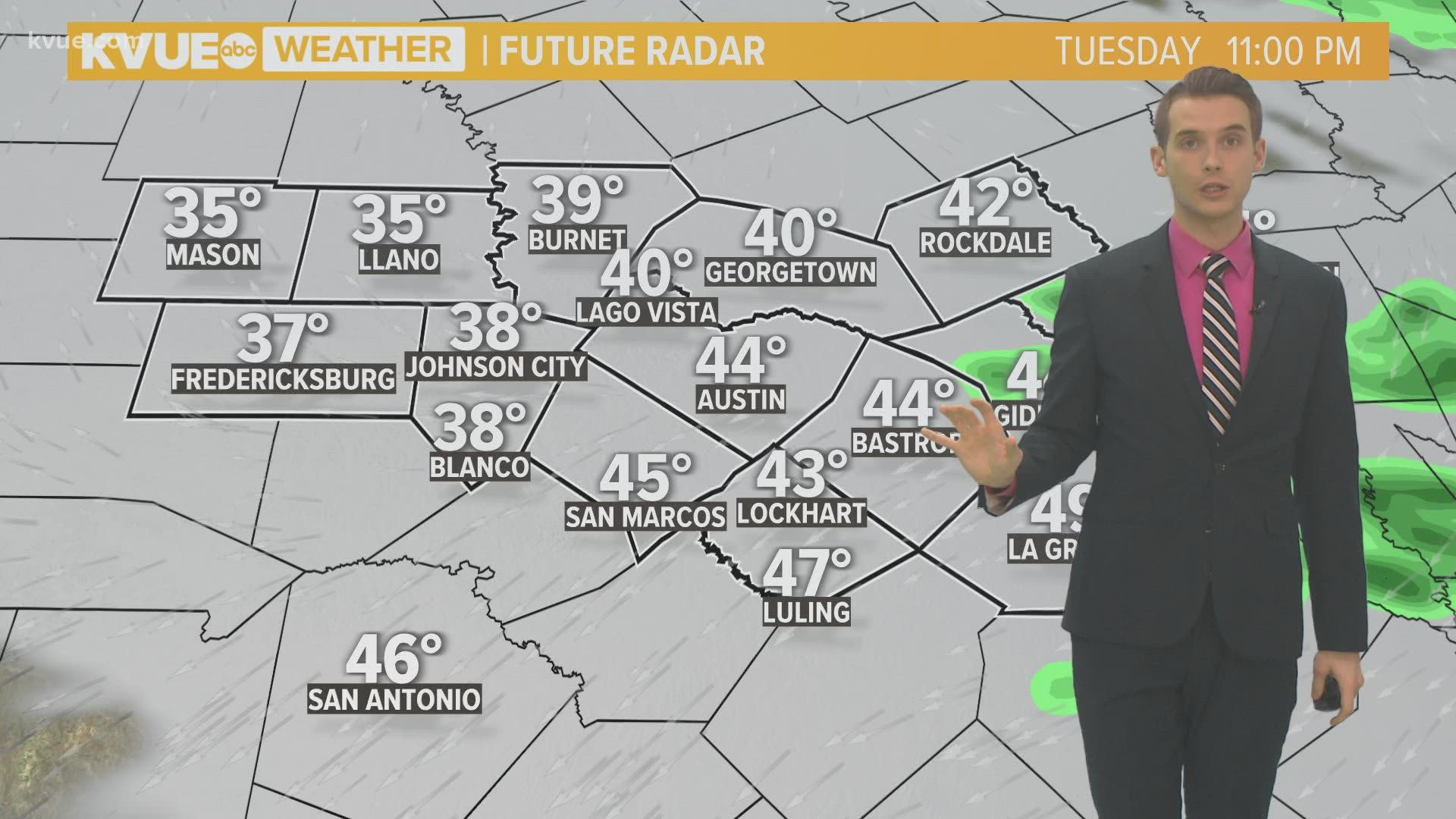
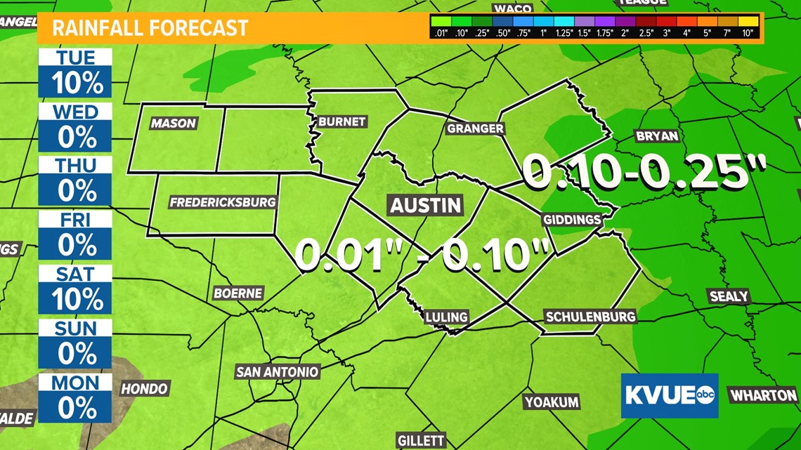
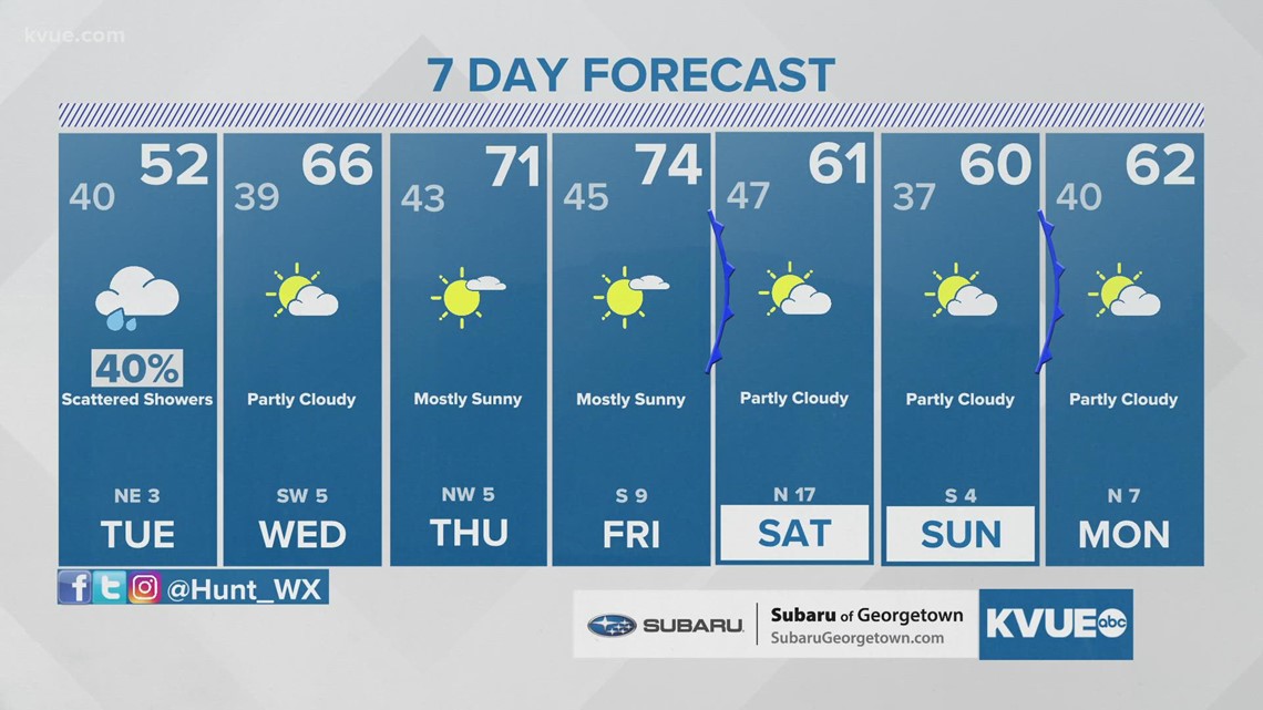
A weak, upper-level disturbance will bring a chance for lightly scattered showers throughout the region on Tuesday. Due to very dry air near the surface, any precipitation would be on the low end. The highest chances for rain will be for portions of the Hill Country and I-35 corridor.
Forecast models are now trending drier for the cold front moving through Central Texas on Saturday morning.
An early look at the rainfall totals shows around a 10th to a quarter of an inch along I-35 with possibly more than half an inch across the Coastal Plains. In the Hill Country, where the drought conditions are the worst, it's looking like less than a 10th of an inch.

Precipitation chances for the second half of January
If you don't get rain Saturday, or as much rain as you'd like, it appears Central Texas will get in on more precipitation chances during the second half of January. A more active subtropical jet stream looks to develop along with more storm systems rolling across the southern half of the country. It appears it's probable to see above-average precipitation from days six to 10 days (Jan. 15 to Jan. 19) and days 10 to 14 days (Jan. 17 to Jan. 23).

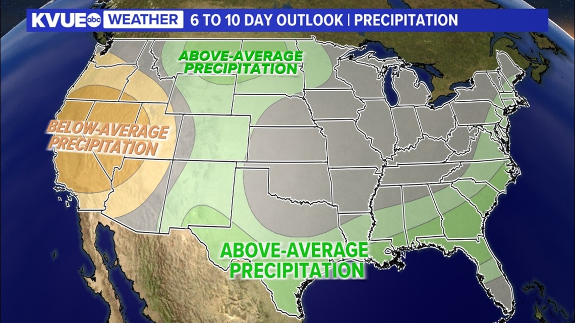

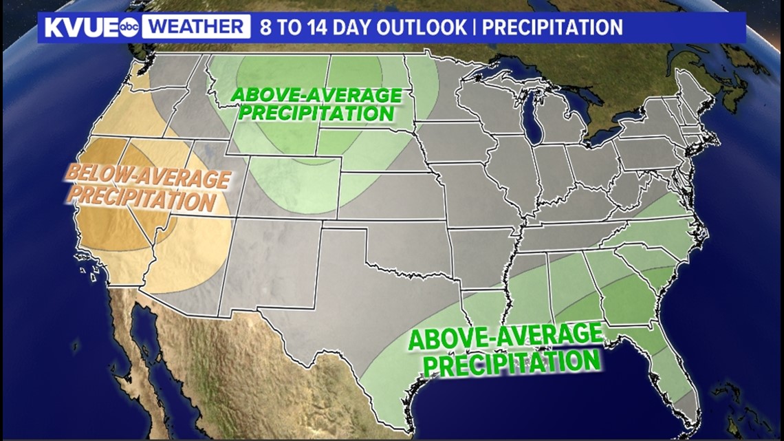
This is what we need to see because storm systems and precipitation can be hard to come by during La Niña winters in Texas. While it's too early to know how much precipitation will fall, hopefully, it's enough to put a dent in the worsening drought conditions.
It's an important reminder that wintry precipitation and severe weather can occur in January in Central Texas. While there are no signals for this right now, just be prepared as we move into a more active weather pattern.
In the meantime, here is a look at your extended forecast:

PEOPLE ARE ALSO READING:

