AUSTIN, Texas — Editor's note: This blog is no longer being updated. For the latest forecast, click here.
Mother Nature continues to spoil us with below-average temperatures as we continue the first week of the historically hottest month of the summer. Tuesday afternoon brought high temperatures in the mid- to low 90s, but high humidity kept it feeling like we were in the upper 90s most of the afternoon.
A stalled-out boundary to our south will keep high humidity in place and below-average temperatures and isolated rain chances in the forecast Wednesday.
Download KVUE's app to check radar and get updates: kvue.com/app.
Looking ahead at Austin's weather forecast
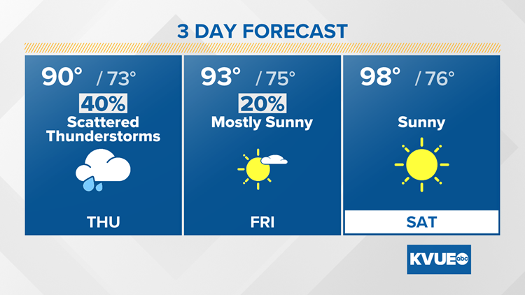
Monday's front has now moved south and will act as a focal point for additional showers and thunderstorms. This keeps slight rain chances in our forecast through mid-week. This front tries to move north Wednesday night into Thursday, bringing us a slightly higher rain chance.

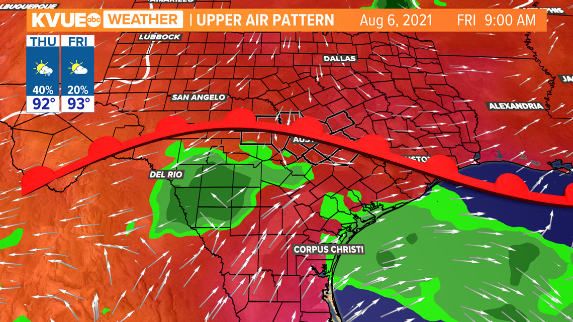
Additional rainfall totals will be less than half of an inch over the next seven days. The best chance for rain will be Thursday as the stalled-out boundary makes its way back up to Central Texas.

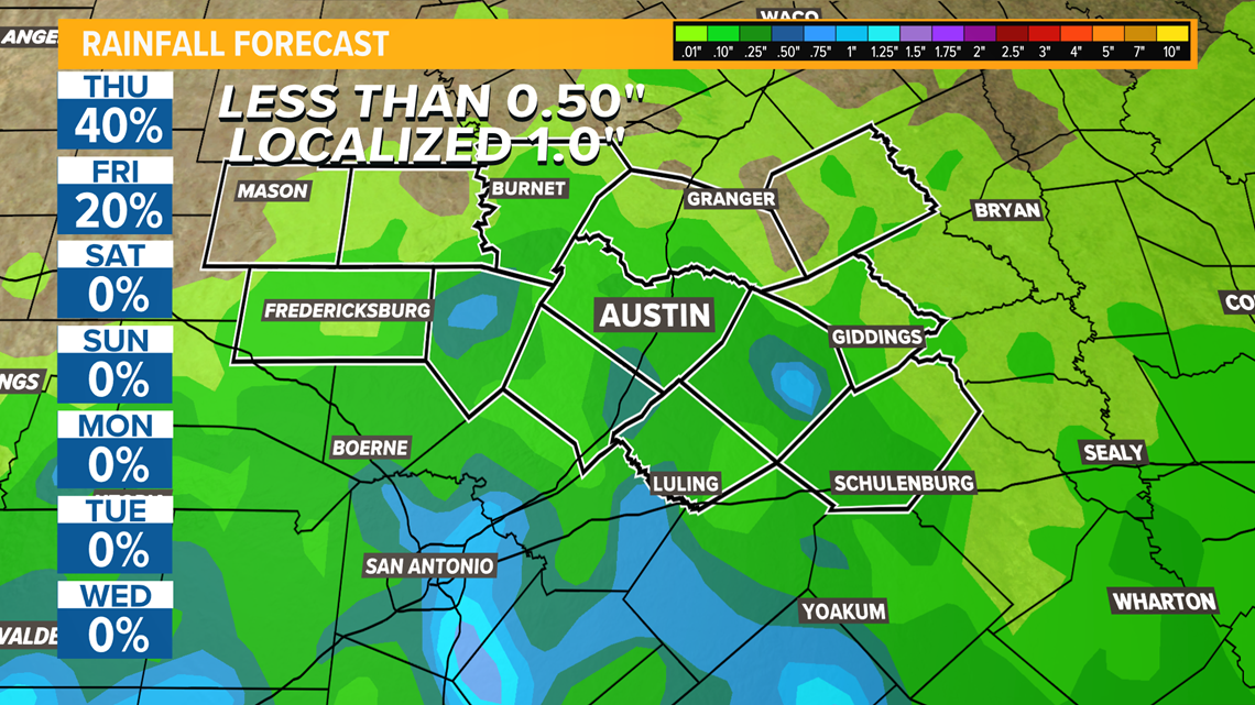
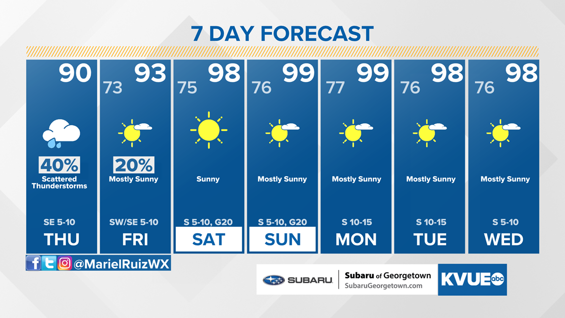
A ridge of high pressure starts to build in again by the weekend. This will shut off the rain chances for Saturday and Sunday, aside from the chance for isolated sea breeze showers, which in turn means the heat ramps up. The current forecast calls for afternoon highs in the mid- to upper 90s by the weekend.
The KVUE Storm Team will continue to closely monitor the forecast.
In the meantime, the extended forecast can be found below:

