
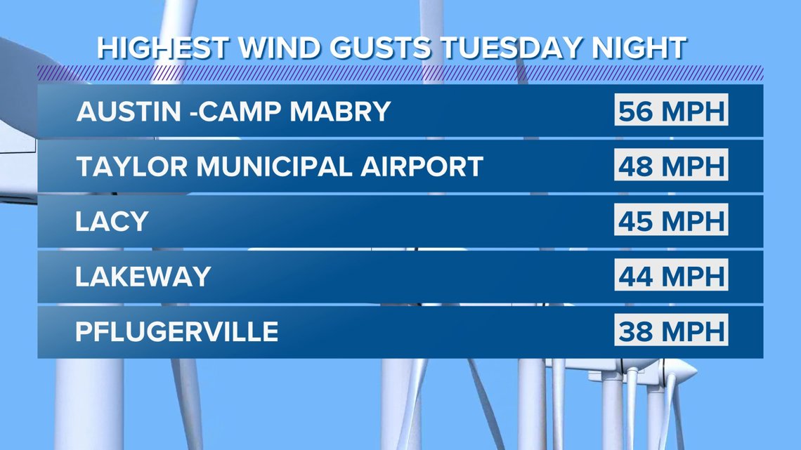
AUSTIN, Texas — Last night, Austinites may have been woken up by the sound of some very gusty winds. Gusts in Austin reached as high as 56 mph at around 1:27 a.m., and radar estimated wind speeds were over 60 mph for parts of Williamson County.
So it got very windy, but what was unusual about this set up is that the strongest winds did not happen during the stormy weather, but rather developed on the backside of the storms and happened as the rain was coming to an end.
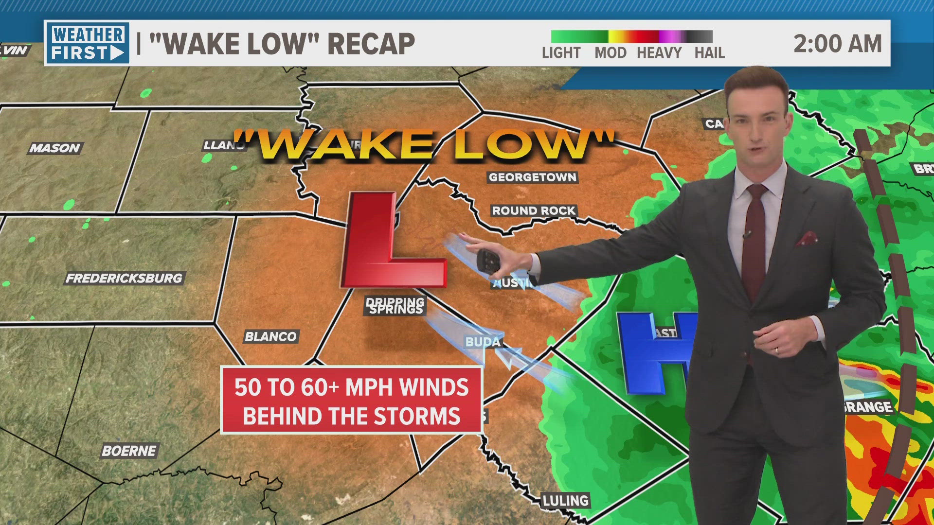
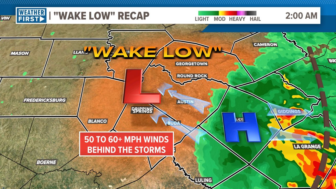
It turns out there is a meteorological reason for this, and it’s something that is know as a “wake low”.
Let’s talk about how it works!
"Wake low" radar Recap for Central Texas
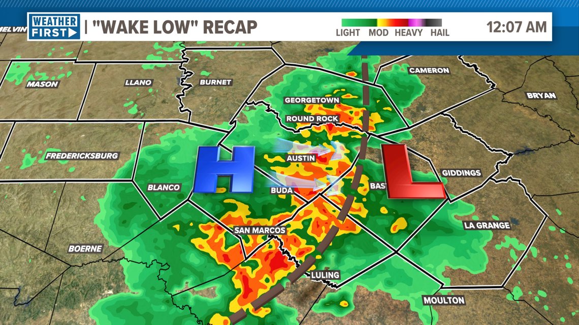
Tuesday night, at around 11 p.m., a line of storms began developing over the I-35 corridor. These storms were not severe, but they were strong. Out ahead of a squall line like this, there is relative low pressure in the warm and humid air at the leading edge of the storms.

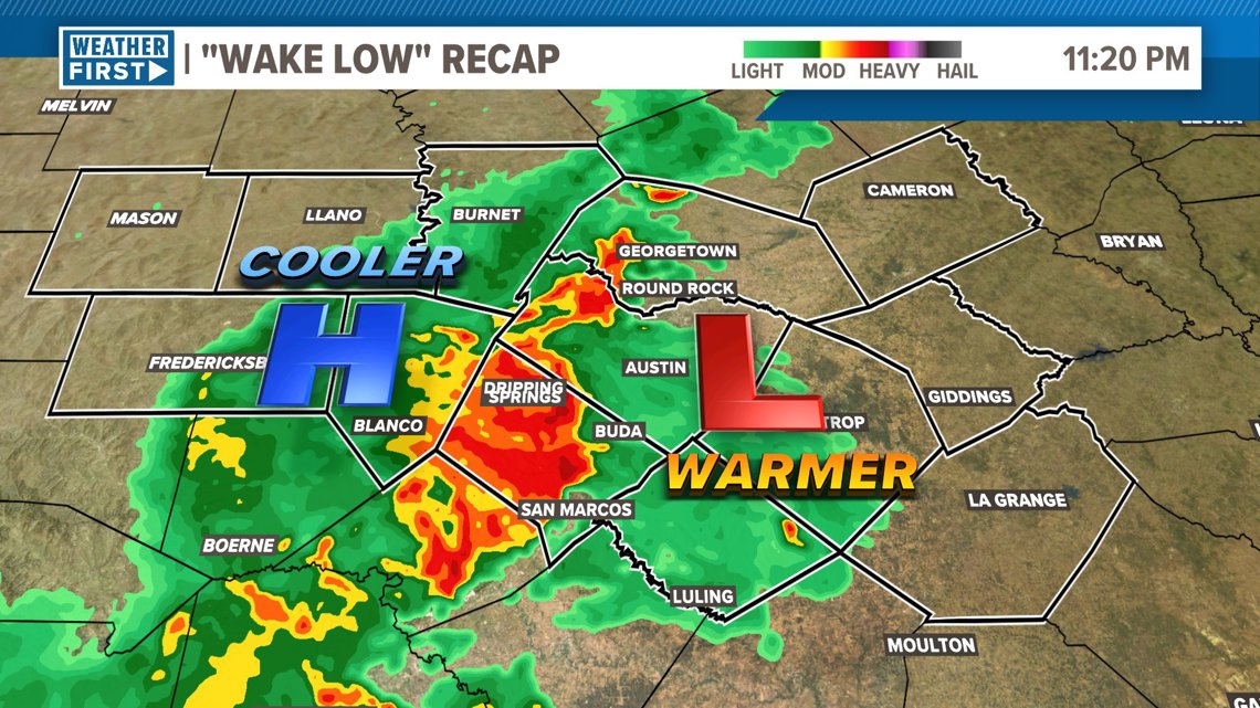
As heavy rain falls, this creates a small area of high pressure right behind the storms due to the dense, cooler air. In the atmosphere, the wind flows from high pressure to low pressure.
Imagine that the high pressure is a mountain top, and the low pressure is a valley. In this scenario, the water would flow from the mountain top down to the valley. The wind works exactly the same blowing from high pressure to low pressure.
So during the storm, there were strong westerly winds (winds coming from the west) that reached 30 to 40 mph.

If conditions are right, the strengthening area of high pressure where the rain is falling can help create another area of low pressure about 30 to 50 miles behind the storms where there is descending air.
This area of low pressure the develops in the wake of the storms is what's known as a wake low.

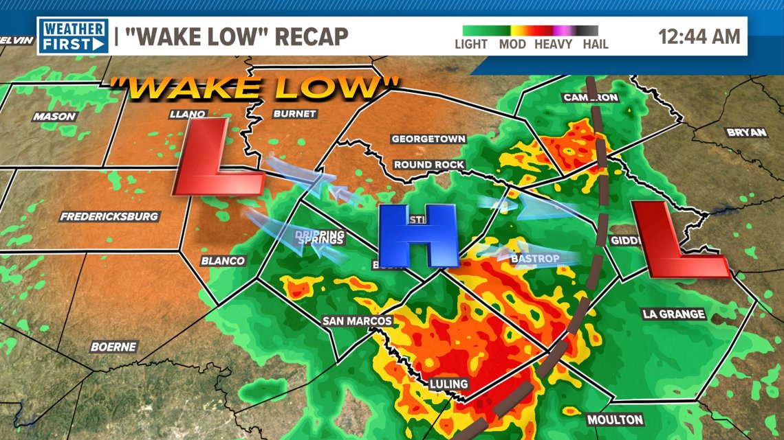
So now, a tightening pressure gradient between the high pressure associated with the rain cooled air and the wake low begin developing behind the storms. This pressure gradient can produce very strong winds, but this time, going in the opposite direction as the winds once again blow from high to low pressure.
Tuesday night’s wake low brought 50 to 60 mph winds out of the east or southeast to much of the KVUE area, especially over Travis and Williamson Counties.

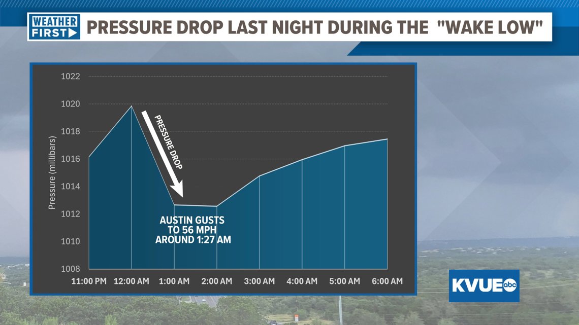
Looking at the hourly pressure data for Austin, you can even see this take place in real time. The pressure dropped suddenly from midnight to about 1 a.m. in Austin as the wake low developed and passed through. During this pressure drop is when Austin recorded the 56 mph gusts.

Other parts of Central Texas also recorded strong winds resulting in sporadic power outages and some downed trees.
You can find some of the other max wind gusts below:

The KVUE Weather Team will be sure to keep you updated on any storm chances through the severe weather season.