AUSTIN, Texas — We're tracking a warmer Sunday on tap across Central Texas!
We've got a good southerly push which will result in breezy conditions during the afternoon hours with winds that could gust up to 25 mph, so if you're going to the Glen Powell Look-Alike Contest at Auditorium Shores, you may want to make sure that wig doesn't fly off. Highs do get to the lower 80s for the afternoon hours, but we're also looking at just a few more clouds hanging around.
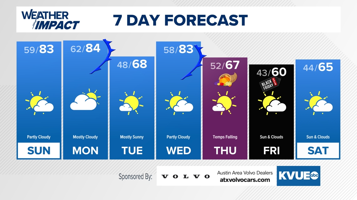
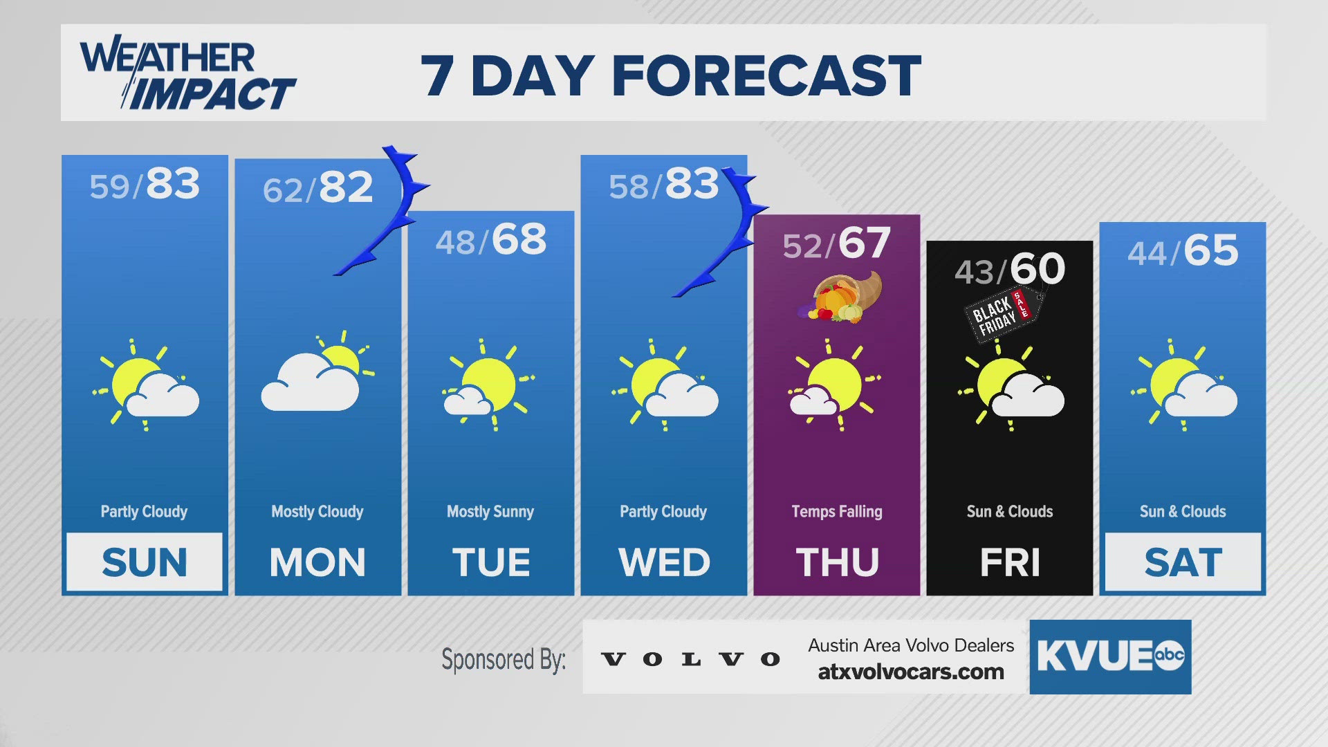
Monday we'll have nmore of the same, but we're tracking the first of two strong, but dry, cold fronts. Behind this first one, we're tracking lows in the mid-to-upper 40s across Central Texas to start your Tuesday morning, before we warm up for Wednesday ahead of that second front.
That second front arrives Thanksgiving morning, and highs could be in the upper 60s to *start* the day, with temps falling through the afternoon before bottoming out Black Friday morning in the lower 40s, so be sure to have the light jacket if you're frying the turkey outside (but we suggest baking it, especially if you didn't thaw it properly).
Stick with the KVUE Weather Impact team for all the latest as you prep for Turkey Day!
SUNDAY MORNING:
Mostly clear. Not as cold. South wind at 5 to 10 mph.
LOW: 59
SUNDAY:
Partly cloudy. Much warmer and breezy. South wind at 10 to 15 mph, with gusts up to 25 mph.
HIGH: 84
SUNDAY NIGHT:
Partly cloudy. Not as cold. South wind at 5 to 15 mph.
LOW: 62
SEVEN-DAY FORECAST:


Check out the live radar for what you can expect the rest of the day and into the workweek.

