AUSTIN, Texas — ***THIS BLOG IS NO LONGER BEING UPDATED. FOR THE LATEST FORECAST, CLICK HERE***
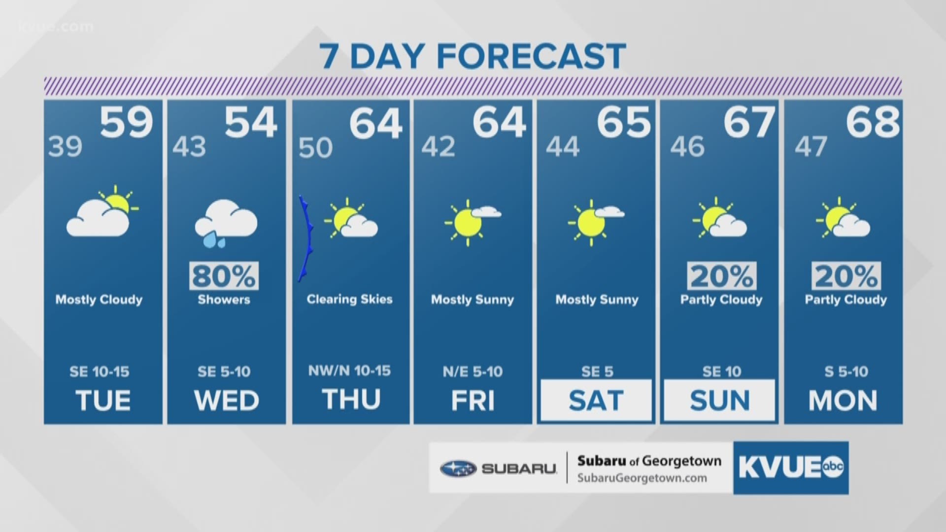
Clouds will increase Tuesday ahead of a storm system that will allow for wide-spread showers on Wednesday. Expect highs on Tuesday to be in the upper 50s to near 60 degrees.

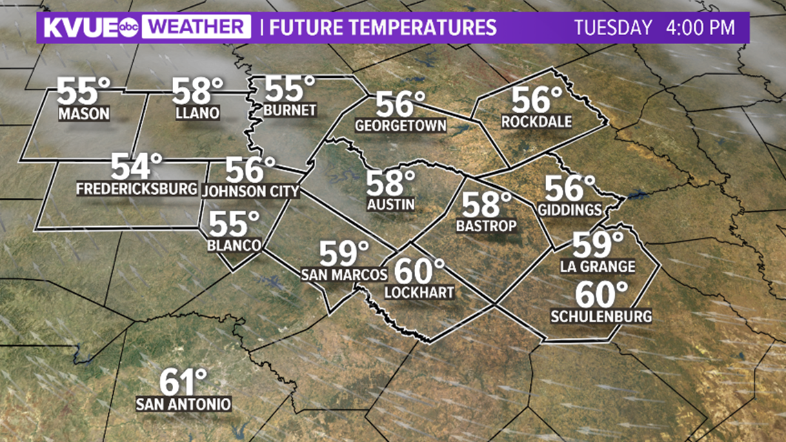
Rain chances will increase for the Hill Country by late Tuesday evening, then spread area-wide before sunrise on Wednesday. Most of the showers will be light to moderate, although an isolated rumble of thunder and a downpour cannot be ruled out.

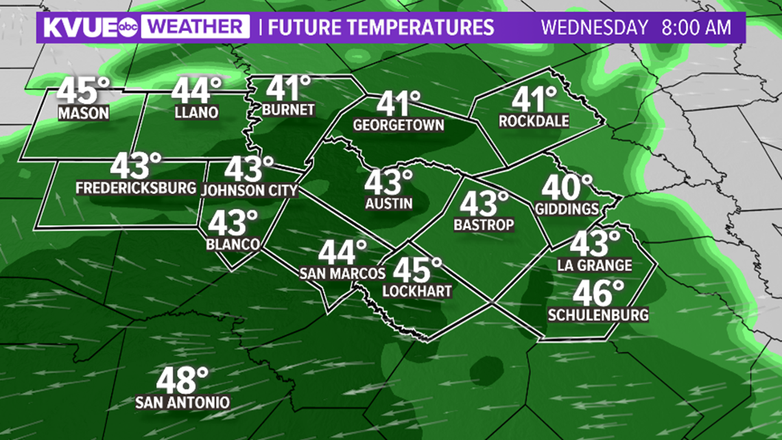
Rain chances will linger for areas along and east of Interstate Highway 35 through Wednesday night.

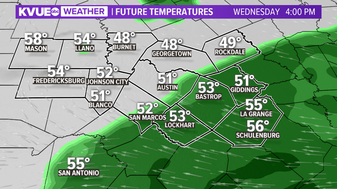
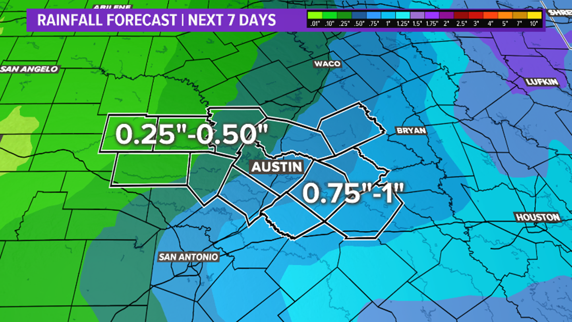
Rainfall amounts could add up to as much as an inch, but mainly for areas along and east of the interstate.

Our next front arrives early Thursday with a strong north wind. Clearing skies is expected through Thursday afternoon with highs in the low 60s.

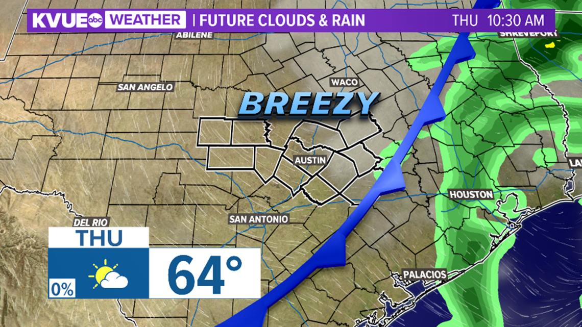
Expect mainly dry conditions with highs just above average for Friday and this weekend.
PEOPLE ARE ALSO READING:

