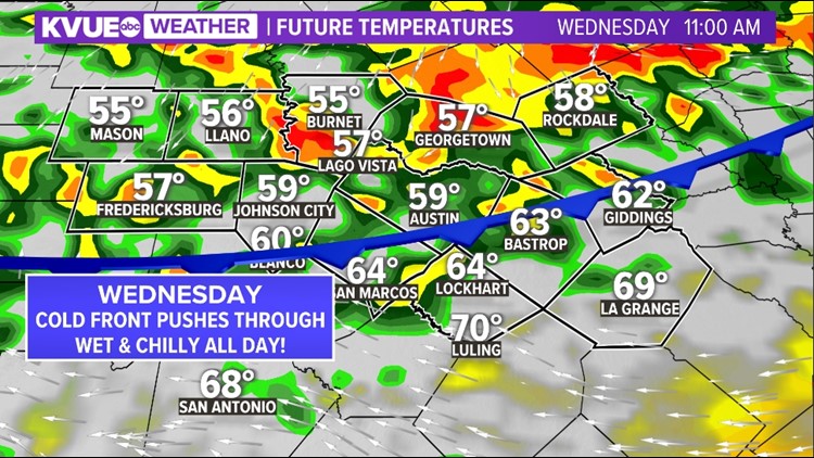
AUSTIN, Texas — It's time to dust off the umbrellas and raincoats. Some of you may want to pull out a warm jacket! The strongest cold front of the season so far is pushing through Wednesday.
This will be a slow progressing front that will keep us wet and chilly all day Wednesday. But don't be fooled by the slow passage of the boundary, it still brings quite the chill for the second half of the workweek.

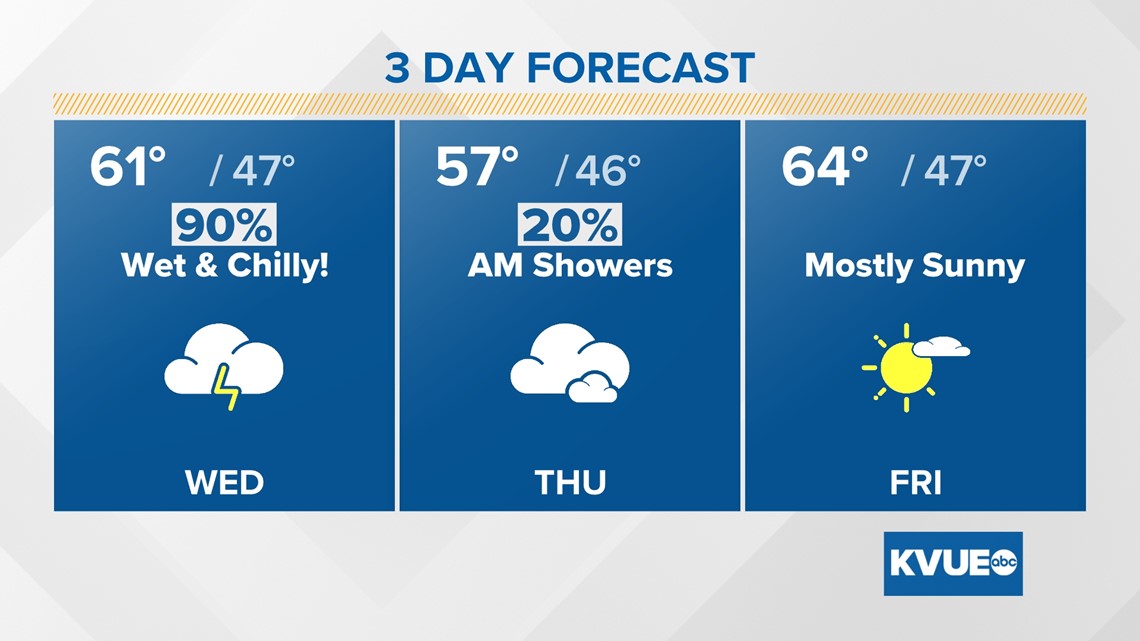
Timeline
Wednesday morning: This is when we'll feel our high temperature for the day, right before the cold front pushes through. Temperatures will be in the 60s for our central and eastern counties. Wet weather will already be at play, so don't forget to grab the umbrella before you hit the road and give yourself plenty of time for your morning commute.

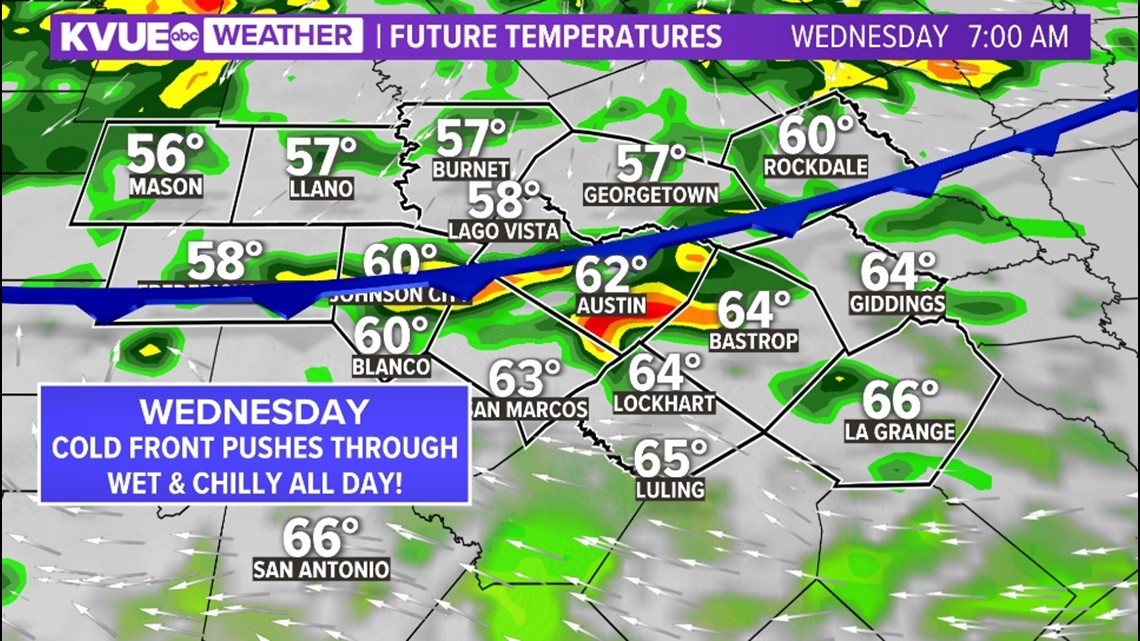
Notice once the cold front pushes through, temperatures quickly drop to the 50s. We expect most to stay in the 50s through the rest of the day with showers and storms becoming widespread. While the severe weather threat is low, showers and storms could still be strong at times.


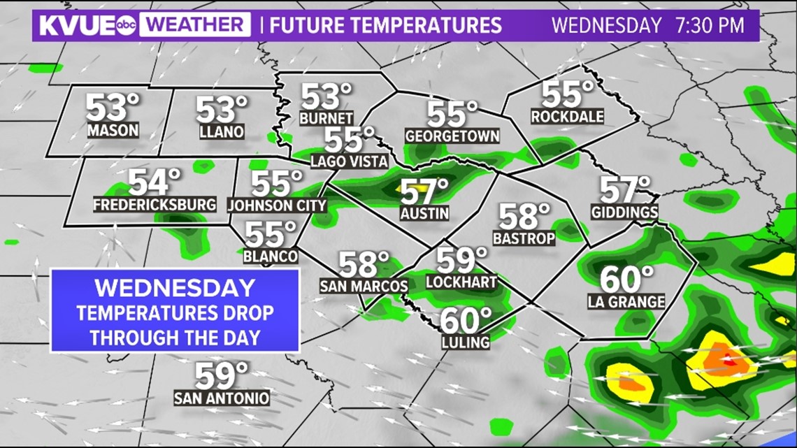
Wednesday evening: Rain chances still linger, but most of the strong storms will be well east of Central Texas. Overcast skies will remain in place and the chilly temperatures will be about 20 degrees below average for this time of the year.
The overcast skies will act as a blanket in the atmosphere and only allow temperatures to dip to the upper 40s and low 50s for most of Wednesday night.

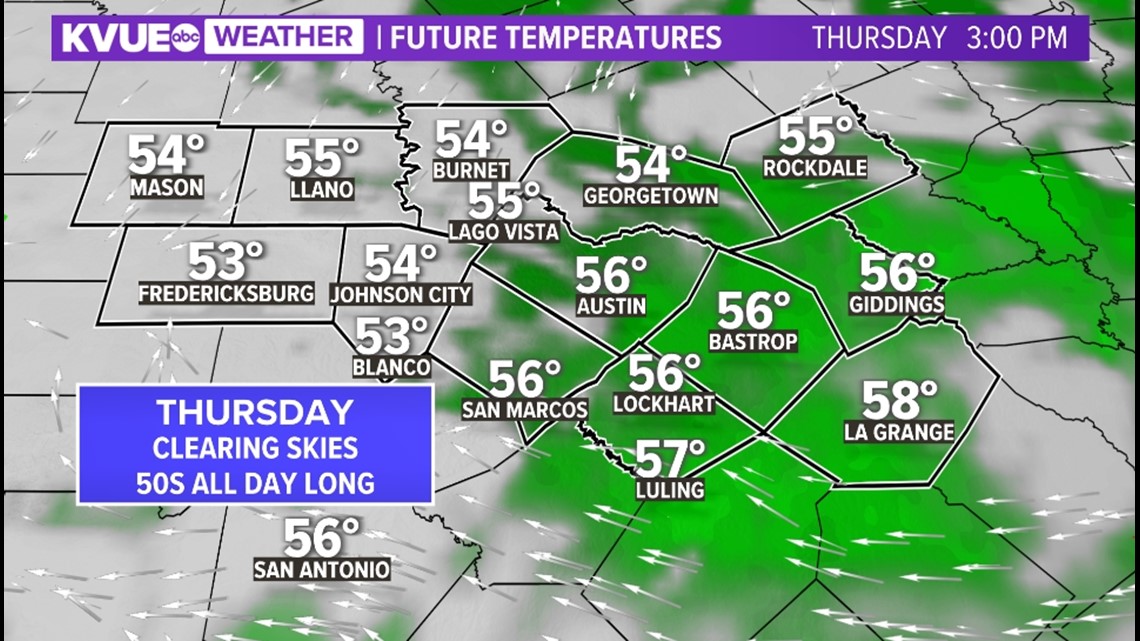
Thursday: Much drier but still chilly. Hoodie weather will be at play with everyone expected the stay in the 50s. There will be a 20% chance of an isolated shower early Thursday morning, but other than that, it's overcast skies and another below-average temperature day.

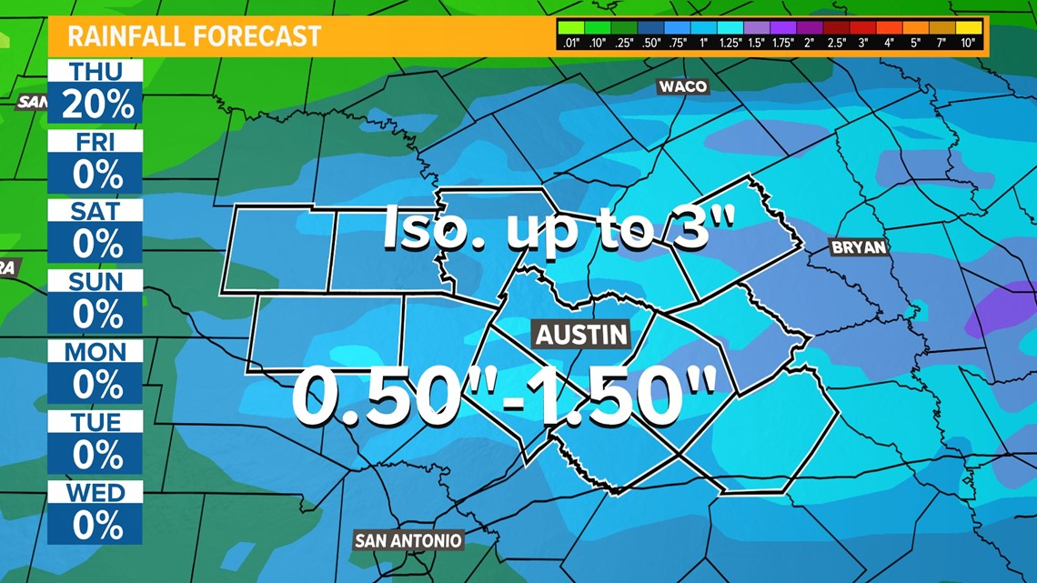
How much rain can we expect? Rainfall accumulation will range from 0.5 to 1.5 inches for most, but isolated spots could see up to 3 inches of rain. This may spark up some minor localized flooding, but a major flooding event is not expected. The highest chances for this occurring would be for our eastern counties.

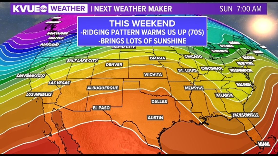
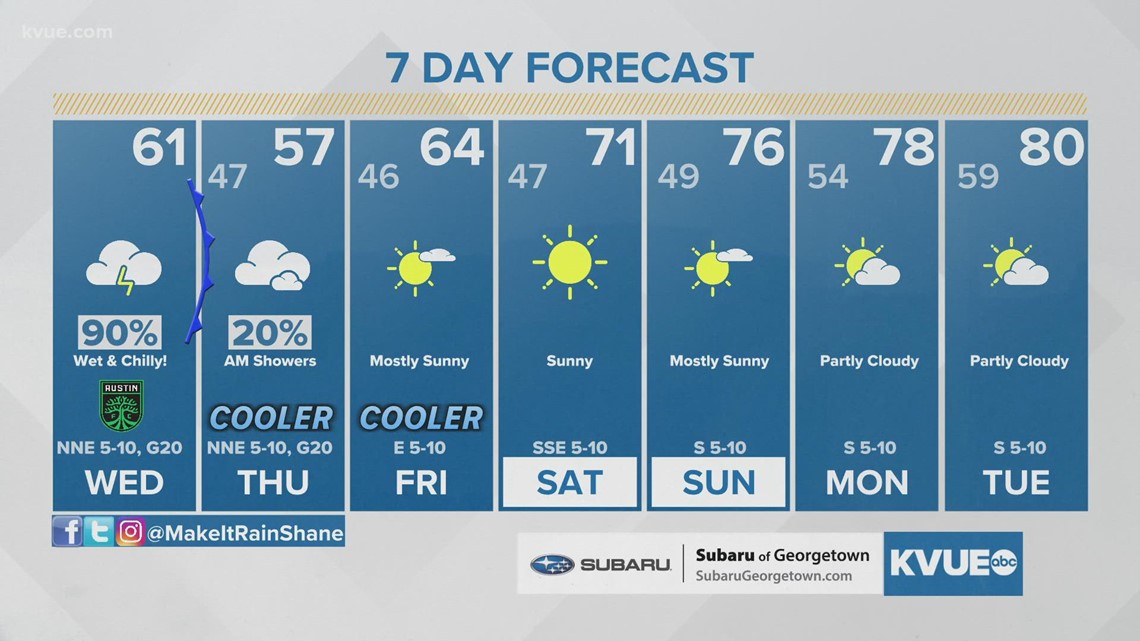
A ridge of high pressure will build back in just in time for the weekend. This will allow for a gradual warming trend and bring plenty of sunshine. Highs will rebound to the mid-60s Friday, then low 70s for Saturday and Sunday.

The KVUE Storm Team will continue to closely monitor this developing forecast.
In the meantime, the extended forecast can be found below:

PEOPLE ARE ALSO READING:


