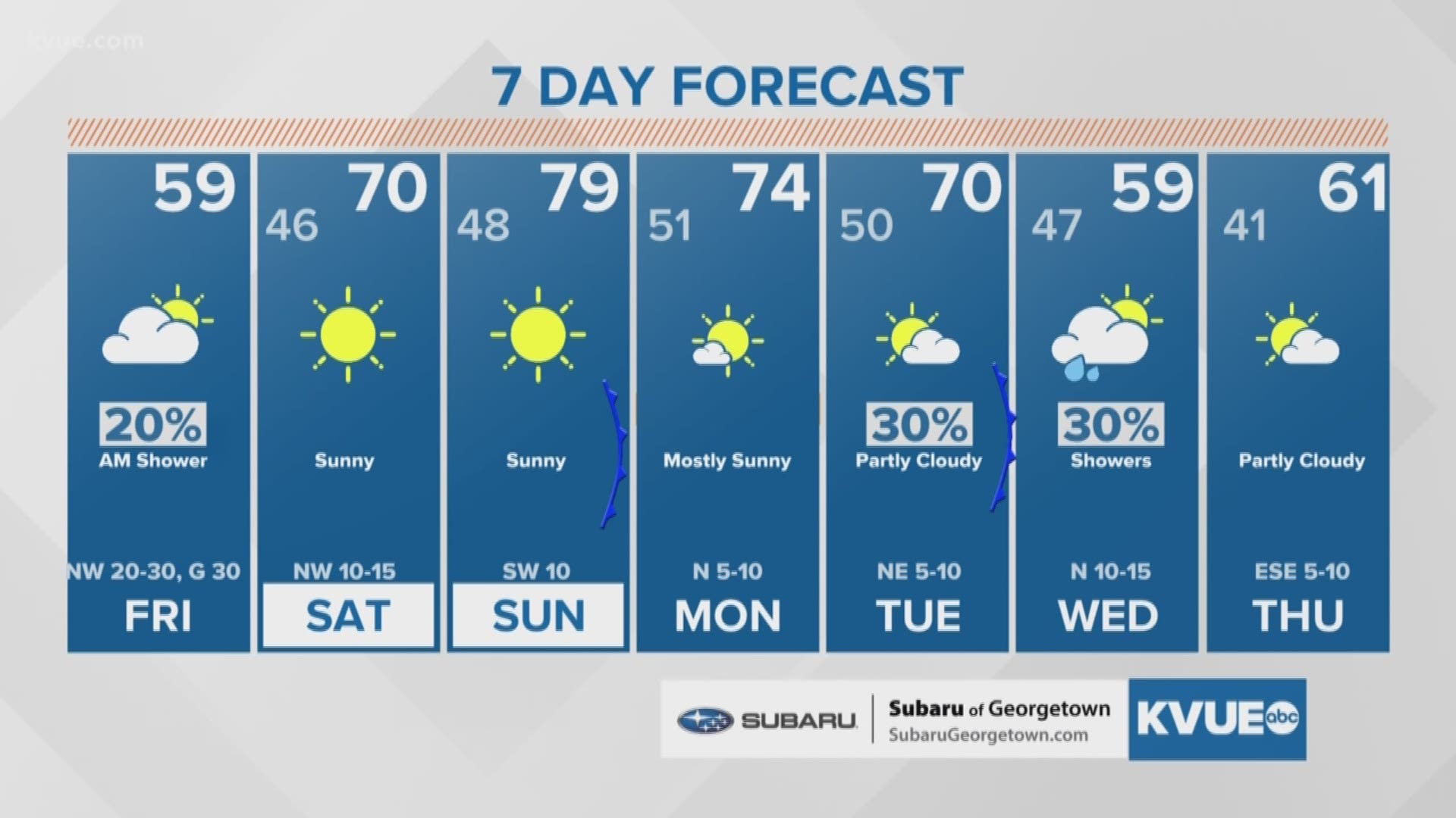
AUSTIN, Texas — ***This blog is no longer being updated. For the latest forecast, CLICK HERE***
The cold front that brought in the stormy weather Thursday night has brought cold air into the Austin area and Central Texas.
Beneficial rain totals ranged from less than one inch to just over seven inches of rainfall. Some city roads in Austin became so inundated with rain that several drivers had to call first responders for help.
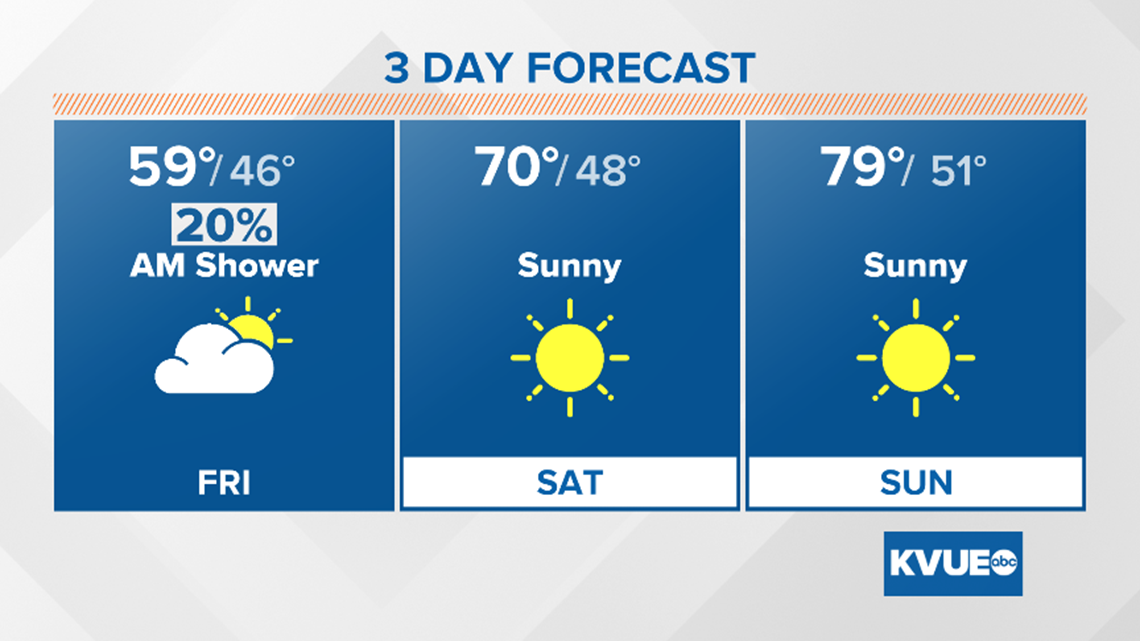
Now that the rain has moved out, cooler and drier air is filtering in, helping clear the cloud cover by the afternoon.
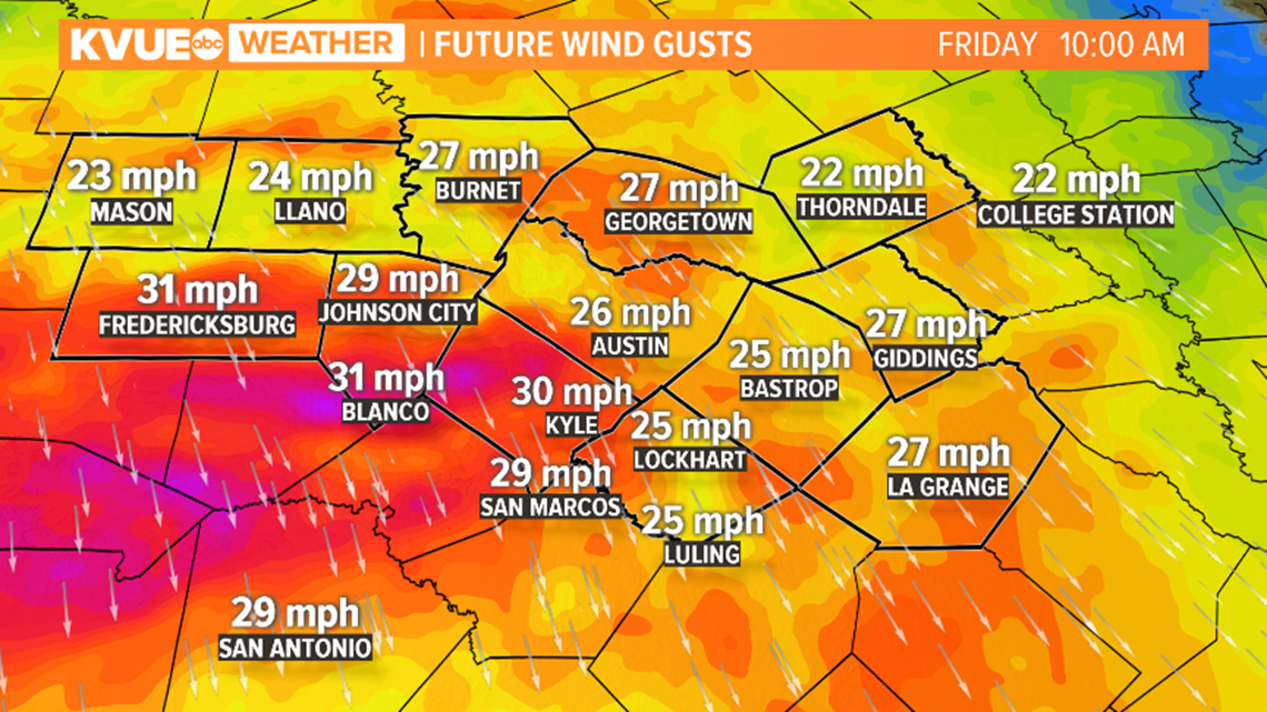
Windy weather follows the front with wind gusts reaching the 30 to 35 mph range. This is why the National Weather Service has issued a Wind Advisory until 4 p.m. Friday.

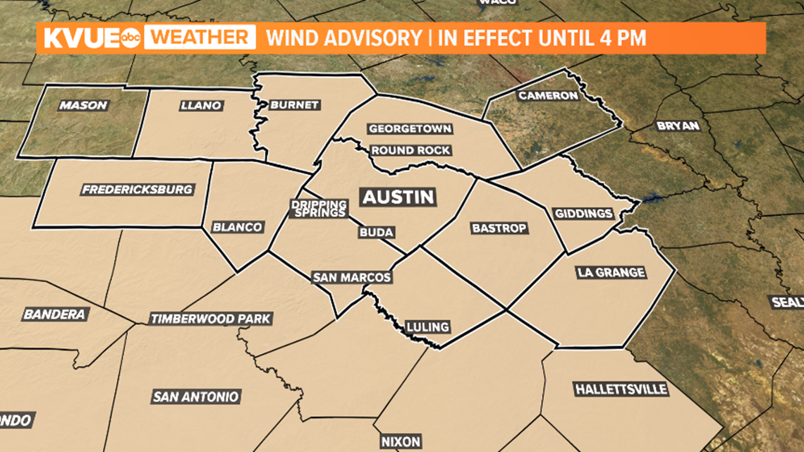
Wind gusts will be the highest Friday morning and will calm through Saturday morning.

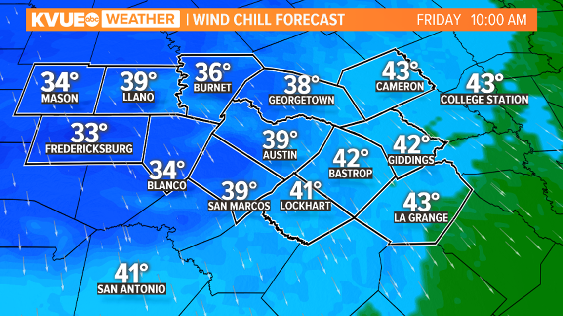
The strong north wind plays a big role with temperatures and wind chills – or the "feels like" temperature. While the actual temperatures will be in the 40s across the region, it will feel like the 30s when the north wind is factored in during the mornings.

While the mornings will be chilly, sunshine will help our temperatures climb to the 70s during the afternoon. A combination of the sunshine and dry air will make the afternoons feel comfortable and pleasant!

Stay up to date with the latest forecast by downloading KVUE's app at kvue.com/app. Follow KVUE on Facebook, YouTube, Twitter and Instagram.
PEOPLE ARE ALSO READING:

