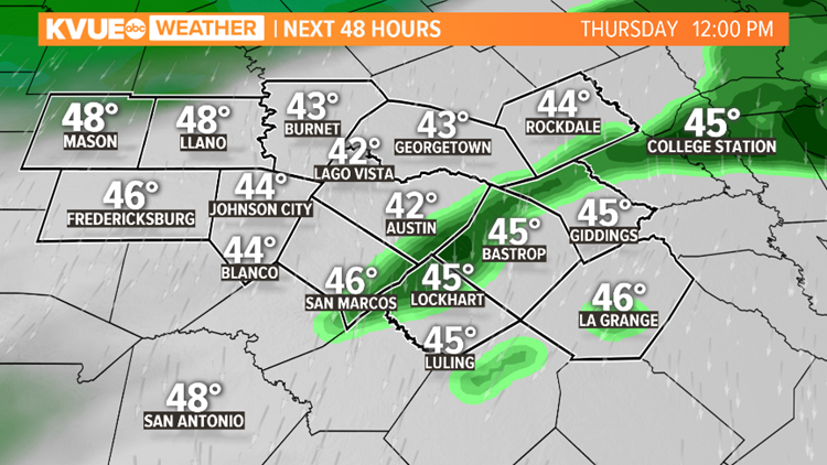
AUSTIN, Texas — Areas of rain and patchy dense fog continue through the morning as moisture moves through the area within an upper-level low. Most of this will be east of Interstate Highway 35. By mid-morning, shower activity will near widespread reach with a decent amount of cloud cover. Rain thins out in the early afternoon.


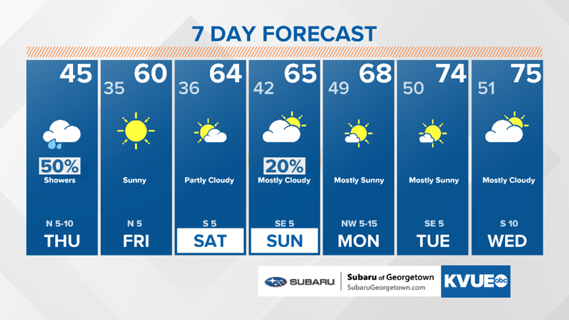
With cloud cover holding on for most of the day, high temperatures on Thursday will only be in the mid-40s – nearly 30 degrees below average for this time of year.

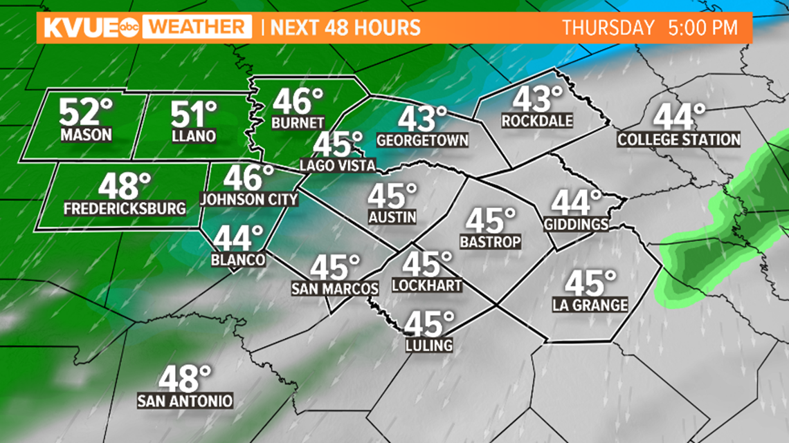
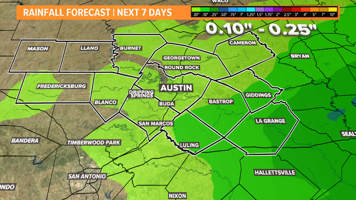
Most of the area will see less than a half-inch of rainfall in the next 36 hours.

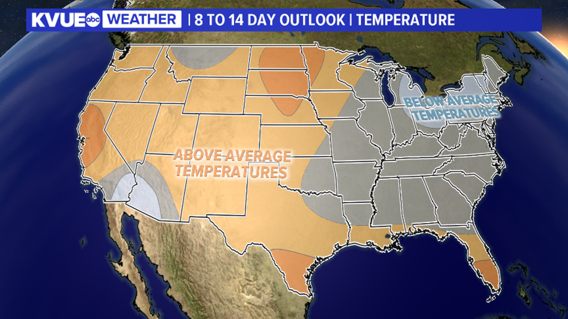
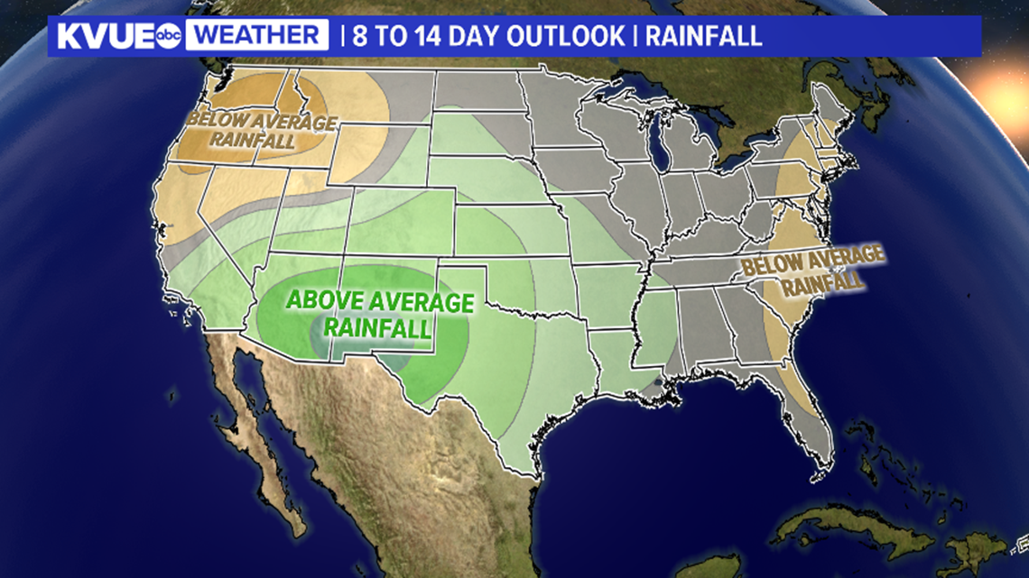
Looking ahead through late November, the outlook for the Lone Star State shows a slight reprieve from the chilly weather with a slight edge of above-average temperatures and slightly above average rainfall.


Prepare for a dry but cooler-than-average weekend with our next chance for precipitation on Monday due to a trough cascading across the region. The front is expected to be swift-moving and limited in moisture. Highs will steadily warm through the 7-day beginning Sunday.

PEOPLE ARE ALSO READING:

