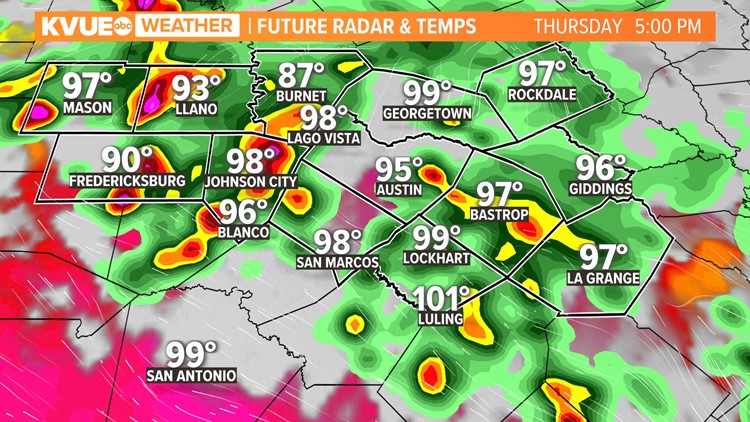
AUSTIN, Texas — Our five-day streak of record heat should finally come to an end Thursday afternoon. Not only that, but we're also looking at our most promising storm chances of the week for the afternoon and evening.
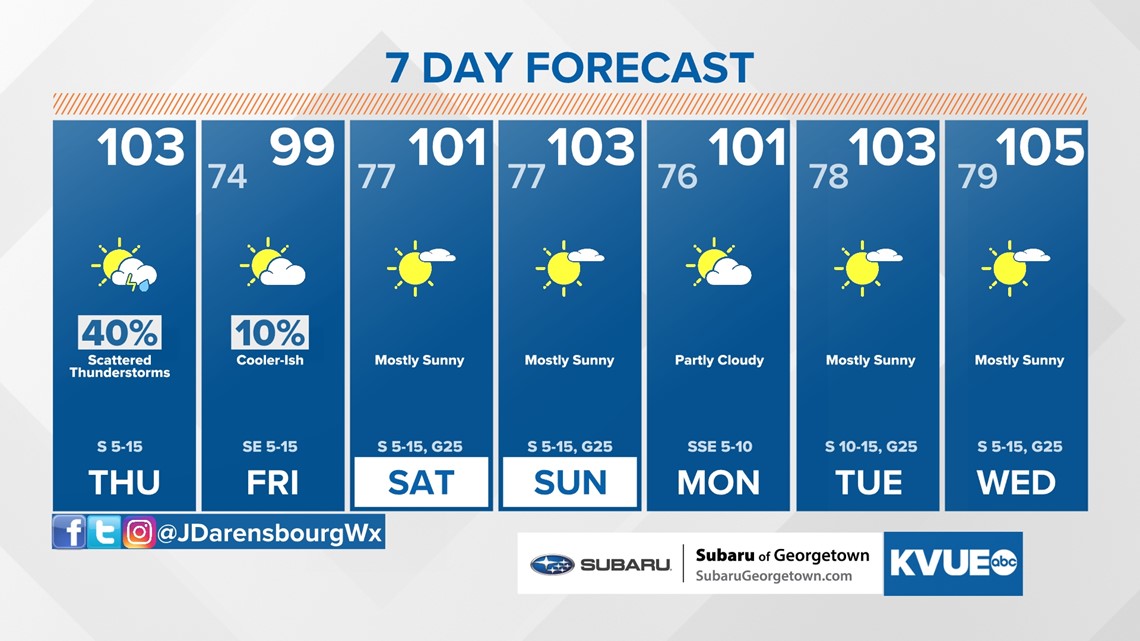
Although it's not record heat, we're still toasty Thursday with a high temperature near 103 today in Austin. Feels-like temperatures could be closer to 110 and a Heat Advisory is in effect for most of the KVUE area until 8 p.m.

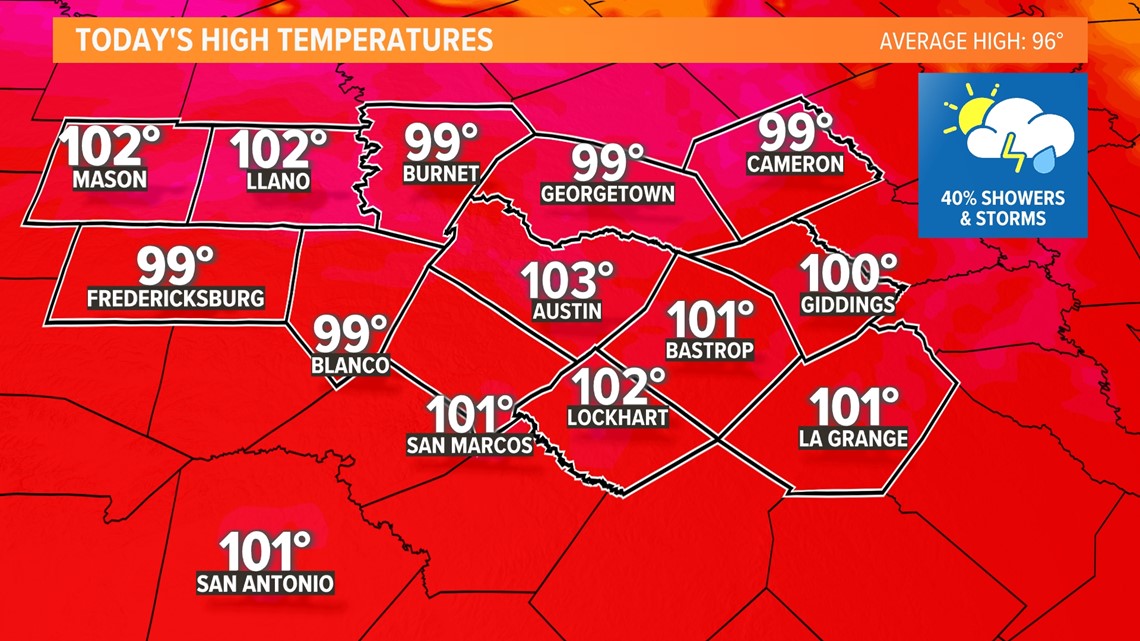
So the rain likely won't move in soon enough to drop us out of the triple digits, but storm chances continue to look more promising for this afternoon and evening.
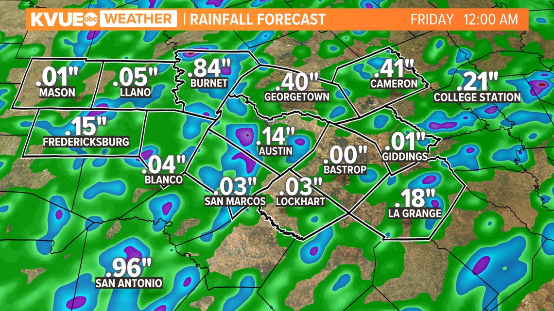
Storms will initially develop north of the KVUE area and will drift southward through the late afternoon and evening. These storms will still be scattered so, unfortunately, there will be some areas that miss out on beneficial rain.

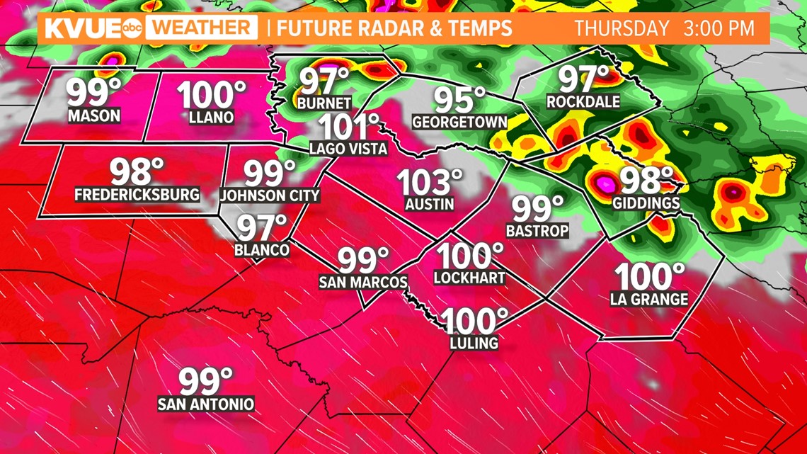
However, some areas that get under heavy storms could pick up a quick inch or more of rainfall.
The severe threat Thursday is low, but there could be one or two strong to severe storms with gusty winds and perhaps some small hail. Remember: when thunder roars go indoors!


Storms should be entirely out of the KVUE area by around midnight or so.
We're knocking on wood and hoping to get some beneficial rainfall through Thursday evening, as drought conditions continue to worsen. Once we get through Thursday's rain chance, the rest of the 7-day forecast looks just about completely dry.

The KVUE Weather Team will continue to monitor this developing forecast.
In the meantime, the extended forecast can be found below:

PEOPLE ARE ALSO READING:

