AUSTIN, Texas — Editor's note: This blog is no longer updating.
Thursday will feature a low-end threat for severe weather across Central Texas.
Widespread storms like what moved through Wednesday afternoon and night are not expected, but an isolated storm capable of hail and gusty winds will be possible.
The latest outlook from the Storm Prediction Center includes the KVUE area in the "marginal" -- level one of five -- risk for severe storms. The higher likelihood of severe weather is expected to remain to the south.
As opposed to Wednesday, the coverage of storms for Thursday will be very widely isolated. This means most locations will stay completely dry and not experience any stormy weather.
Be sure to download KVUE's app in order to get constant updates on severe weather in Central Texas: kvue.com/app. Also be sure to follow KVUE on YouTube, Facebook, Twitter and Instagram.
LIVE UPDATES HERE:
7:35 p.m. - Severe Thunderstorm Watch has been canceled for Central Texas.
4:35 p.m. - A Flash Flood Warning has been extended in East Gillespie County until 8:30 p.m. One to two inches of rain have fallen and rain continues in the county.
3:57 p.m. - Severe Thunderstorms have moved south of the KVUE viewing area. Flash Flood Warning for Gillespie County is still in place until 8:15 p.m.
3:12 p.m. - Flash Flood Warning for Gillespie County until 8:15 p.m. An estimated two to three inches of rain have already fallen and heavy rain continues.
2:40 p.m. - Severe Thunderstorm Warning for Gillespie County until 3:15 p.m. for a storm south of Fredericksburg moving south at 15 mph. Half-dollar size hail possible.

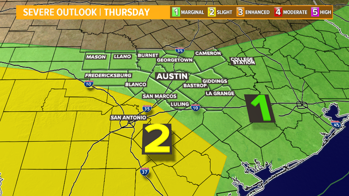
A timeline of Thursday's possible severe storms in Central Texas
After a quiet morning, isolated storms may begin developing as early as 2 p.m. or 3 p.m. Thursday afternoon.
RELATED: Today's Allergy Report

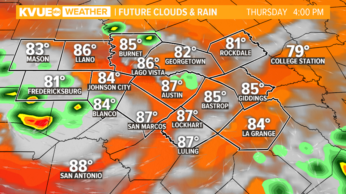
Widely isolated activity will continue through the mid- and late-afternoon hours. For areas not experiencing storms, expect mostly to partly sunny skies with temperatures in the 80s.
The threat for severe storms will continue through the evening hours as any storms gradually build to the south.

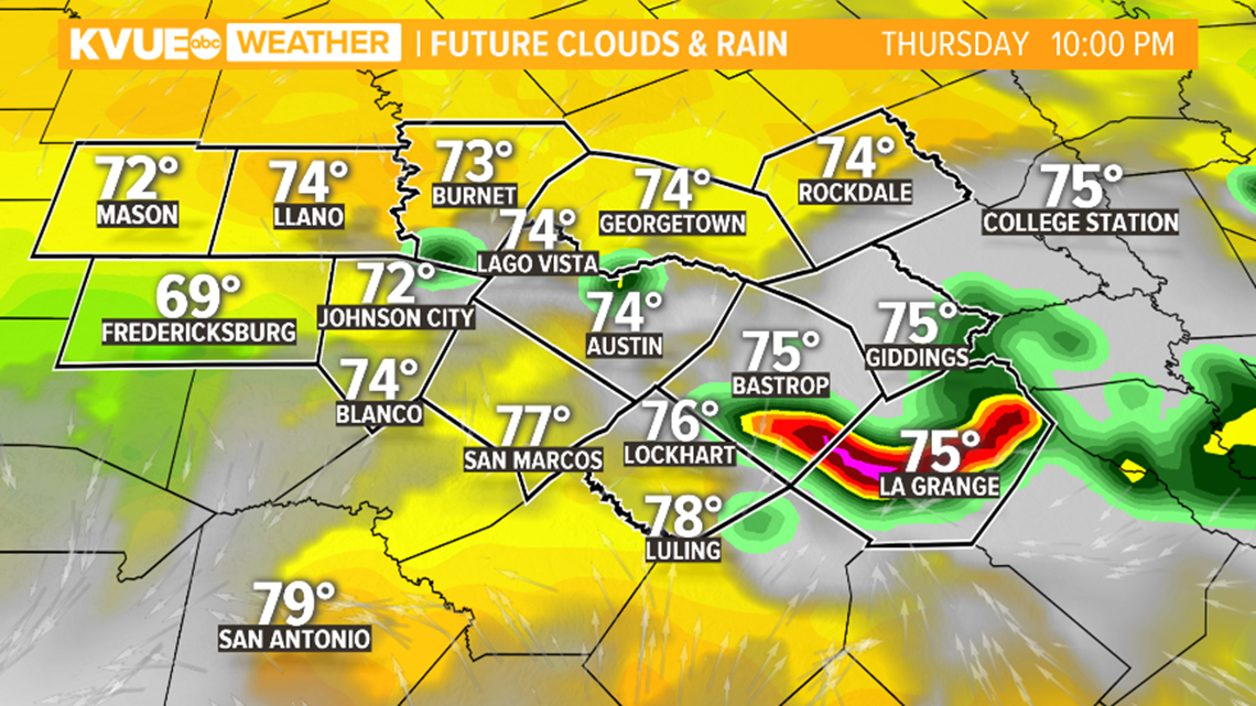
As activity moves southward through the evening, a few more organized clusters of storms may develop, especially just south of the KVUE area where the higher severe weather risk is expected.
By about midnight any remaining storms should be moving south of the area, and the severe weather risk will come to an end.

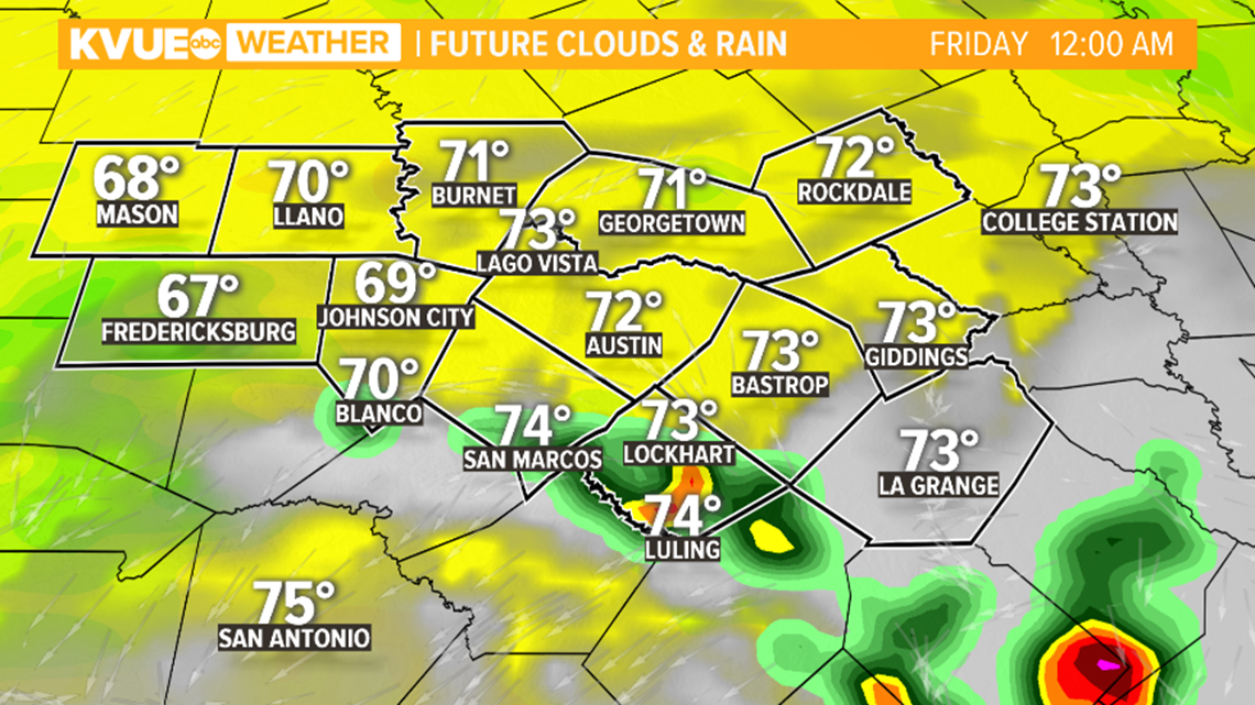
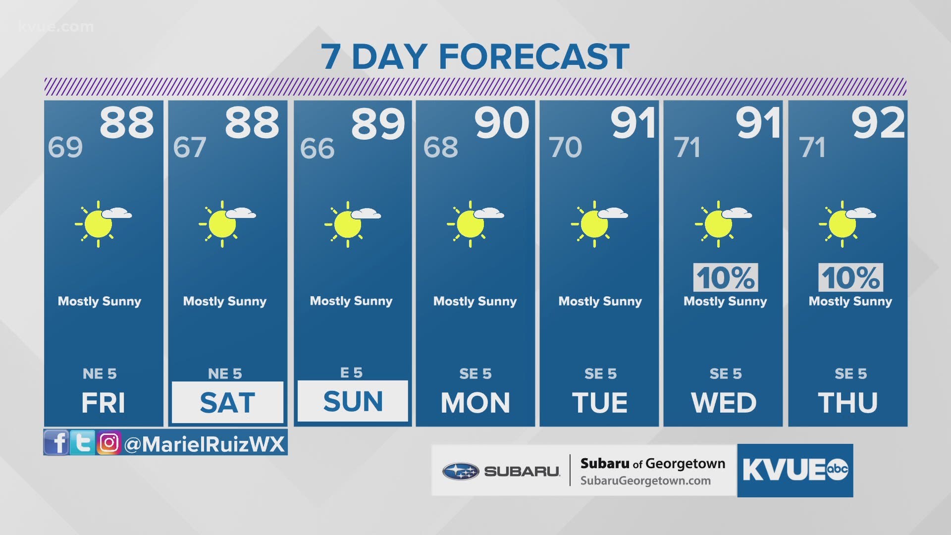
Friday will be just about completely dry, and very nice weather is in the forecast for the upcoming weekend.
Here are some tips to help you prevent hail damage:
The KVUE Storm Team will continue to monitor this developing forecast.
The extended forecast can be found below:
PEOPLE ARE ALSO READING:

