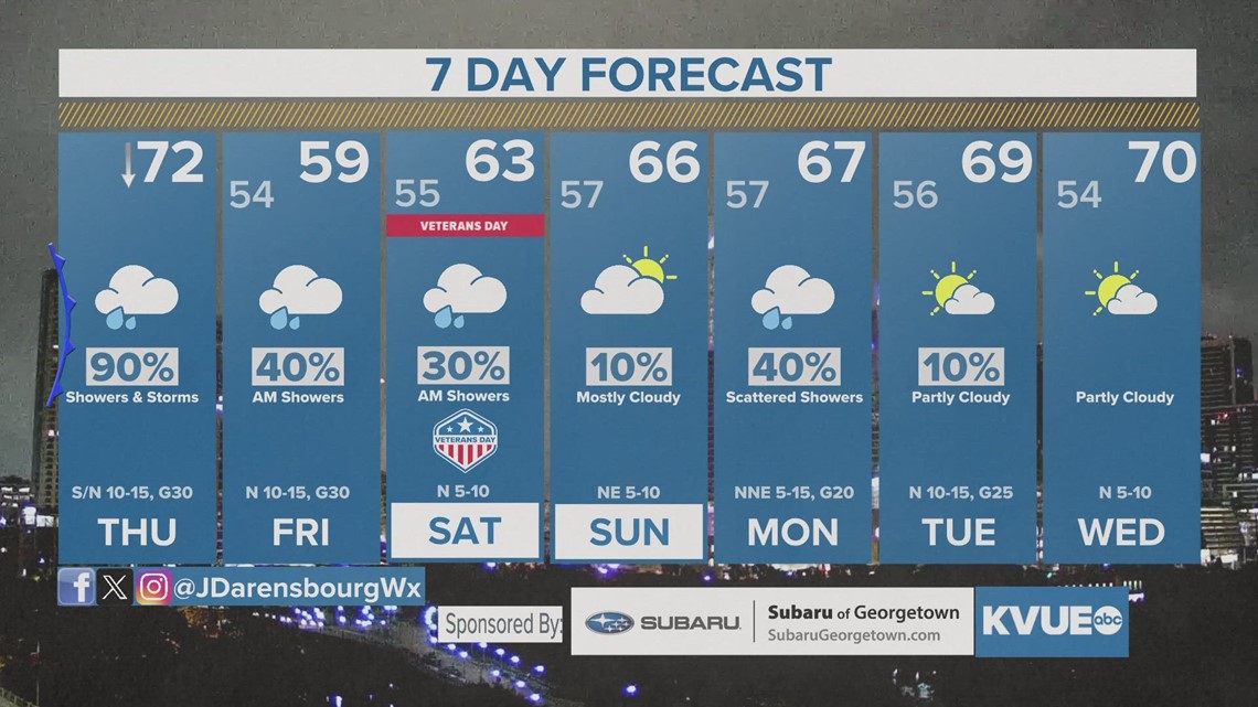
AUSTIN, Texas — After spending a few days this week in the 80s, we're now looking ahead to a significant cool down that will last through early next week. This will be the result of a cold front that has pushed into the Hill Country early Thursday morning and crossed the Interstate 35 corridor.
Ahead of the front, Thursday morning was cloudy, muggy and damp with pockets of fog and light rain showers. Temperatures warmed into the low to mid 70s during the mid to late morning hours and then fell through the second half of the day behind the front.

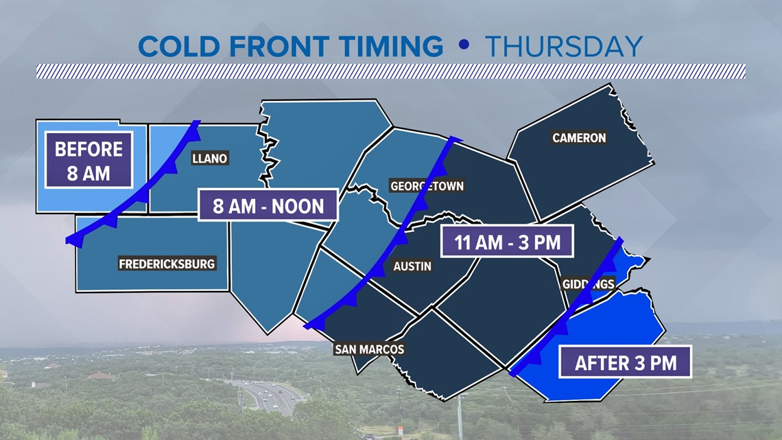
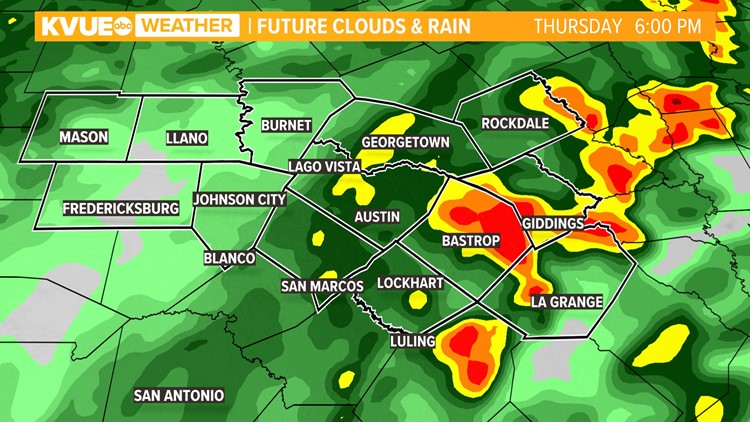
Scattered showers and storms developed along the front and behind the front. Just about all of Central Texas was expected to pick up some sort of rain, with the rain chance up to 90% on Thursday.

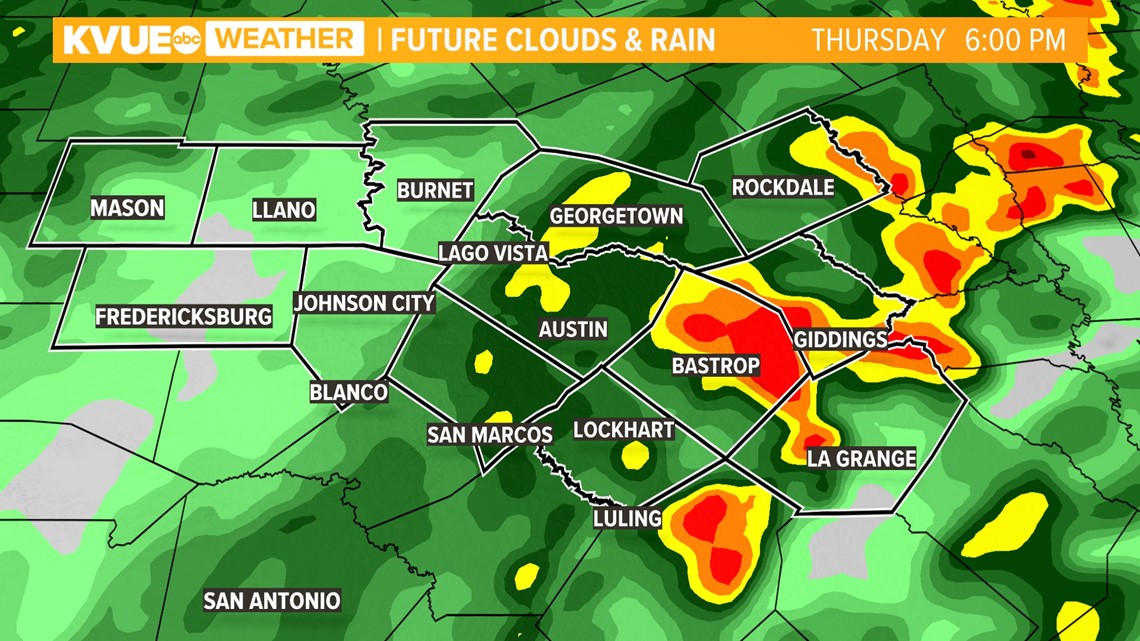
There was no risk for severe weather or for significant flooding. Thursday evening and Thursday night brought a widespread cool rain.
Temperatures were in the 50s, with a brisk north wind making it feel even cooler.
Lingering showers Friday morning will eventually give way to drier conditions by Friday afternoon and evening. However, even behind the rain, it will be cloudy and quite chilly with highs on Friday only in the mid to upper 50s for most locations.
A widespread half-inch to 1 inch of rainfall is expected with some isolated pockets of 1 to 2 inches.

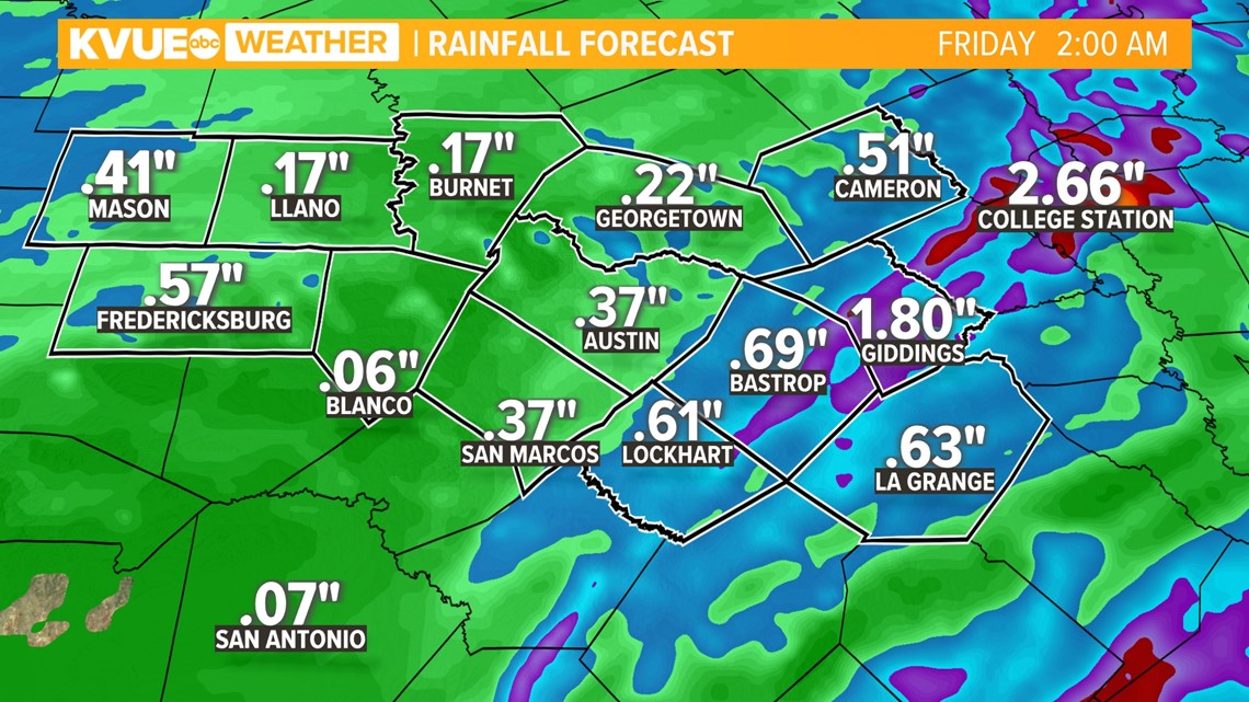
The weekend will be drier with just a 20 to 30% rain chance for Saturday and Sunday, but temperatures will remain cooler than average for this time of the year with highs only in the 60s.
Rain chances may briefly trend higher again for Monday of next week, but drier and warmer weather takes hold by the middle of next week.
The KVUE Weather Team will continue to monitor this developing forecast.
In the meantime, the extended forecast can be found below:

