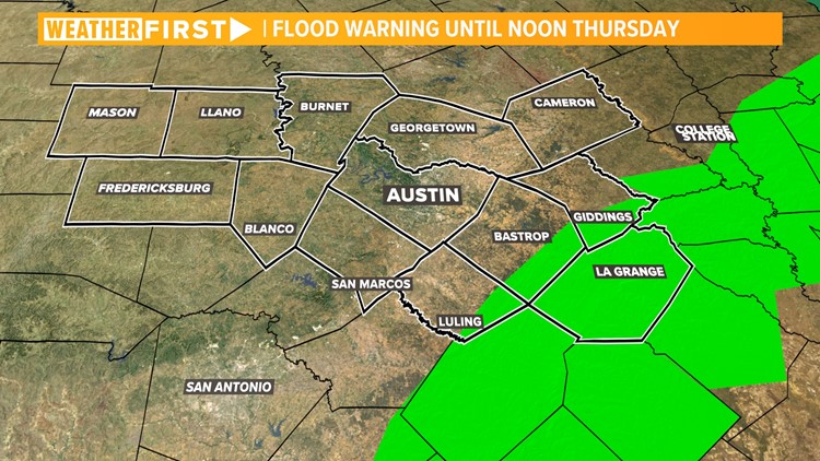
AUSTIN, Texas — *A Flood Warning is in effect for portions of Bastrop, Caldwell, Fayette and Lee counties until noon Thursday.*
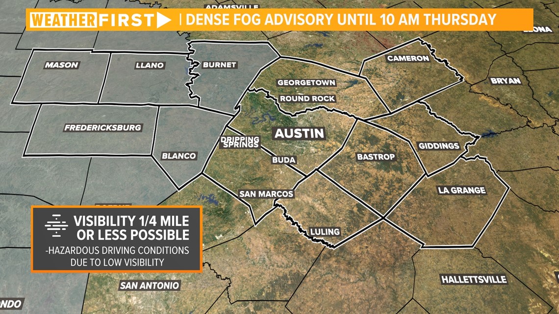
*A Dense Fog Advisory is in effect for Mason County until 10 a.m. Thursday.*
The past several days have brought more than a foot of rain to parts of our area, and we're still not done with the wet weather just yet.
Rain continued to move through the area Wednesday night but kept pushing east through sunrise. Central Texas should finally see drier weather after sunrise Thursday.
The risk for flooding will continue for areas southeast of Austin that are already very saturated. A Flood Warning has been extended for parts of the Coastal Plains until noon Thursday. Between 10 to 14 inches of rain have fallen in some parts of the Coastal Plains, but no additional rainfall is expected. Remember, turn around don't drown!


The risk for flooding is much lower for the Interstate 35 corridor and the Austin metro Thursday morning because these areas have not seen quite as much rain in recent days. However, there is still a low risk for localized flooding in the metro.
The higher risk will be southeast of Austin for the areas included in the Flood Watch.
Behind the rain, the saturated soil will likely give us another round of widespread fog Thursday morning. Visibility could be a quarter mile or less in spots, so please drive carefully!


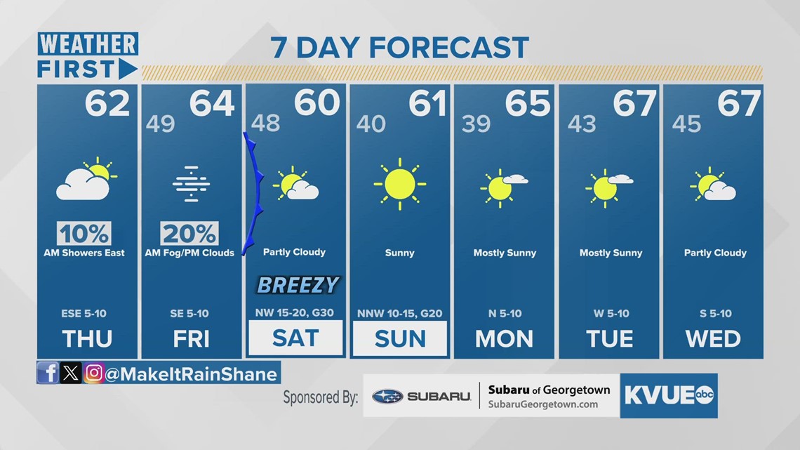
Morning fog and low clouds will be stubborn through most of the day, but some will break out into sunshine by late afternoon. A weak cold front moves through Friday night but brings only a small chance for showers and no additional flood problems.
The weather forecast for the rest of the weekend and most of next week will be completely dry.
The KVUE Weather Team will continue to monitor this developing forecast.
In the meantime, the extended forecast can be found below:


