AUSTIN, Texas — Editor's note: This story is no longer active. For the latest weather updates, check out our new story here.
Early July was quiet for the tropics and dry for Central Texas. In fact, Camp Mabry reported a three-inch rain deficit since June 1. Things are a bit more active and the National Hurricane Center (NHC) is monitoring two areas of interest. The first is Tropical Storm Gonzalo that is expected to move near the Windward Islands this weekend. The second is a tropical wave in The Gulf of Mexico.
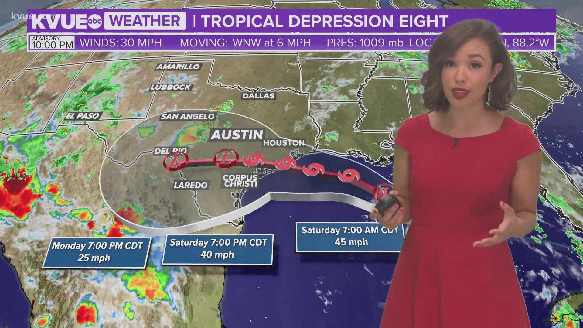
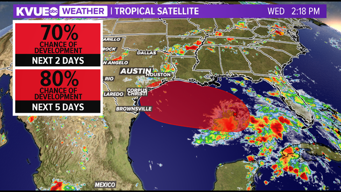
The tropical disturbance in the Gulf of Mexico is expected to bring rain to Central Texas by the end of the week and the weekend. This system is now giving a 80% chance of development in the next five days. If it strengthens as it moves west over a favorable warm Gulf, it will be named Hanna.

The latest models show an area of circulation along the Texas coast Friday night and early Saturday morning. The eastern side of the track will have heavier rain and it is expected to expand along coastal Texas and Louisiana.

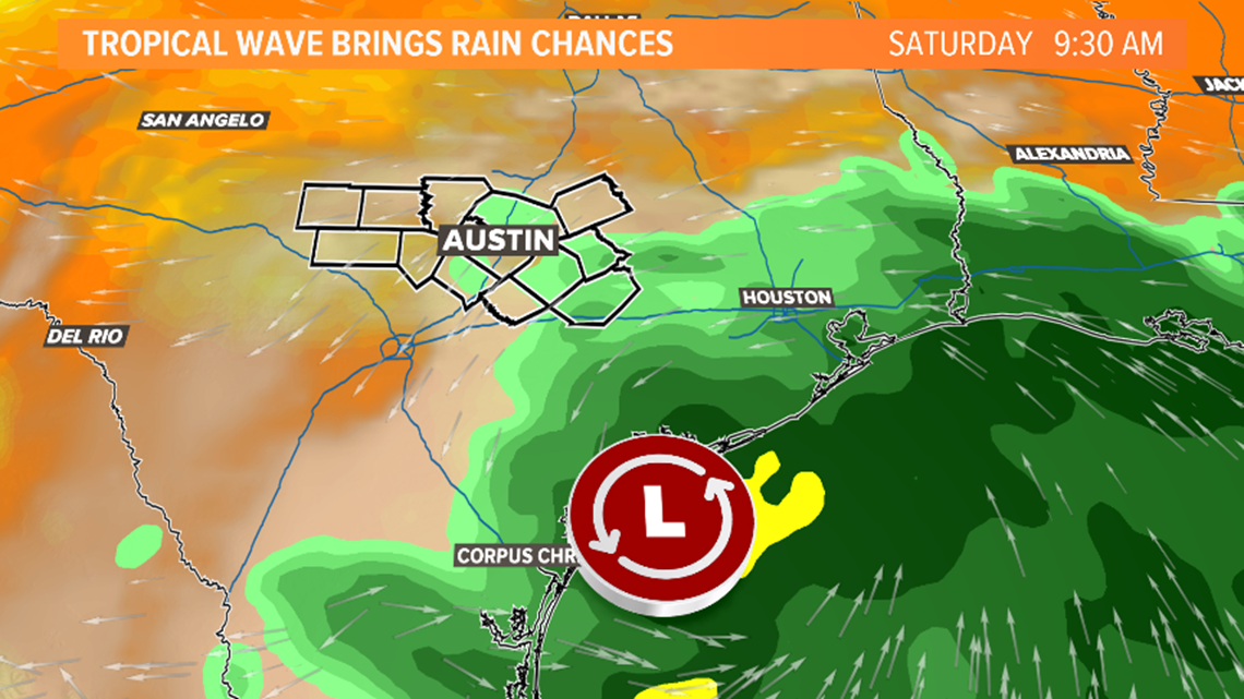
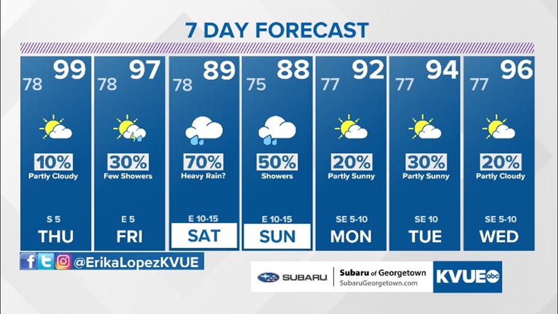
Even if the system does not organize, the tropical moisture will be enough to bring rain into the KVUE viewing area Friday evening through the weekend. The current forecast calls for a 40% chance of rain on Friday and a 60% chance of rain on Saturday.

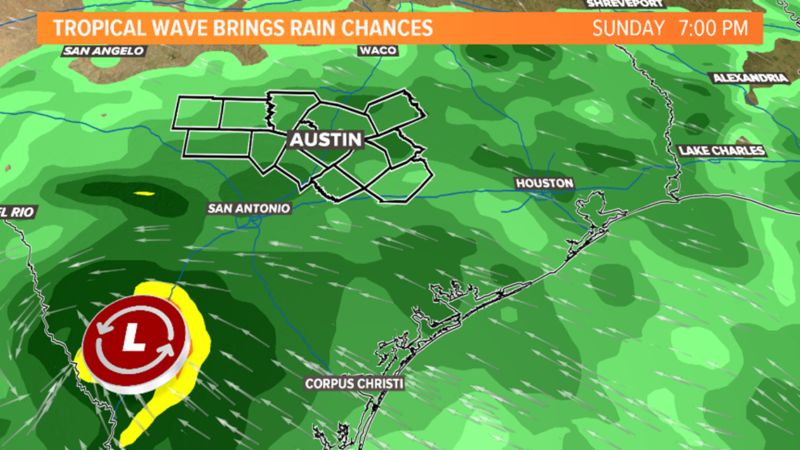
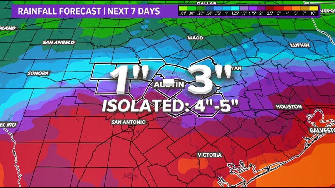
If the low stays on the current track, higher rainfall totals will be south and southeast of the KVUE area.
The latest rainfall forecast from the European model brings between one to two inches of rainfall over the next week with totals under one inch for the Hill Country.
There is still time for this forecast to change in the coming days. Regardless if this organizes or not, beneficial rain is expected this weekend.

Make sure to stay up to date with the KVUE Storm Team for the latest on this tropical wave in the coming days and download the KVUE app for the latest weather alerts.

PEOPLE ARE ALSO READING:

