AUSTIN, Texas — Rounds of freezing rain on Tuesday and Wednesday of last week brought Austin to a halt. Traffic accidents, downed trees and region-wide power outages were the largest impacts felt from this event, and in many neighborhoods, restoration is ongoing.
Now this week, a cold front poses new threats to Central Texas and could cause setbacks to communities on the mend.
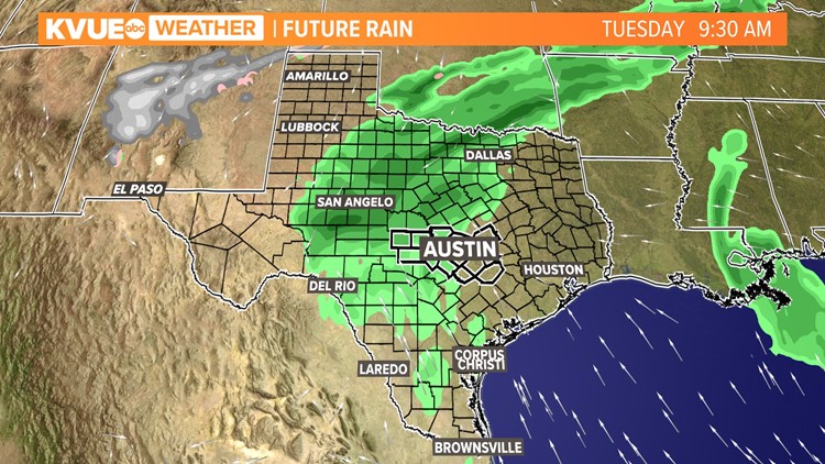
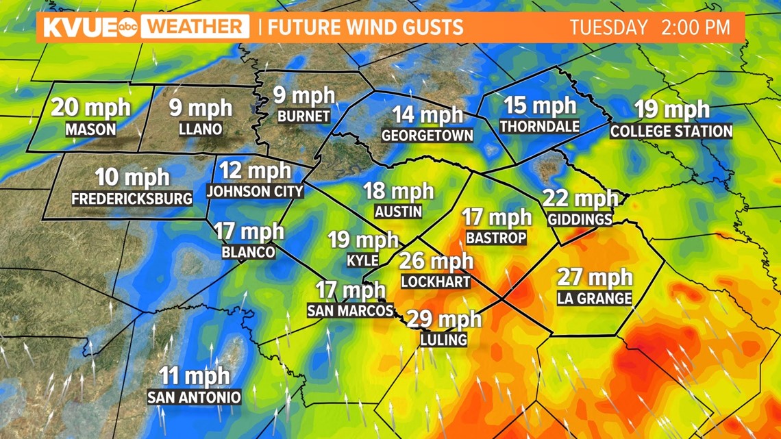
The cold front will offer up lots of moisture ahead of it, creating widespread rain chances for the KVUE viewing area Tuesday into Wednesday. The scattered rains will also include thunderstorms, and a few of those on the strong to severe end.
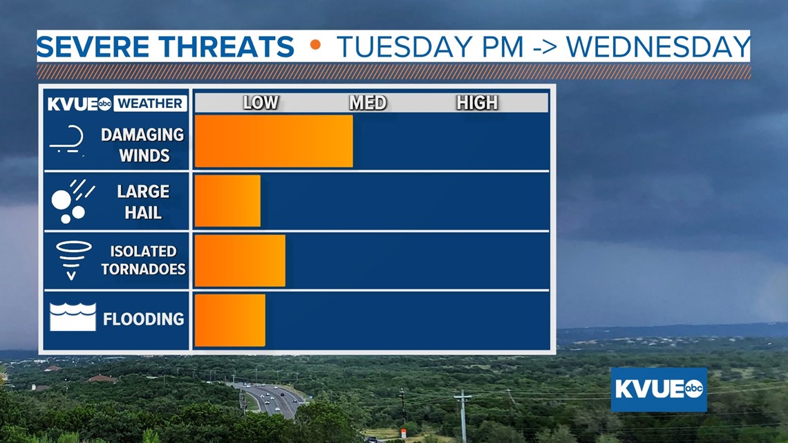
The main threat within strong to severe storms will be damaging winds, locally heavy rains and isolated tornadoes.

Here's a breakdown of the timing:
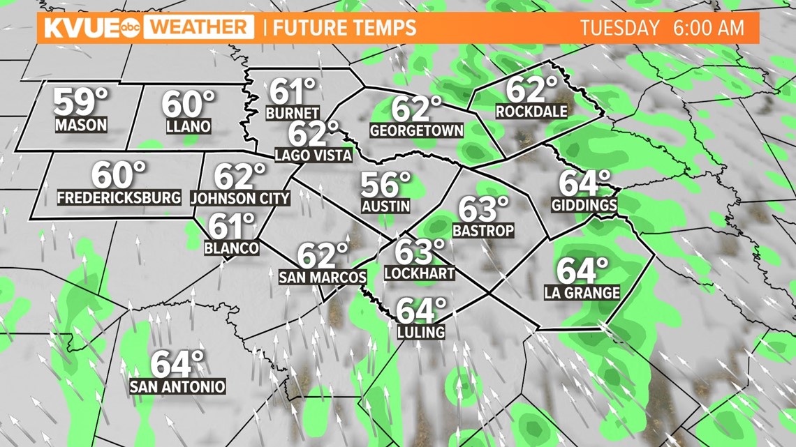
On Tuesday morning, many will note wetter conditions across the region on the commute to work. The rain coverage over the Austin area will become more widespread throughout the first half of the day.

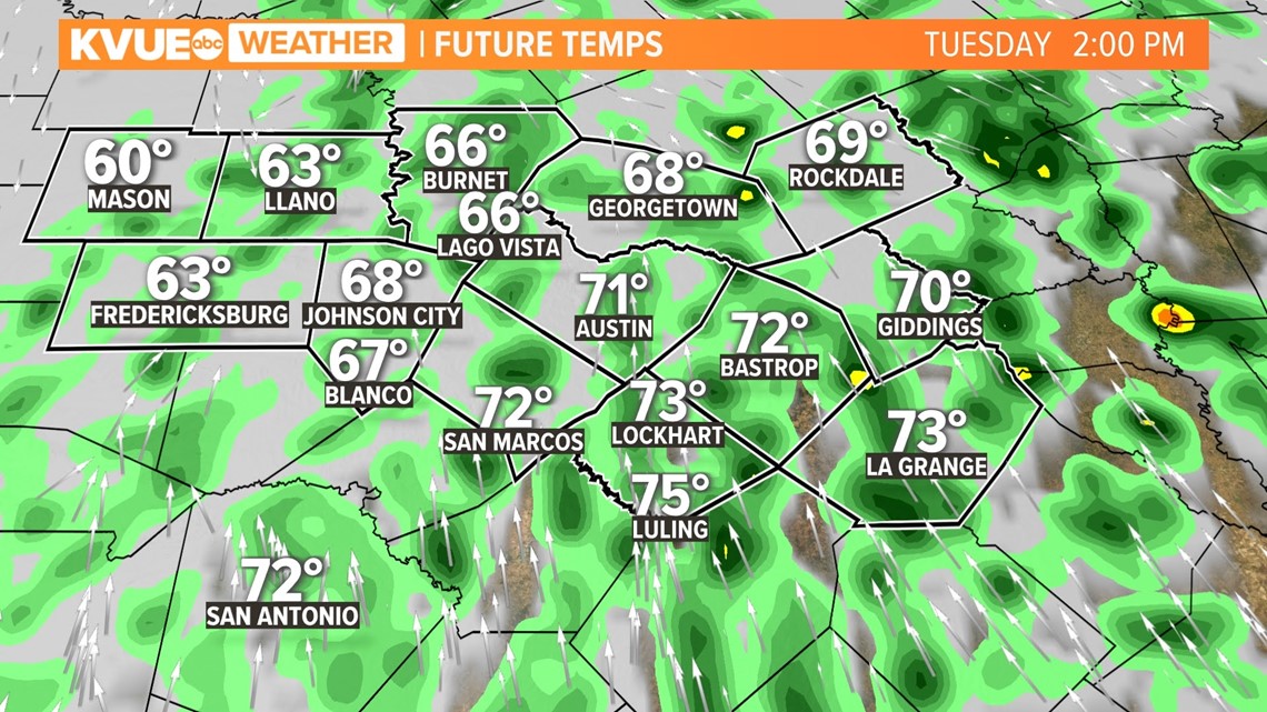
In the early afternoon is when we will start to see isolated storms pop up in the area. Model guidance keeps embedded thunderstorms generally east of the Interstate 35 corridor during this time.



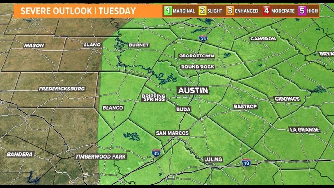
The Storm Prediction Center has outlined most of the Austin-area counties under a marginal risk for severe weather. This includes Williamson, Travis, Hays, Blanco, Burnet, eastern Llano, Caldwell, Bastrop and Lee counties.
By Tuesday night, the cold front will start to push east toward the Hill Country, and there is potential for a line of storms to become more organized through the overnight hours. Severe storms that develop could harbor damaging winds in excess of 55 mph, produce heavy rainfall and small hail. There is also a low-end threat of isolated tornadoes.

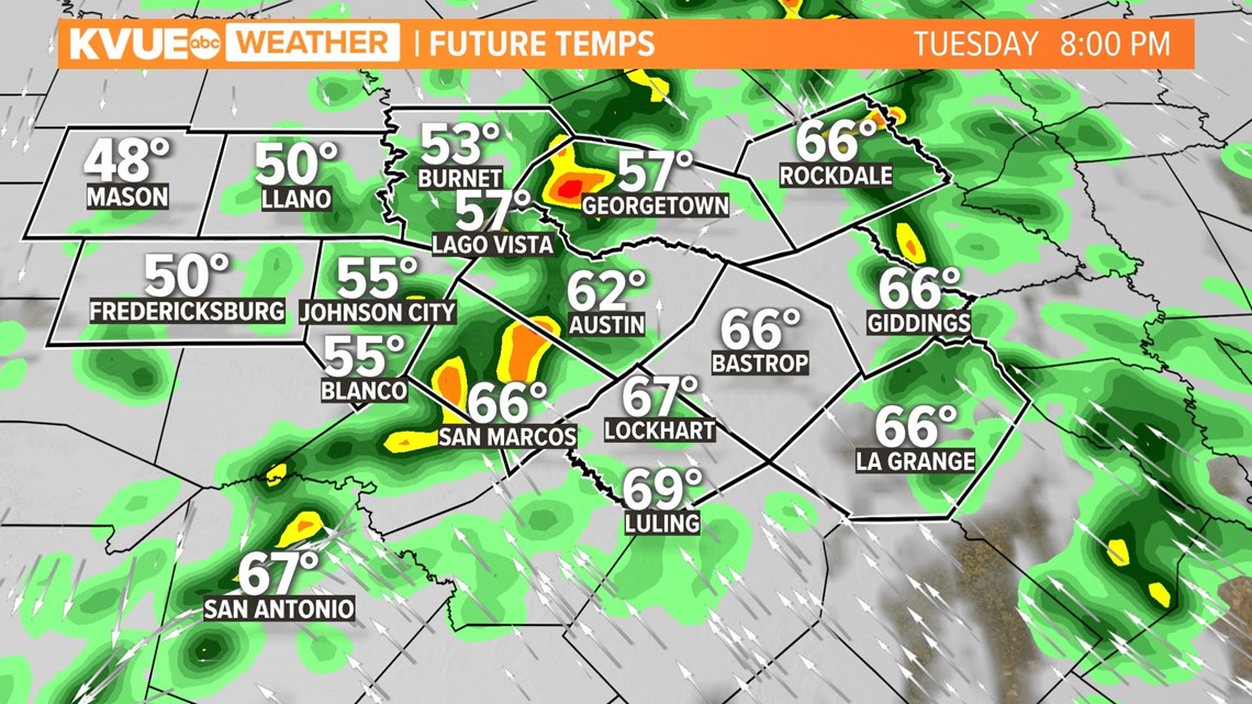
The line of storms is expected to inch slowly east for much of the overnight hours. By Wednesday morning, the overall strength of storms is set to decrease; however, the slow-moving rains could still pose a flooding threat.

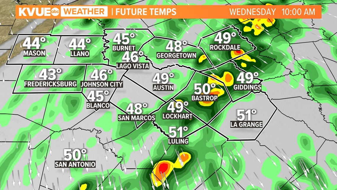
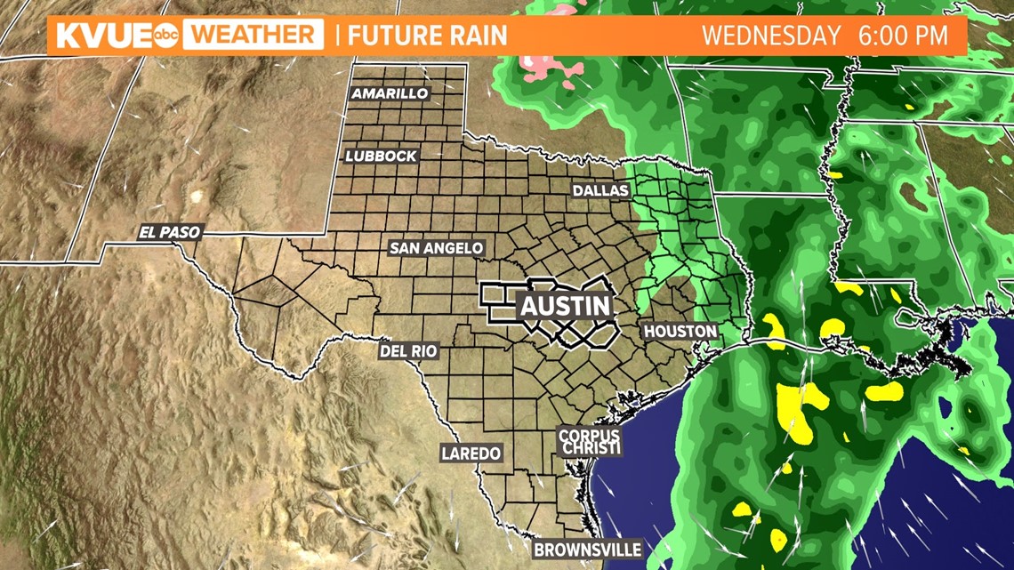
Conditions will clear pretty slowly throughout Wednesday, with the last of the rainfall exiting east of the area by about 5 p.m. to 6 p.m.

While this is overall a low-end severe weather threat for Central Texas, it comes at a bad time. Small impacts such as stiff winds and heavy rain that would not cause problems normally, likely will. Here are some added threats to be aware of:

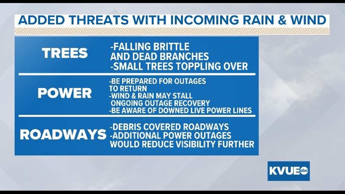
Trees, power outages and bad road conditions were the main threats to the community during Austin's round of winter weather last week.
There are still many downed limbs in yards and neighborhood streets, as well as dead branches that haven't fallen to the ground yet. Gusty winds and heavy downpours will set the stage for more issues with tree debris. This could cause more rounds of power outages, even for those who had power restored already. Roadways could become impassable again if large limbs or small trees do fall.
If you still have tree limbs lying on your property, it would be a good idea to secure them somehow – weighted under a tarp or bagged up and brought into a garage, shed or covered area.
On roadways, heavy rain may cause visibility issues. If downed trees and powerlines are added to the equation, this could make for a dangerous situation, especially at night if streetlights go out. Be extra cautious when commuting on Tuesday evening and Wednesday morning.


