AUSTIN, Texas — Changes are on the way for Central Texas on Thursday.
The KVUE Weather Team has been monitoring a system that could bring potentially strong storms to Central Texas through early Thursday afternoon.
An area of low pressure is developing north of the Texas Panhandle. This system is forecast to pull a warm front through Central Texas, bringing warmer temperatures and instability to the area for the first half of the day.
This instability will create the potential for stronger storms to develop on the east end of the region. The cold front attached to this system will then clear out any wet weather for Thursday night.


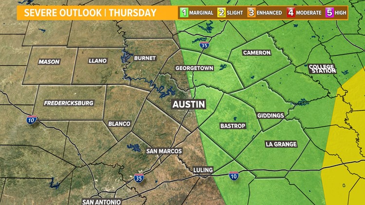
As of 10:30 a.m. Thursday, the KVUE viewing area has been downgraded for its severe weather risk. Areas of the northern Interstate 35 corridor and points east are now in the lowest risk of strong storms – a "marginal," or level 1 out of 5, risk.
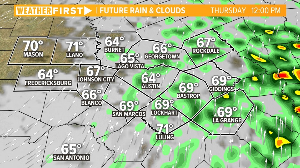
So far Thursday morning, any storms that have developed have remained outside of the KVUE viewing area. Despite this, it is still possible a strong to severe storm could arise in areas east of US 77, mainly in the early afternoon.
Timeline
Stronger storms are possible nearing the 12 p.m. hour.
There are also additional chances for strong to severe storms to continue for the late morning on Thursday. Again, most of this activity will occur in the Coastal Plains, east of US 77. Heavy downpours and gusty winds will also be an impact, along with the isolated tornado risk.

However, that tornado risk has also been downgraded. It now includes only the far eastern stretches of Lee County and the majority of Fayette County .

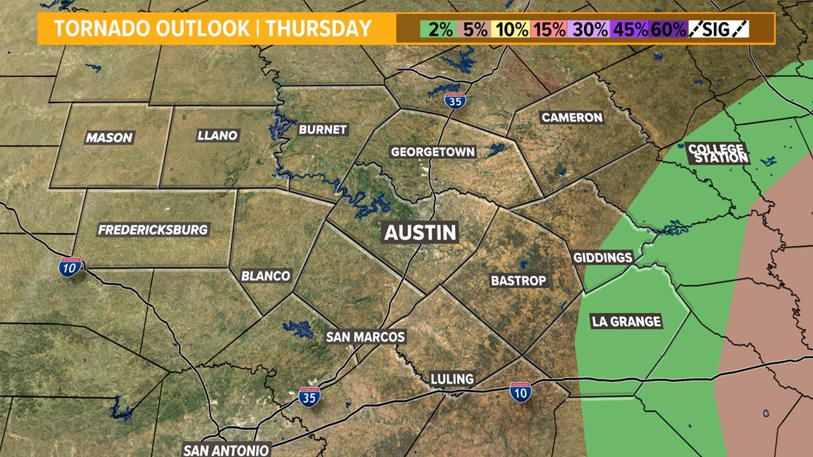
This means that there is now only a 5% risk for tornado formation within 25 miles of any point within the green-shaded area shown above, as opposed to the 10% risk from earlier Thursday morning. This is a significant downgrade.
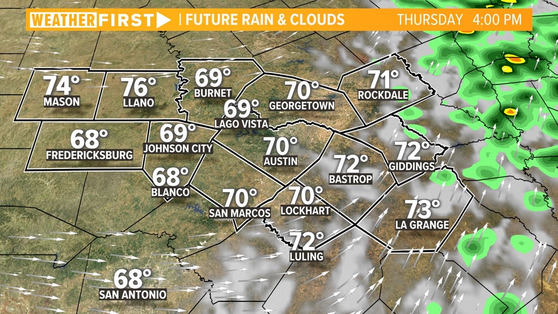
Showers and storms will start to wind down behind the cold front that will arrive Thursday evening. You can expect mostly dry conditions after about 3 p.m. Thursday.

The KVUE Weather Team will continue to provide updates on air and online.
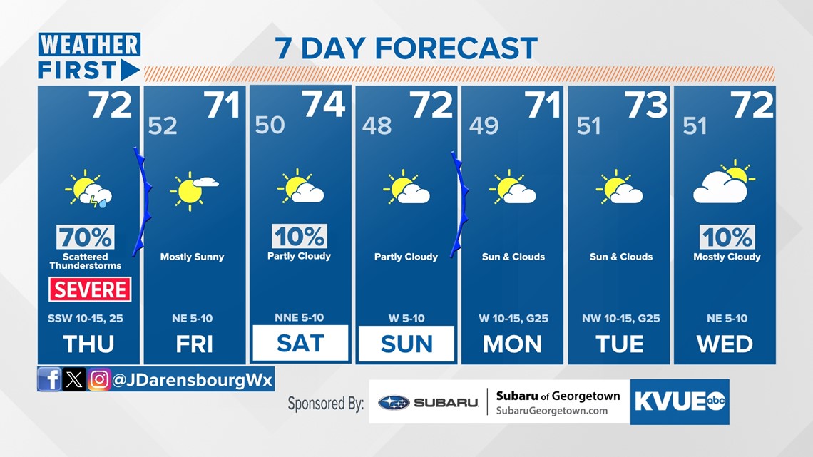
In the meantime, here is a look at your extended forecast: