AUSTIN, Texas — As many of y'all are aware, we're tracking a very complex system for Sunday night into Monday that could bring in not only a chance for precipitation but wintry precipitation.
This is all created by an Arctic air mass that will come in behind the front late Sunday morning into early Sunday afternoon, which will drop our temperatures from the upper 50s in the morning.

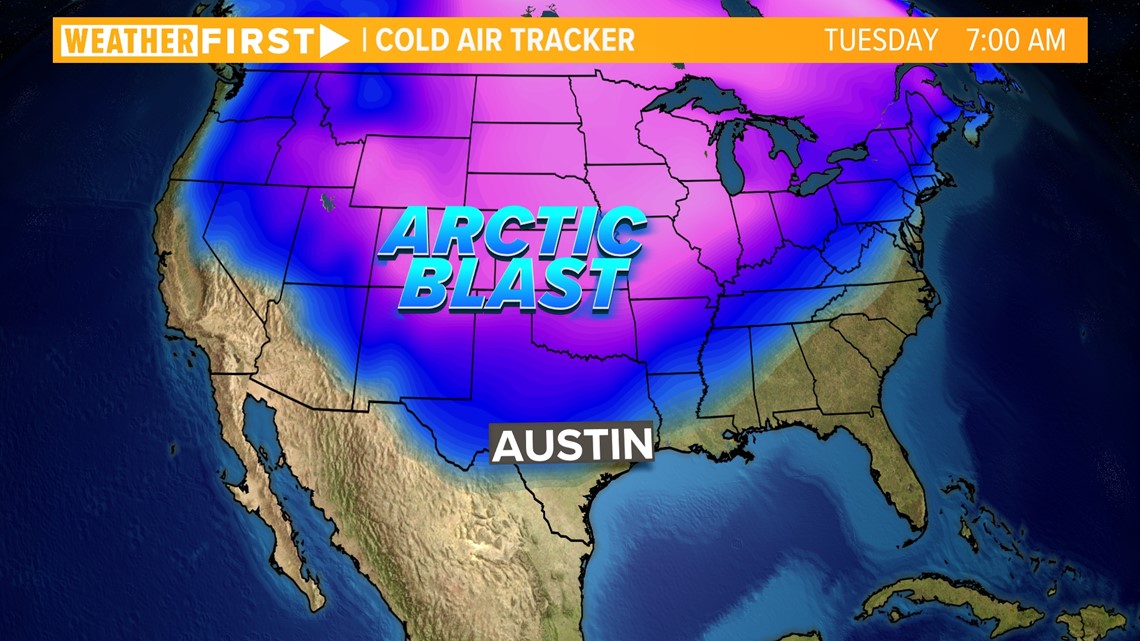
Lows Sunday night look to get down to the teens and lower 20s and when we factor in the wind speeds, we'll likely have wind chills in the single digits to lower teens.
With that, it is important to remember the Four P's – pets, plants, pipes and people – to make sure all bases are covered when it comes to these cold temperatures. You'll want to keep pets inside, plants brought in, pipes covered with faucets dripping and to make sure to check on your elderly neighbors.
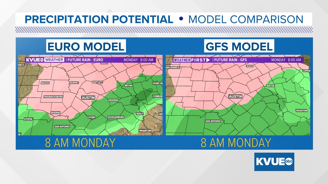
In addition to the bitterly cold air, there could be some overrunning with the frontal system, which means that moisture is able to overtop the frontal system, creating post-frontal activity. Forecast models on Thursday evening are in agreement on the potential for freezing rain or drizzle late Sunday night through the first half of Monday. The National Weather Service has mentioned that little to no accumulation is expected at this time.

With this in mind, it's important to note how some of these types of precipitation form.
Freezing rain forms when the rain falls as liquid, then hits the ground in a slim layer of cold air, causing it to freeze on contact. This is what creates the glaze that you'd see on trees and powerlines.
Sleet is much different. This is because the cold air layer is thick enough for the raindrop to freeze before making contact with the ground. This is especially important because freezing rain can cause power outages and more crippling conditions, but sleet is merely only a travel danger.

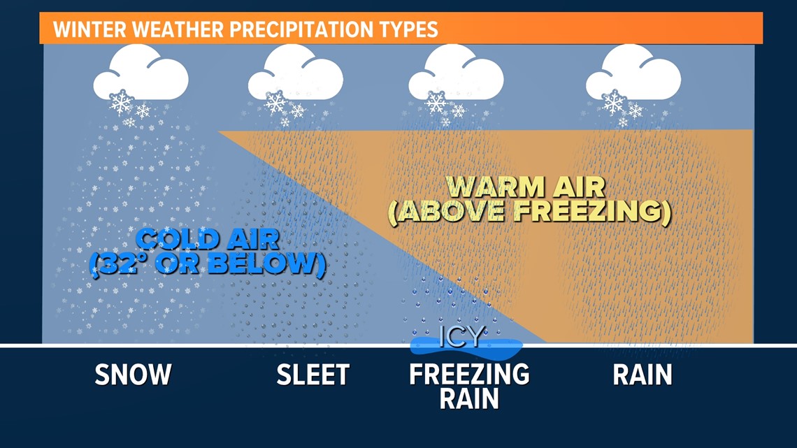
When it boils down to it, Monday's precipitation chances look good, but we are still too far out to determine what type of precipitation falls from the sky. This is going to come down to how cold we get or stay Monday, as well as how thick the cold air layer at the surface will be.
Stick with KVUE for the latest on this forecast.
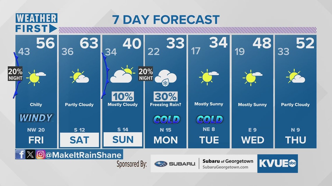
In the meantime, your 7-day outlook is below: