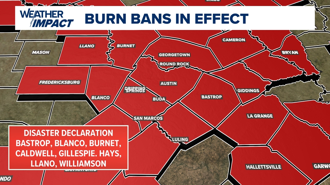
AUSTIN, Texas — As of Oct. 15, Austin has not seen measurable rain in 40 days. As weeks have gone by, the dryness has exacerbated drought conditions and caused vegetation to be devoid of all moisture.
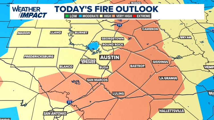
A majority of counties in Central Texas fall into the "abnormally dry" to "moderate" drought category as of last week. And with a stretch of sunny weather in the forecast this week, we are now on watch for wildfire danger.
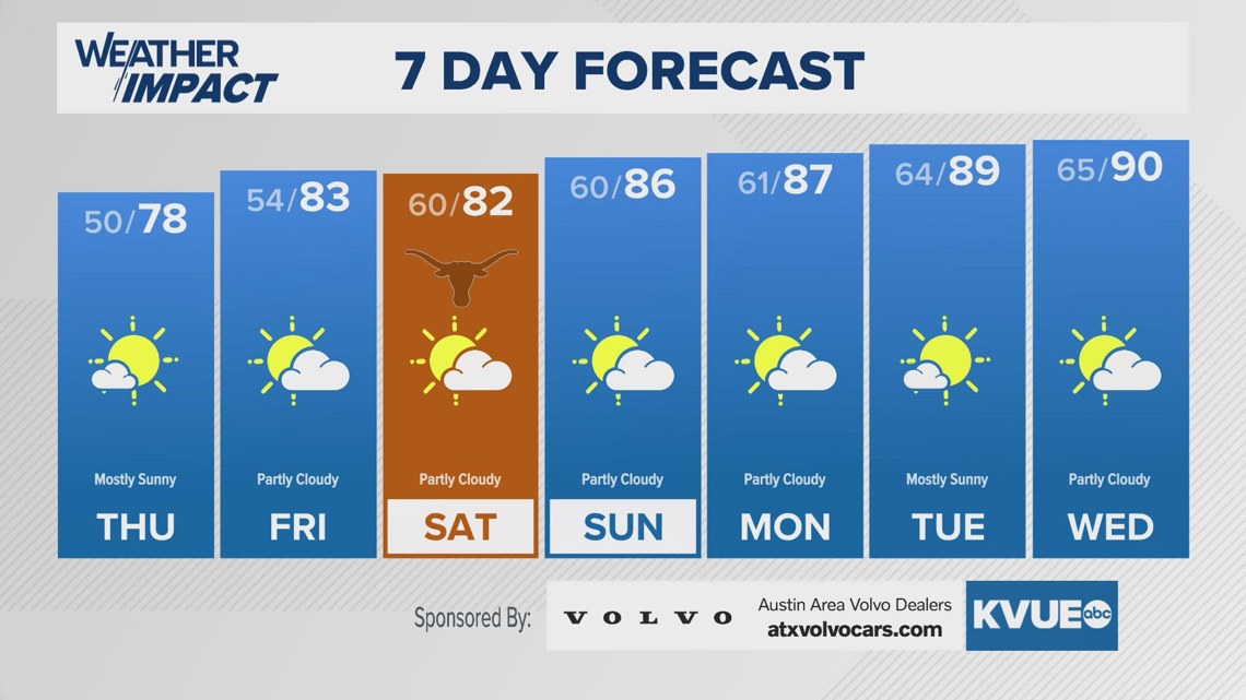
While our afternoon temperatures Wednesday will not be as hot as the start of this week, the combination of high winds and dryness will be more than enough to spread anything that sparks, at an alarming rate.

While our conditions are not enough to warrant a Red Flag Warning, the Austin/San Antonio National Weather Service Office has issued a Rangeland Fire Danger Forecast from 10 a.m. to 7 p.m. Wednesday. They recommend the following in regards to burning:
"Residents are urged to exercise care with respect to all outdoor activities that could inadvertently cause wildfires. Avoid the use of welding or grinding equipment near grass and dry brush. In addition, avoid parking vehicles in tall, dry grass and weeds that could be ignited. Do not toss cigarette butts on the ground. Report wildfires quickly to the nearest fire department or law enforcement office."

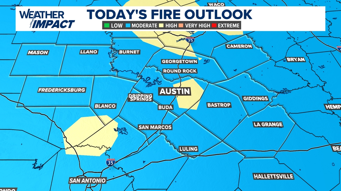
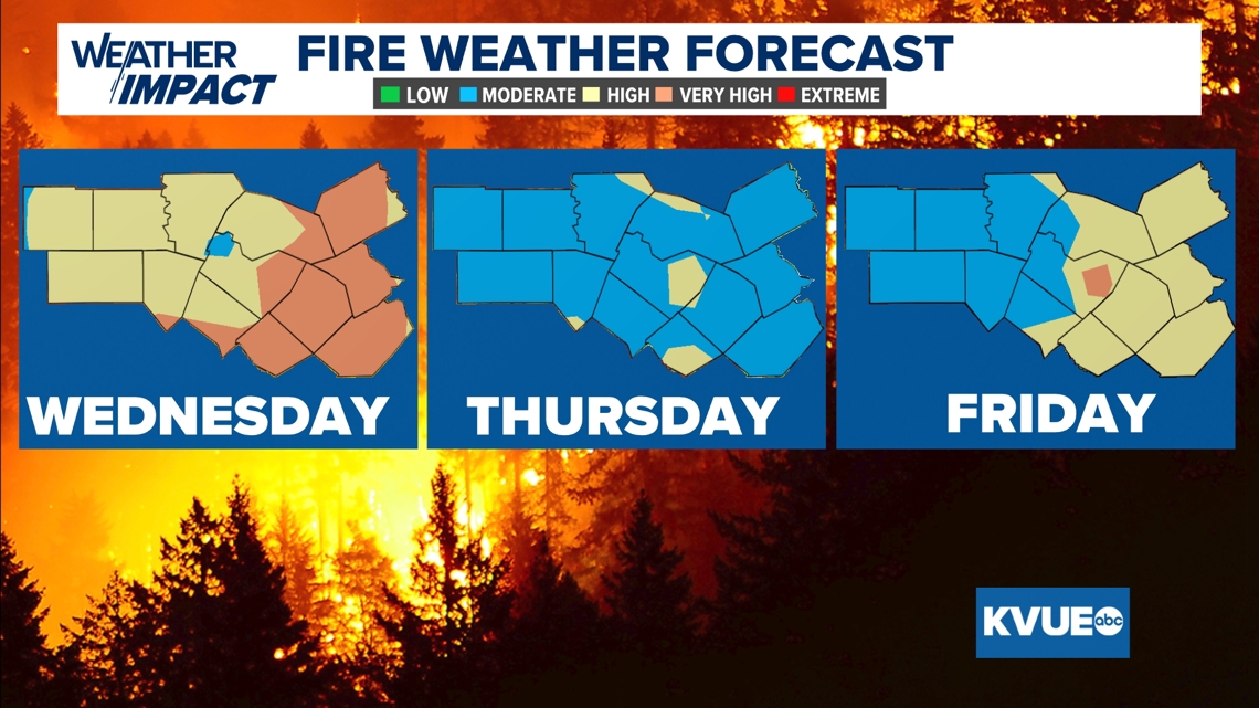
End of week wildfire risk
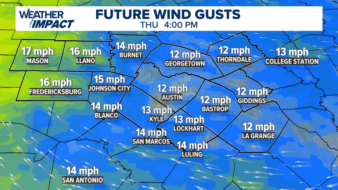
Wind flow will calm overnight into Thursday, but some gusty conditions remain possible for the afternoon. Flow shifts southeast with gusts from 10 to 20 mph. Humidity stays very low, with dewpoints ranging through the 30s and 40s, while actual temperatures rise back into the low 80s for the afternoon.

The "high" threat for wildfire danger will become more isolated on Thursday. On Friday, areas east of the Interstate 35 corridor will again rise into the "high" to "very high" category.

We will monitor the forecast each day for additional wildfire danger risks.