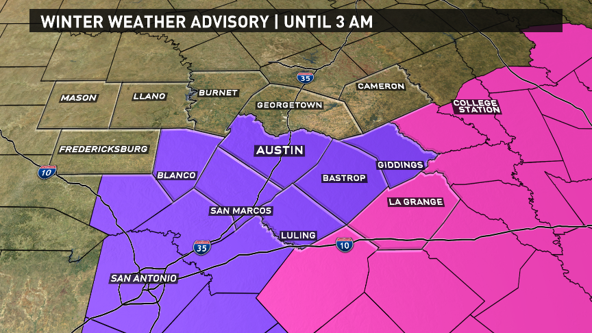
A WINTER WEATHER ADVISORY is in effect until 3 a.m. for all the counties in purple. That is Travis, Hays, Blanco, Bastrop, Caldwell, Lee counties. A WINTER STORM WARNING is still in effect for Fayette County until 6 p.m.
Go here for school and office closures and delays.
Go here for information on accidents, road closures, outages and flights.
Follow along with the updating blog below.
Tuesday, Jan. 16
The following is the final update on this blog.
8:34 a.m. Freezing rain and sleet is increasing over areas south of downtown Austin, and moving to the east-northeast.
8:15 a.m. There's a 50-degree temperature difference between Amarillo and Brownsville.
5:27 a.m. With temperatures below freezing and moisture coming in from the west, several icy spots on roads are now being reported across the metro. This will be the trend over the next few hours. Be safe
5:02 a.m. Current conditions around Central Texas
4:47 a.m. TxDOT Austin is reporting icing on Highway 45 westbound in Round Rock
3:22 a..m. Wind chills are in the 20s now but will be in the teens by 7 a.m.
2:59 a.m. Make that 52 flights scheduled to leave ABIA before noon canceled
2:47 a.m. If you have a flight into or out of ABIA, make sure and check your flight status at austintexas.gov/airport before heading out. At last check 28 departures scheduled before noon already canceled.
2:45 a.m. REPORT: A local spotter has reported ice beginning to accumulate on elevated surfaces near Wells Branch.
2:27 a.m. Seeing reports of sleet and snow across Austin Metro!
1:42 a.m. Seeing much of the rain turn into frozen precipitation across the viewing area.
12:15 a.m. Freezing temperatures have moved into portions of Burnet and Llano County. Will be moving into Williamson shortly
12:08 a.m. Radar Update: Temperatures are expected to fall below freezing by 3 a.m. in Austin
Monday, Jan. 15
10:40 p.m. Deteriorating wintry conditions overnight | Winter Storm Warning
10:05 p.m. Current conditions
9:20 p.m. Cold front moving in
7:15 p.m. Temperature expectations
What to expect
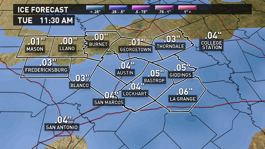
Freezing rain, sleet and snow are all expected to be a threat. Significant ice accumulations of around a 1/10 inch are possible with isolated amounts as high as 1/4 inch. Also, as much as 1 inch of snow accumulation is possible.
This winter weather will bring dangerous road conditions to much of Central Texas for Tuesday and Wednesday morning. Latest forecast data continues to show increasing consistency and confidence for a winter storm on Tuesday around Austin.
As temperatures drop quickly below freezing early Tuesday morning, it is likely that this rain will develop into freezing rain, sleet, snow, or a combination of the three.
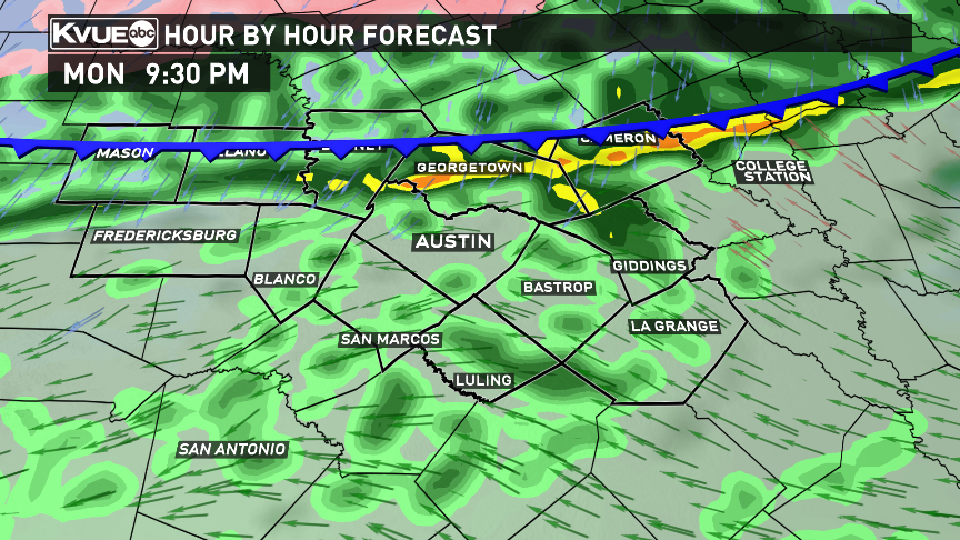
And continue through much of the morning hours making roads, especially bridges and overpasses, exceptionally slick.
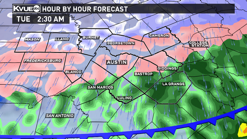
The wintry mix could continue into the afternoon.
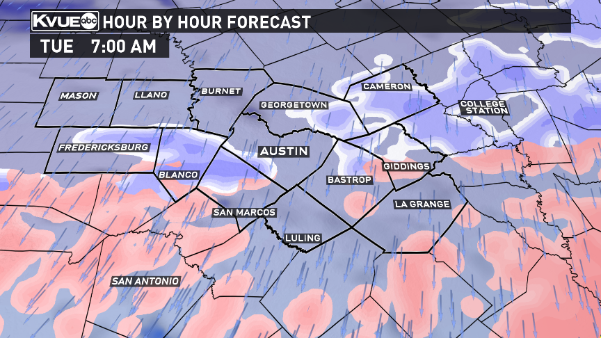
The wintry weather should push south of Central Texas during the afternoon on Tuesday.
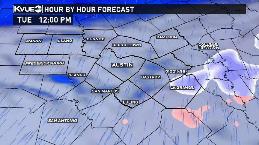
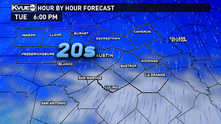
Because temperatures are forecasted to stay below freezing all day Tuesday, icy spots will linger through Tuesday and Wednesday morning.
Here are forecast ice and snow accumulations around Central Texas for Tuesday.
More wintry weather will be possible Wednesday night into Thursday morning. Stay up to date with KVUE for the latest details.

