AUSTIN, Texas — Mother Nature is throwing us one more curveball before we ring in the new year, with big changes on the way for the last few days of 2020. Within the next 48 hours, we're tracking a strong cold front, heavy rain, the potential for strong to severe storms and even the possibility of winter weather.
Chance for snow or a wintry mix New Year's Eve
This is where the forecast gets interesting. An upper-level, low-pressure system will track toward Central Texas on New Year's Eve. This will keep moisture across the area, even well behind Wednesday's strong cold front.
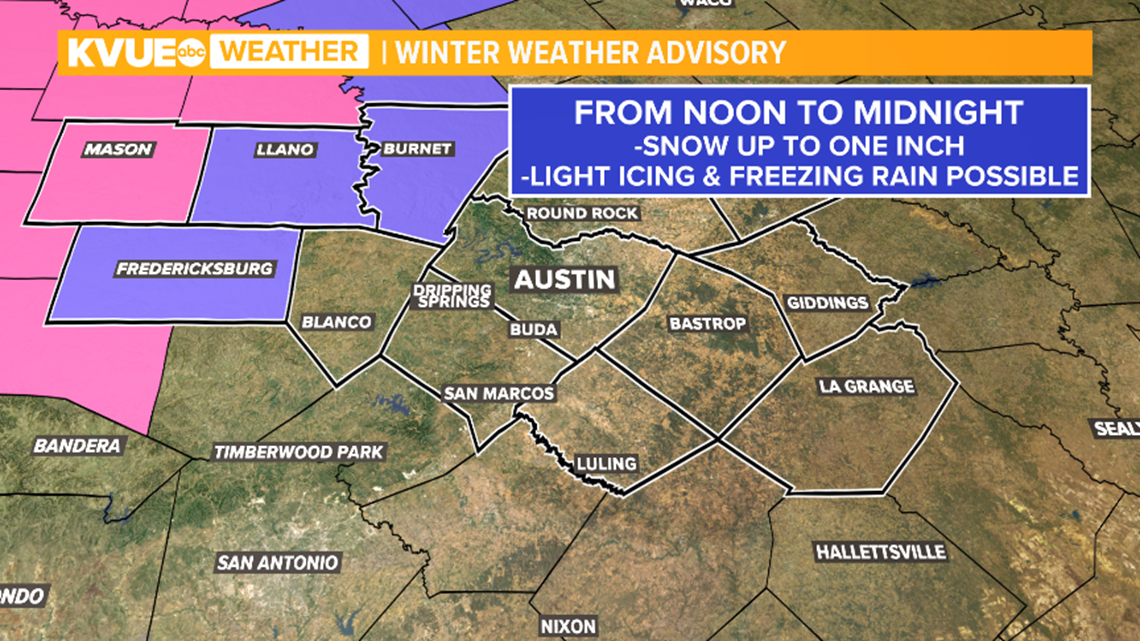
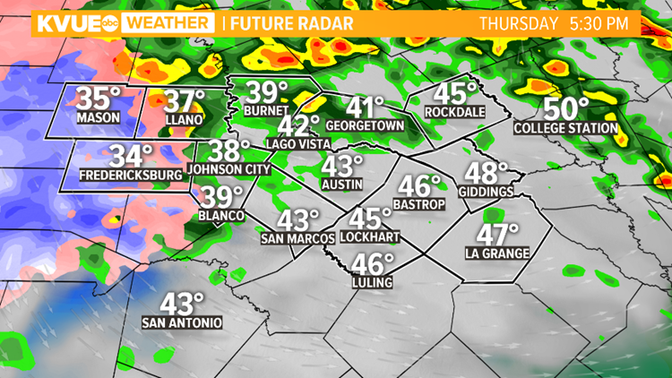
This means there may be an overlap of cold air and moisture on New Year's Eve across the Hill Country, and this will provide a winter weather risk. Ahead of this setup, a Winter Weather Watch has been issued for Burnet, Llano, Mason and Gillespie counties.


For areas in the Winter Storm Watch, minor snow accumulations up to one inch, and some light icing will be possible. This could cause some travel issues, especially with bridges and overpasses.
We spoke to TxDOT and a spokesperson confirmed Tuesday that crews have already begun pre-treating roads just in case travel issues arise.
For the Austin area and locations to the east, we're still looking at mainly just a cold rain.


Regardless of any wintry weather, plan on a dry and cool New Year's Day with highs in the 50s.
The KVUE Storm Team will continue to update the forecast and will provide specifics as they come into focus. Download KVUE's app for the latest: kvue.com/app. And stay with KVUE on YouTube, Facebook, Twitter and Instagram.


PEOPLE ARE ALSO READING:


