AUSTIN, Texas — With a high of only 81 degrees, Tuesday was the coolest afternoon in Austin since May 13. It has certainly been an odd stretch of weather over the past several days, with localized flooding and heavy rain taking place in what is typically the second-driest month of the year.
We're still not done with rain chances, but the Weather Impact Alert Day for Wednesday has been canceled as the risk for widespread heavy rain and flooding is decreasing for the rest of the week. That being said, although the heaviest rain has fallen, it still needs to work its way through the creeks, streams, rivers and lakes of Central Texas.
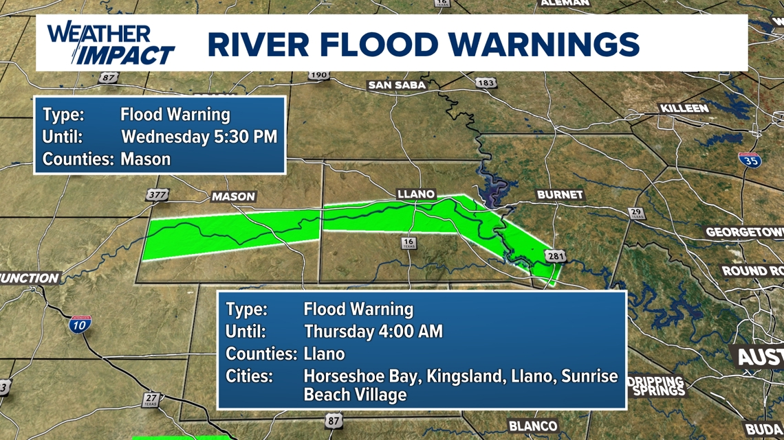
River flooding on the Llano River remains a concern as flood waters are now pushing downstream. A River Flood Warning is now in effect for the river through Thursday morning. As of early Wednesday morning, the Llano River near Mason was at the lower end of the minor flood stage.

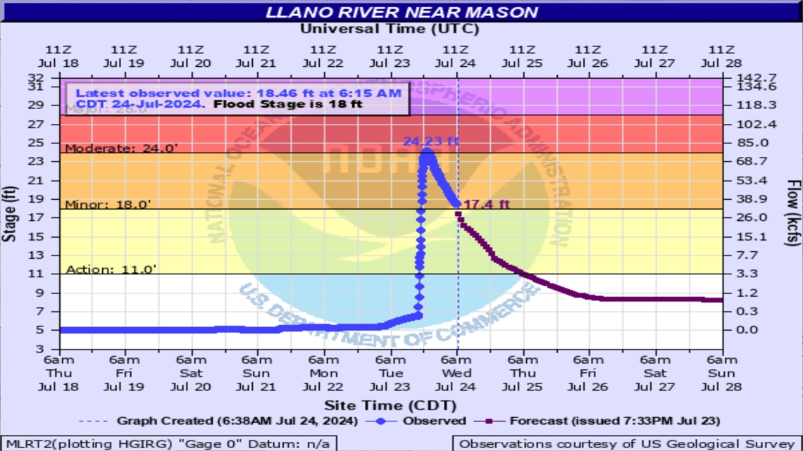
The latest update on the Llano River at Llano shows the level peaked at 1 a.m. Wednesday at 17.2 feet and is currently falling. It still remains in the moderate flood stage at this time.
If you live near the water or have interest on the river, please take the appropriate flood precautions.

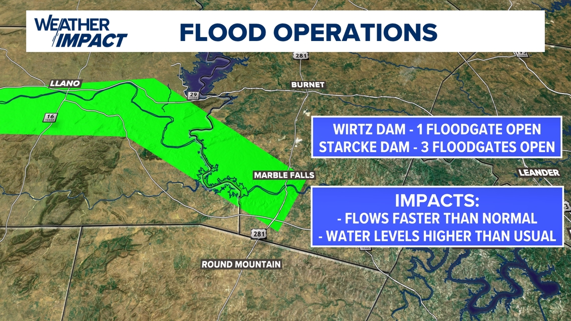
The Llano River ultimately empties into Lake LBJ. From there, flood water will be passed through Lake Marble Falls and into Lake Travis. The Lower Colorado River Authority (LCRA) officially opened one floodgate at 5 a.m. at Wirtz Dam and three floodgates at 5:30 a.m. at Starcke Dam. Residents can expect faster than usual river flow along with above-average water levels.

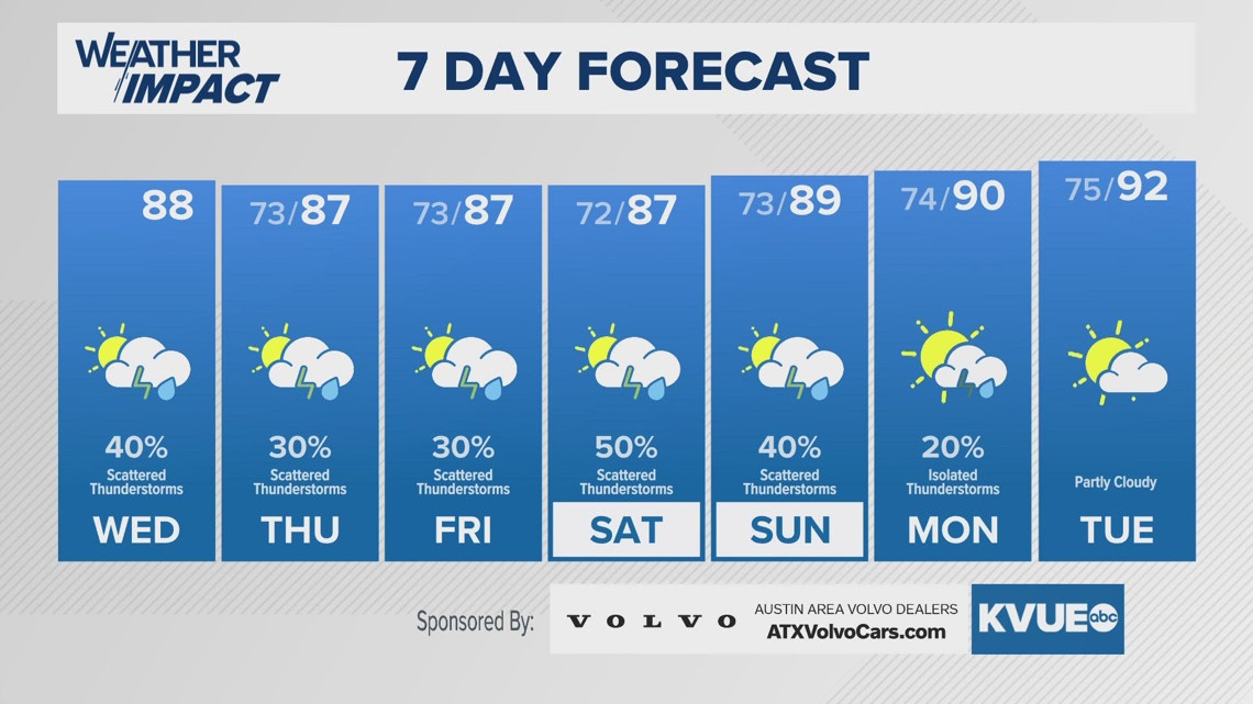
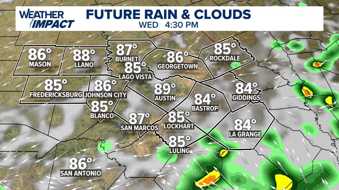
Rain chances through the rest of this week are lower, but certainly not zero. On Wednesday, we have a 30% chance of rain and storms in the forecast. Rather than bringing the highest totals to the Hill Country, as we've seen the past few days, the highest rain chances are now shifting along and east of Interstate 35.

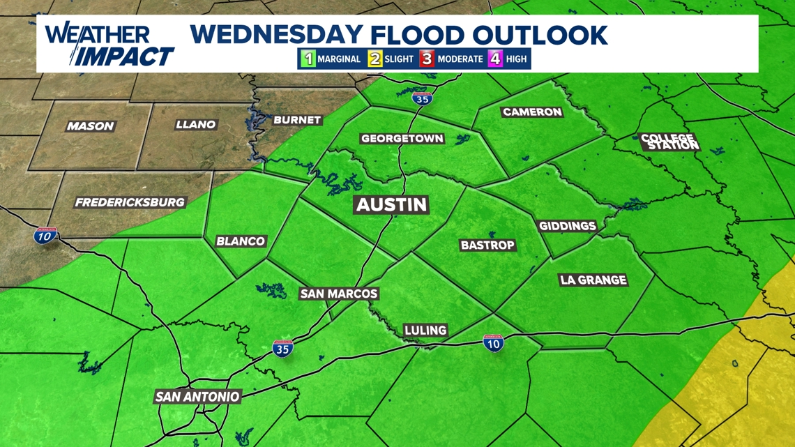
The risk for flooding is lower Wednesday, but there is still a Level 1 out of 4 risk in place for much of the KVUE area. Issues will not be as widespread as in recent days, but some isolated minor flooding is still possible in locations that are already saturated from recent rains.

Scattered rain chances remain in the forecast through this weekend, as high temperatures continue to run well below average for this time of the year. Again, there could be some spotty minor flooding, but no major concerns.
The forecast trends completely dry and noticeably warmer through the beginning of next week.
The KVUE Weather Team will continue to closely monitor this developing forecast.
In the meantime, the extended forecast can be found below: