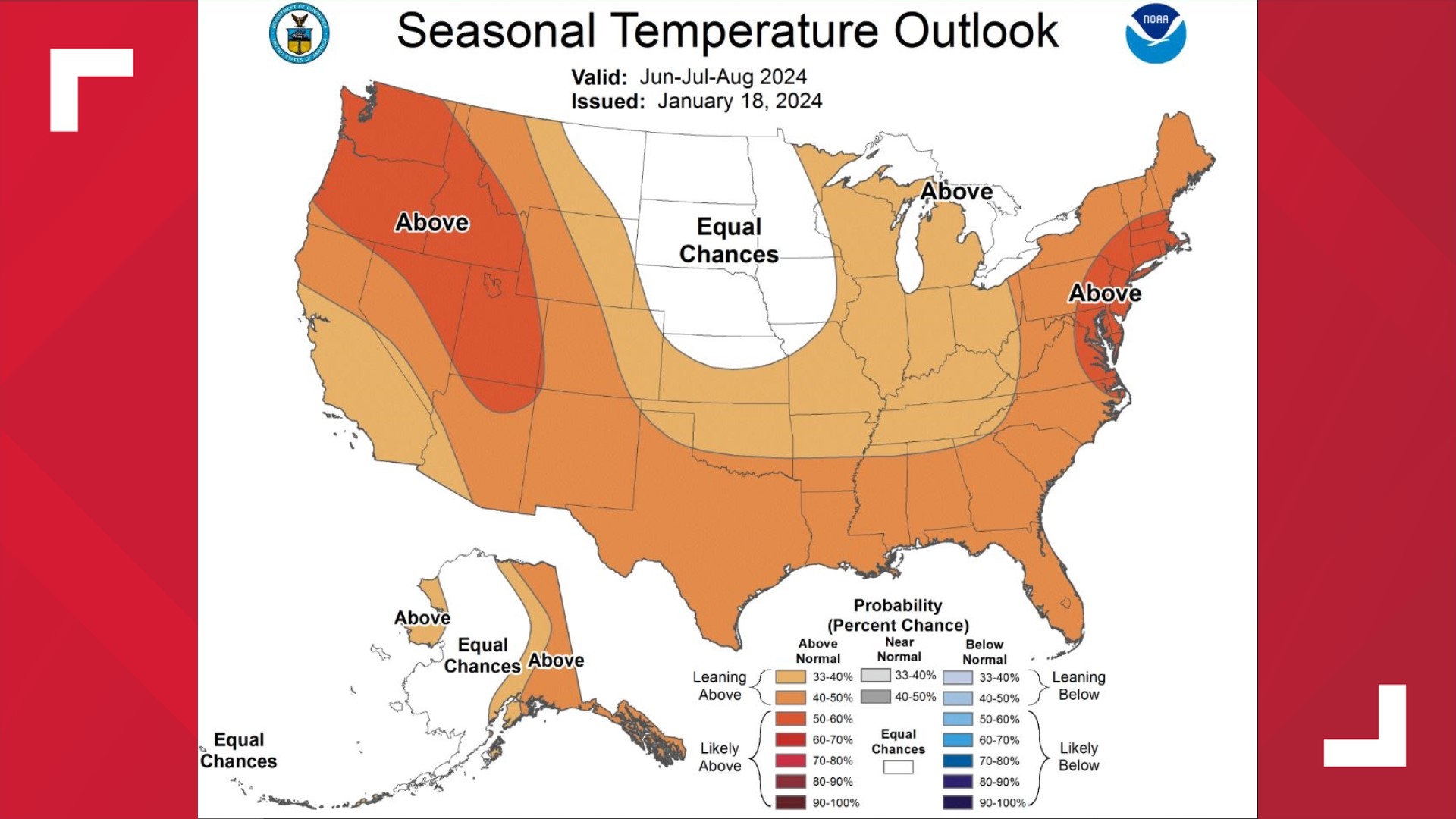
AUSTIN, Texas — While many of us have enjoyed this winter of wetter, cooler weather, especially when it comes to improving drought conditions, do not expect this summer to be similar.
This is a result of a shift to La Niña conditions forecast for the upcoming spring from our El Niño Southern Oscillation (ENSO) neutral conditions.
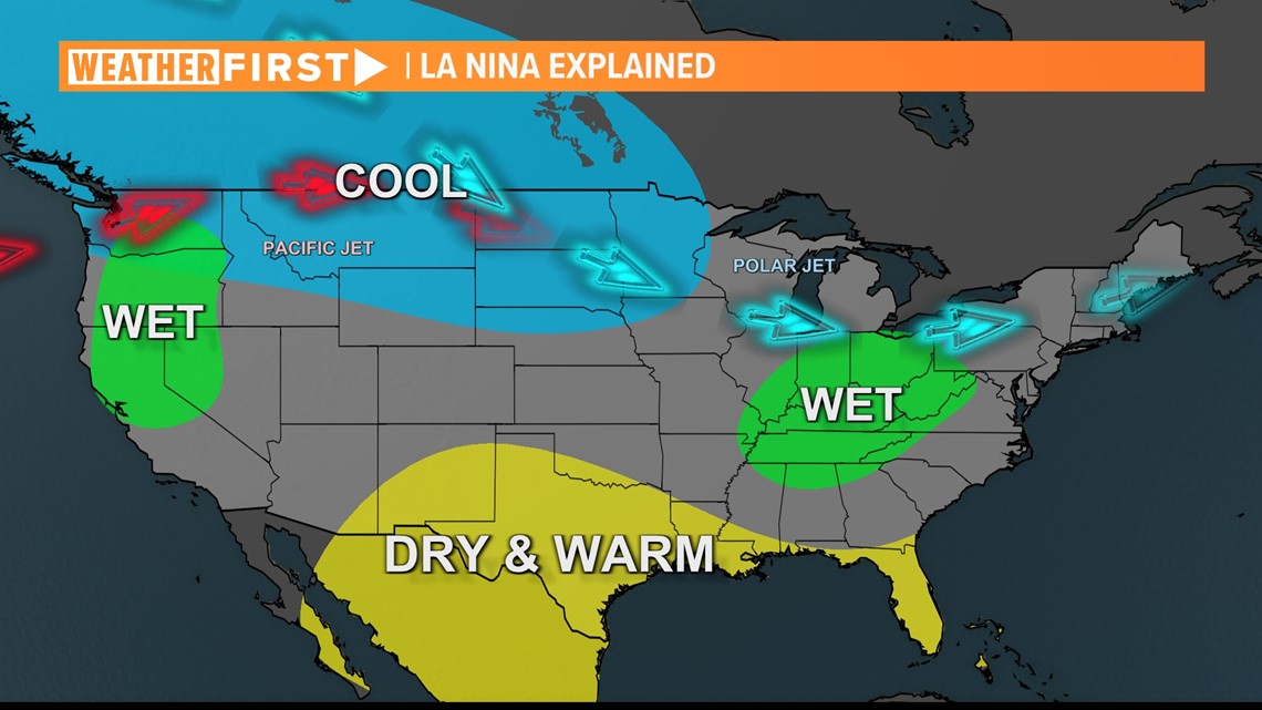
In a La Niña event, Central Texas is usually warmer and drier than average. The Climate Prediction Center says this will exactly be the case for not only us locally, but for most of the country as well.
What is La Niña?
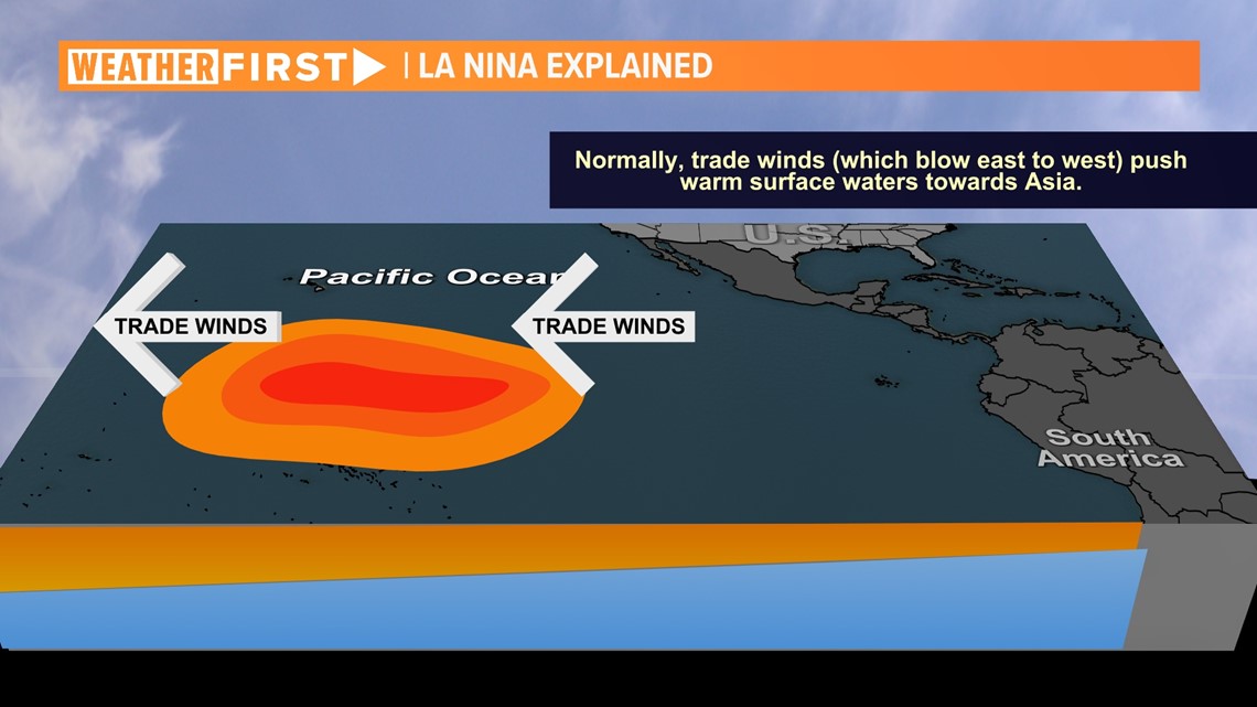
Trade winds in the Pacific usually blow warm water away from the Ecuadorian coast and the Galapagos Islands and pushes it toward Asia.

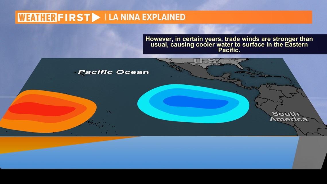
However, there are occasions where the trade winds are stronger than normal, leading to a process called "upwelling," where the cold water deep beneath the surface is elevated to the surface.

The result of this process is warmer and drier conditions for most of the nation, including us locally.

Local effects of a La Niña summer
The Climate Prediction Center is predicting a hotter and drier summer than average not only for Texas, but across much of the nation. While a La Niña pattern is likely for meteorological summer, it is unlikely to be a very strong La Niña, as a stronger pattern would also include cooler and wetter conditions for much of the Pacific Northwest.

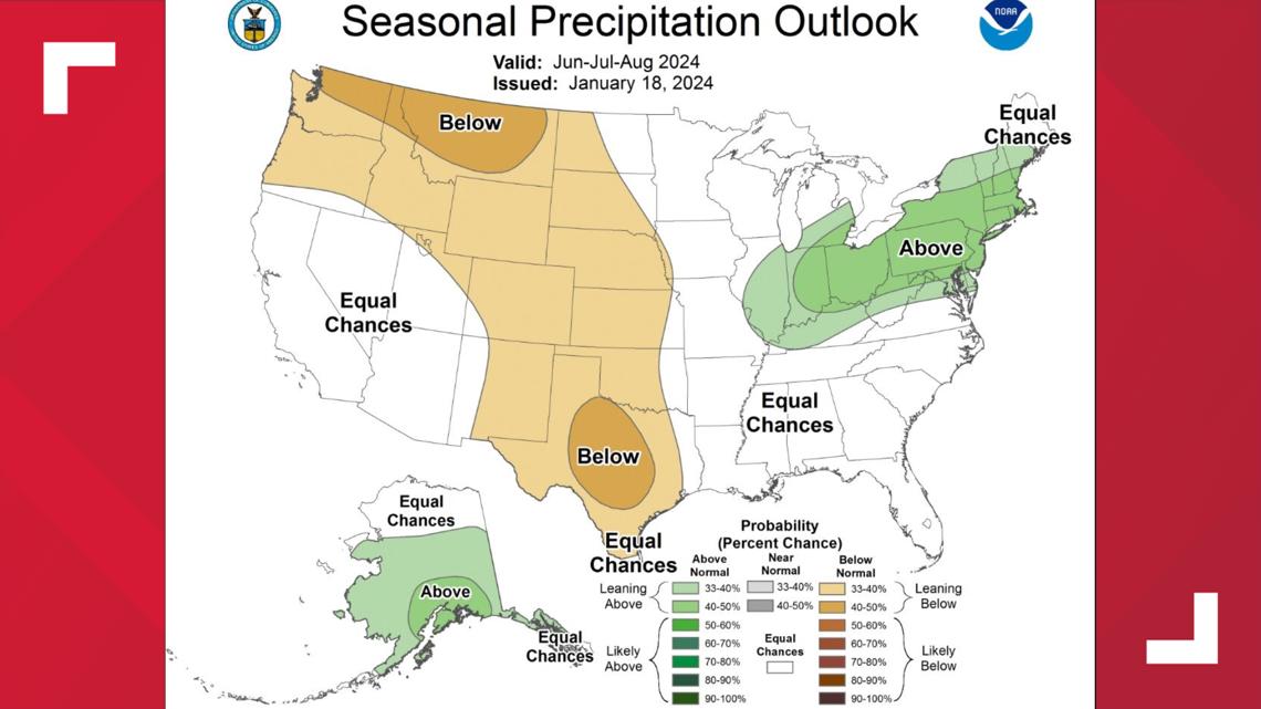


Be prepared for a hotter and drier summer in Central Texas, but don't expect it to change by as much as previous La Niña years. This is still several months out, so forecasts can change. Stick with KVUE as we track this throughout the spring, and we'll be sure to let you know if anything changes.

