AUSTIN, Texas — Editor's note: This blog is no longer being updated. Here's a look at your 7-day forecast.
Latest updates:
12:09 a.m. – A Severe Thunderstorm Warning has been issued for parts of Gillespie County, including Fredericksburg, until 1:15 a.m.
11:15 p.m. – The Tornado Warning has now expired.
A Severe Thunderstorm Warning has been issued for parts of Hays, Blanco, Gillespie, Llano and Burnet counties until 12:15 a.m. Winds of up to 70 mph and penny-sized hail are possible
10:52 p.m. – A Tornado Warning has been issued for parts of Blanco, Hays and Burnet counties until 11:15 p.m. Take shelter immediately if you are in the path of this storm.
10:35 p.m. – A Severe Thunderstorm Warning is in effect until 11:30 p.m. for portions of Blanco, Burnet and Travis counties.
Forecast:
Tired of the heat and humidity? Well, you're in luck – kind of.
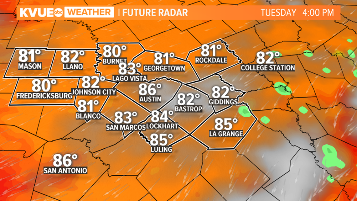
A rare, late-season cold front will move through Central Texas Monday night. This will bring a round of storms including a risk for a few strong ones and then a quick drop in temperatures to the 80s for Tuesday to go along with lower humidity.
The exact timing remains fluid, but after about 9 p.m., we could have a broken line of storms rolling in from the north. These storms should move quickly southward through the late afternoon hours and the evening.


Given ample instability and moisture to work with, it's possible that a few of these storms through the evening hours could be strong to severe with gusty winds and perhaps some hail. The Storm Prediction Center includes all of the KVUE area in the "marginal" – level 1 of 5 – risk for severe storms.


Behind the front, we're left with just cloud cover by Tuesday morning and a light northeasterly breeze. The combination of these two factors will keep humidity down and afternoon highs only in the 80s. This is not a common occurrence for this time of the year and will be much appreciated by some.
Unfortunately, it won't last long. A quick return to southerly flow will bring the heat and humidity back by Wednesday with highs in the mid- to upper 90s once again to close out the week.


The KVUE Storm Team will continue to closely monitor this developing forecast.
In the meantime, the extended forecast can be found below:


