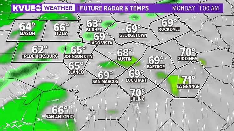
AUSTIN, Texas — A quick storm chance rolls in on Sunday night with a Pacific cold front. This won't be much rain, but we're looking at about a 20-40% chance for scattered showers and storms.


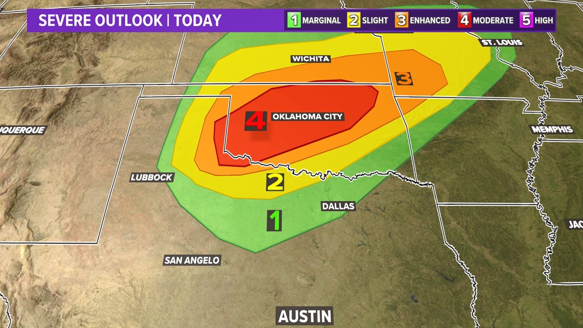
The higher storm chances likely remain north of our area where there will be a threat for severe weather. Locally, we can't rule out some breezy winds across the Hill Country, but overall the severe weather risk is low at this time for Central Texas. However, portions of western Oklahoma are under a moderate risk for severe weather, where strong tornadoes are possible, but derecho-like straight-line winds are the main threat.

Behind this system, we're tracking stronger winds that could gust up to 35 mph, and combined with drier air, could increase our fire weather potential in the Hill Country, where pockets of Llano and Gillespie counties are under a "very high" risk from the Texas A&M Forest Service.

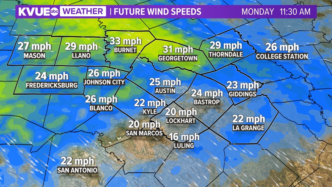

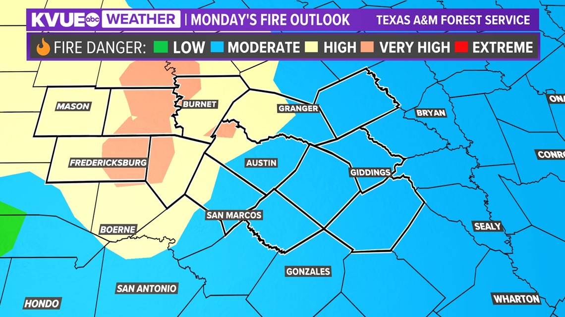
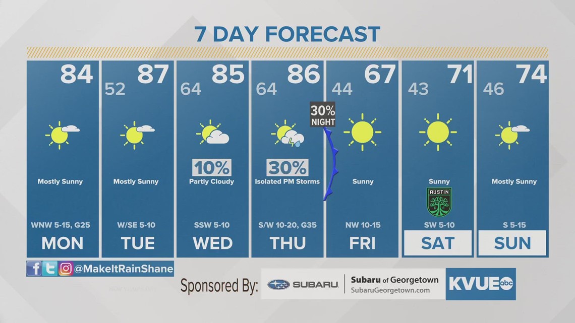
Additionally, there's not much if any cooldown. The middle of the week will once again soar to the mid- and upper-80s as we close out the month of February. We will need to watch the wind speeds for Monday, as a fire weather concern may again pop up with the stronger winds.
The KVUE Storm Team will continue to monitor this developing forecast.
In the meantime, the extended forecast can be found below:

