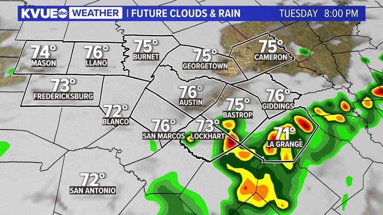
AUSTIN, Texas — Drier weather is about to begin, but this evening brings a final opportunity for rain and storms, especially south of Austin.
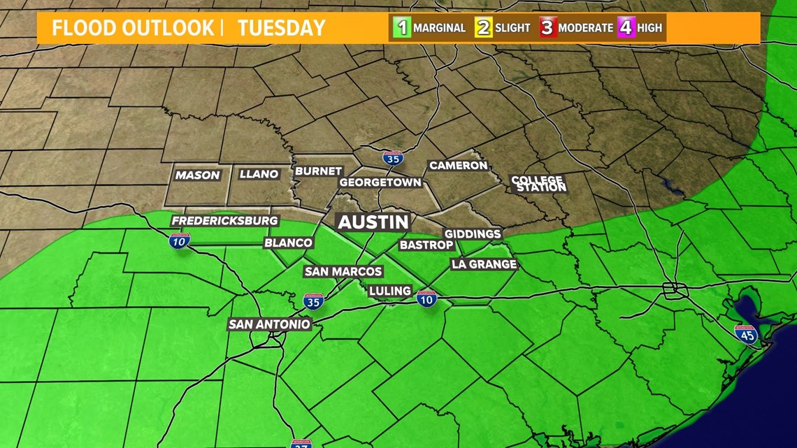
We don't expect major impacts or severe weather, but some minor flooding remains possible due to runoff from already saturated soil. In fact, the WPC has cut the north side of Austin out of the marginal flood risk for the rest of Tuesday.


Tuesday evening will bring one last chance for scattered storms before a drier forecast takes hold for mid-week. There will be a 30% to 40% storm chance through the afternoon and evening, which will once again bring the risk for minor flooding due to saturated soil.


Some areas won't get additional rainfall, but others will pick up another inch or two of quick beneficial rain. As of noon on Tuesday, high-resolution weather models have backed off the scattered chances for storms in the afternoon and evening, leaving activity more isolated in nature.
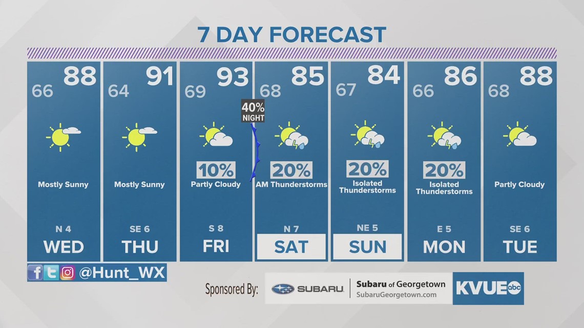
After Tuesday, the middle and end of the workweek look primarily dry and very warm. High temperatures will return to the low 90s by Thursday and Friday.
A weak cold front Friday evening brings the return of small rain chances, and a slight drop in temperatures for the weekend.
Stay with KVUE for the latest on this developing forecast
In the meantime, your seven-day forecast is below:


