AUSTIN, Texas — Editor's note: This blog is no longer updating. For the latest, click here.
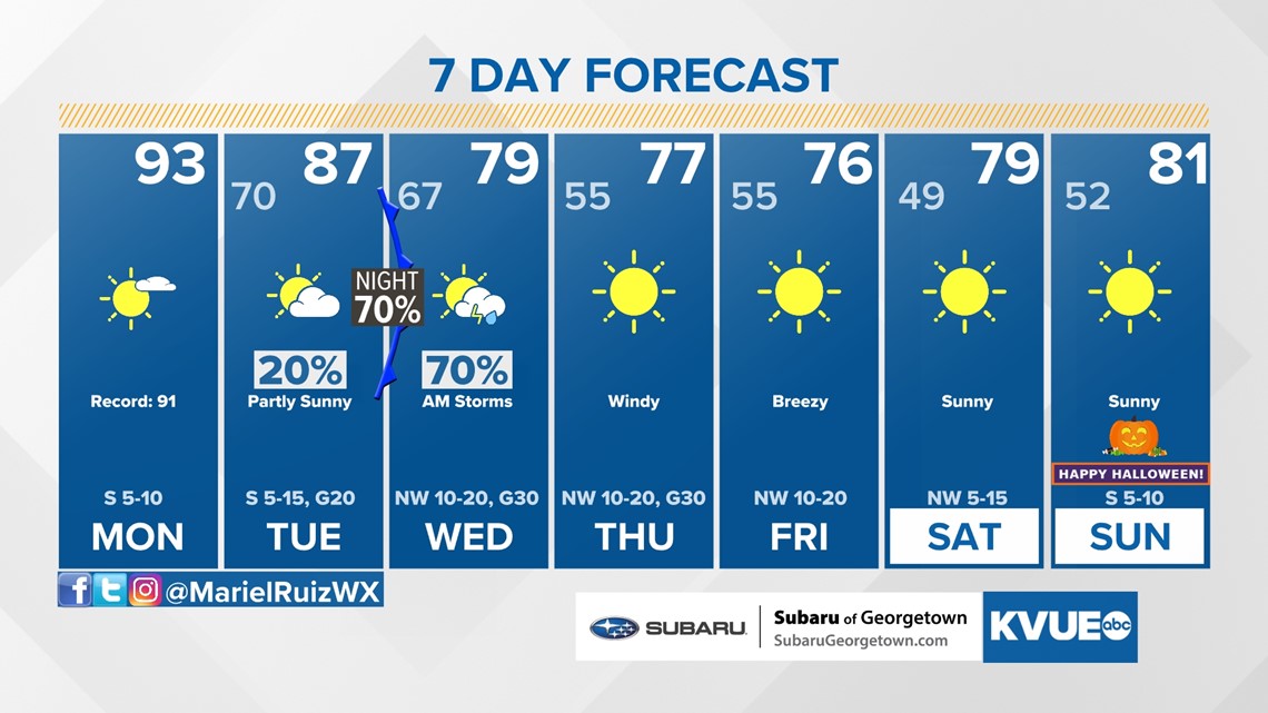
We're beginning the last week of October, but it will feel more like a mid-June Monday afternoon with record heat in the forecast. The good news is that fall-like temperatures will finally return this week and stick around for Halloween festivities.
Record heat to start the week
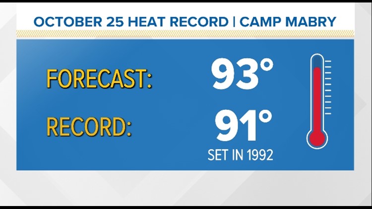
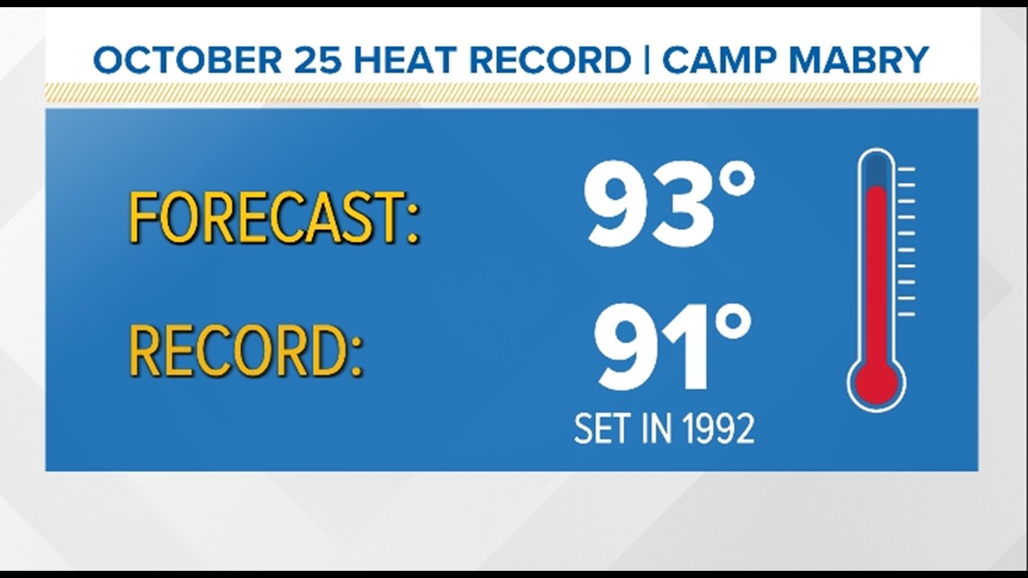
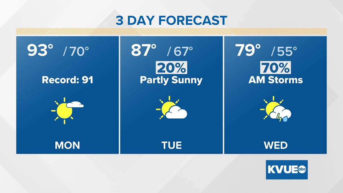
It's going to be a toasty start to the workweek. Monday is likely to bring record heat with a forecast high of 93 degrees. If this verifies, it will break the daily record of 91 degrees set at Camp Mabry back in 1992.

Each day will gradually get cooler this week, but we're still talking temperatures almost 10 degrees above average on Tuesday as clouds build in along with a breezy south wind. We'll be just ahead of the next strong cold front that will be pushing through Central Texas early Wednesday morning.

Strong cold front mid-week
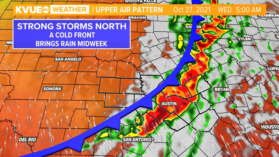
This is the same Pacific system that is bringing major flash flooding, landslides and power outages across the West Coast. We anticipate the stormy weather to kick off overnight Tuesday into early Wednesday morning for Central Texas.
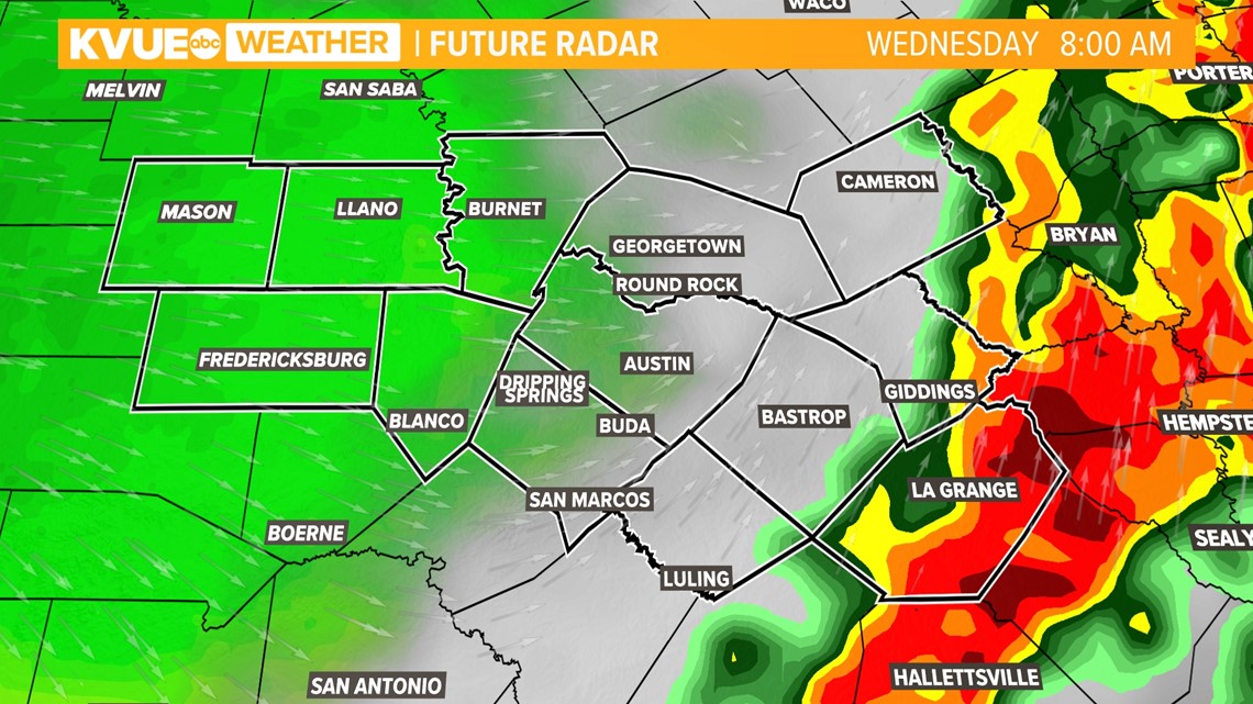
We're currently tracking a 60% chance of showers and storms for Wednesday morning's commute, and some of these storms could be strong to severe with gusty winds and large hail.

Timeline
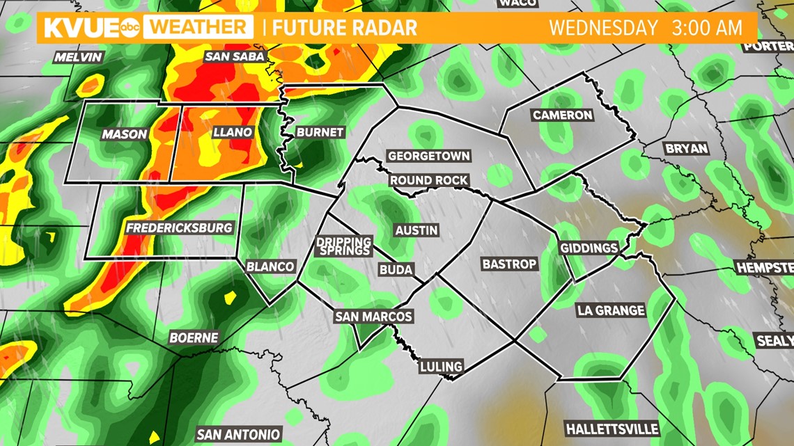
Hill Country: As of Sunday night, computer models are showing the stormy weather moving in after midnight Wednesday. This brings an overnight strong-to-severe storm threat, which means we recommend multiple ways of receiving weather alerts overnight. The KVUE app is our No. 1 recommended method where you can receive weather notifications if any warnings are issued in your area.

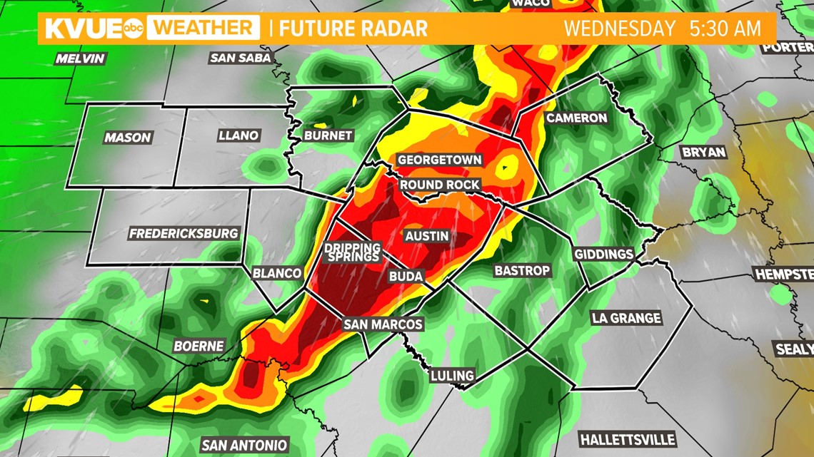
Interstate 35 corridor: The line of strong-to-severe storms is expected to push through just in time for Wednesday morning's commute. Make sure to check in on KVUE Daybreak before you walk out the door for live weather updates to see.

Eastern Counties: The stormy weather will be pushing through areas east of I-35 by mid-morning with showers and thunderstorms that could still be strong at this time. The system should clear from the KVUE viewing area by midday. This will give us clearing skies for the second half of Wednesday and a windy northwest wind shift.

The wind shift will usher in lower humidity that will stick around through the rest of the workweek and into Halloween weekend. Dewpoints will drop to the 40s, which will allow for those cool and crisp fall-like mornings to return.

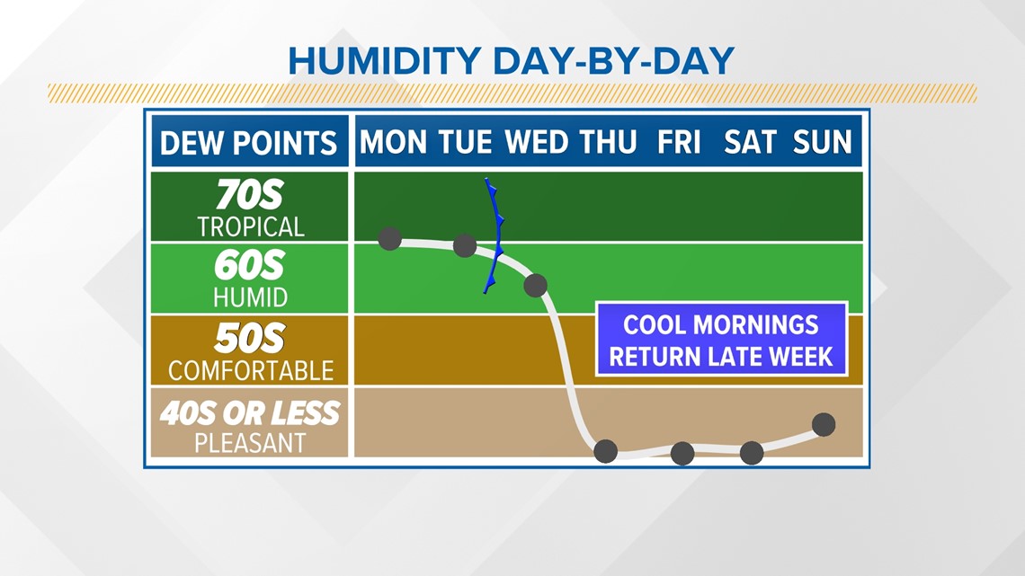
The 7-day forecast is looking mighty nice once we get through the stormy weather Wednesday morning!
We're still about one week out from Halloween, but as of right now, high temperatures will be near 80 degrees with lows in the 50s.

