AUSTIN, Texas — *A Red Flag Warning will be in effect for the counties of Blanco, Burnet, Gillespie, and Llano on Sunday from noon until 7 p.m. The warning will be in effect for Mason County until 9 p.m.
We continue to track elevated fire weather conditions as we go throughout the weekend. Areas of highest concern remain west of Interstate 35 where conditions are expected to be the breeziest.


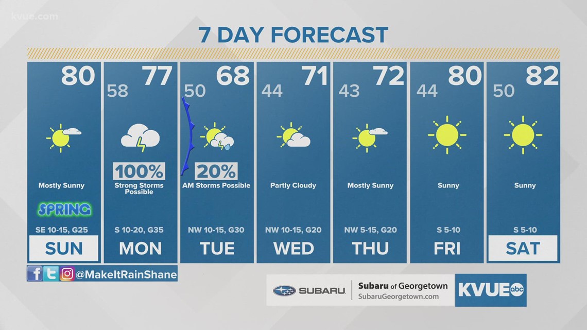
Outside of the fire potential, the weekend forecast looks quite pleasant with chilly mornings and warm, sunny afternoons. Afternoon high temperatures are expected to climb into the upper 70s and lower 80s.
It's also worth nothing the Austin Parks and Recreation Department has issued a parks burning restriction effective March 18 and until further notice to ensure the safety of park patrons and surrounding communities. This restricts the building of fires and grilling in all city parks, greenbelts and preserves until further notice. Propane stoves are still allowed in designated picnic areas only. Violations could result in a fine between $300 and $500.
Severe weather threat early next week
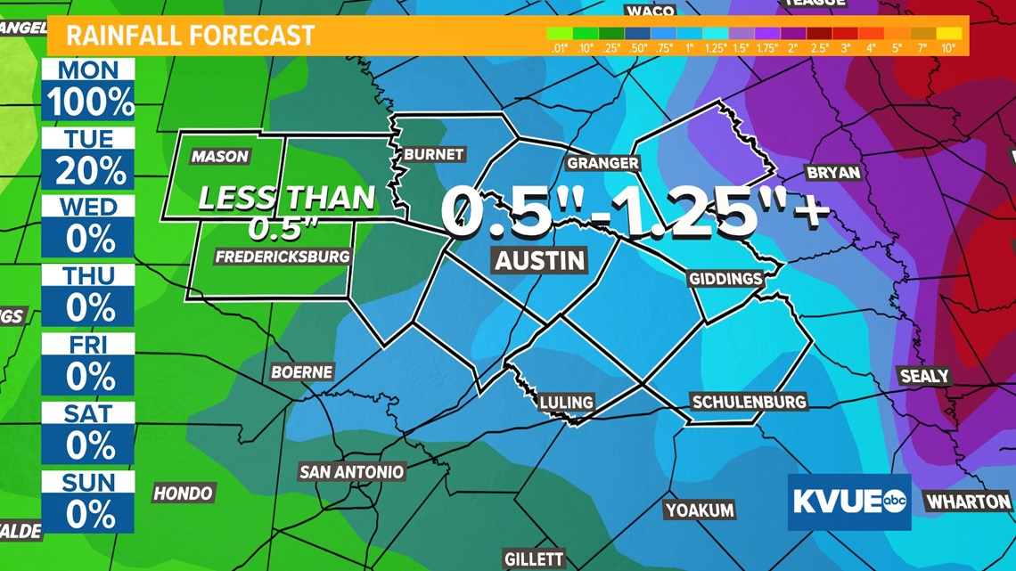
The start of next week will be a busy one with our first major severe weather threat of the season, and we want to make sure you are staying weather aware Monday through Tuesday morning. Long-range models are showing the potential for not just widespread rain, but perhaps a more organized threat for severe weather.
The Storm Prediction Center has included parts of the KVUE area in the "enhanced" and "slight" risks for severe weather. Our eastern areas appear to have the highest severe risk for right now.
All types of severe weather appear possible with tornadoes, hail, gusty winds and flooding all on the table.
We'll have to keep an eye on the flooding potential as well, especially east of Austin. Drier and cooler weather returns by the middle of next week.


The KVUE Storm Team will continue to closely monitor the forecast. Be sure to download KVUE's app for radar and updates: kvue.com/app.
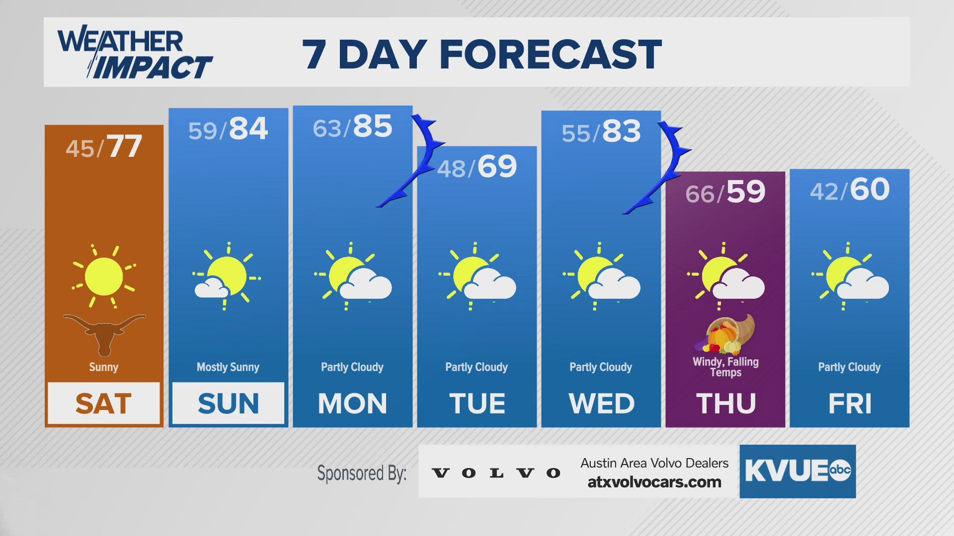
In the meantime, the extended forecast can be found below:


