AUSTIN, Texas — We've been spoiled so far this week! We've had below-average temperatures, just enough rain to water the lawns and even the pollen count hasn't been too bad.
Slight changes are in place for the second half of the workweek as rain chances go down. An upper-level ridge of high pressure will briefly build in, but it won't stick around long enough or is not nearly strong enough to bring us back to scorching heat.
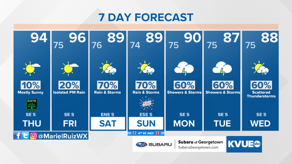
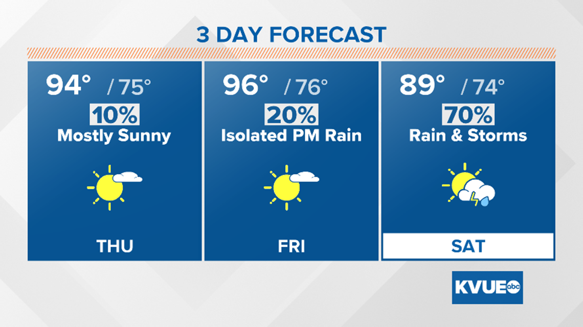
This high pressure will suppress rain chances a bit and drop them down to 10% to 30% as deep tropical moisture is still in place. Expect high temperatures to remain in the low 90s through the start of the weekend.

Download the KVUE News app to check radar, get updates and upload pictures: kvue.com/app.
The next system we'll be keeping a close eye on arrives Fourth of July weekend as another trough of low pressure brings a very rare early July front to Central Texas. Some computer models are even showing this front pushing south of the KVUE viewing area and stalling, which means a brief north wind shift may be possible at times over the weekend.
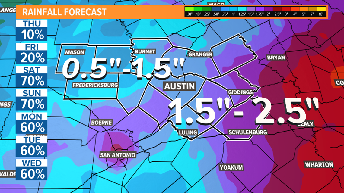
Regardless of what the boundary actually does, this will elevate rain chances Saturday and Sunday with rounds of showers and storms likely, including the possibility of strong storms.

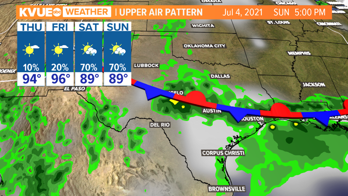
Computer models are showing rainfall accumulation totals of 1.5 to 3 inches in the next week, with isolated areas possibly seeing higher totals. Minor localized flooding can not be ruled out at this time.
This forecast is still a few days out, so it could still change. But at this time, we recommend an indoor backup plan for Independence Day celebrations.

The KVUE Storm Team will continue to monitor this developing forecast.
In the meantime the extended forecast can be found below:

