Beneficial rain fell this morning across much of Central Texas. Camp Mabry in Austin picked up a quick quarter-inch of rain, but these relatively light totals are not going to be enough to end our fire weather concerns for the week.
Rain from this morning has been quickly followed by a strong west wind that could gust 30 to 40 mph through this afternoon. Breezy conditions, ongoing drought and low humidity mean a continued threat of wildfires.
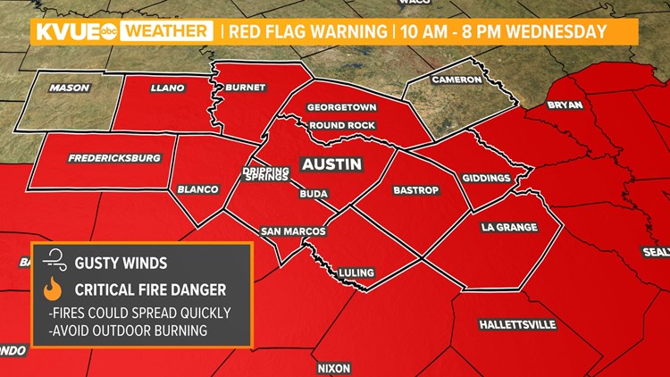
A Red Flag Warning is in effect through 8 p.m. Wednesday.

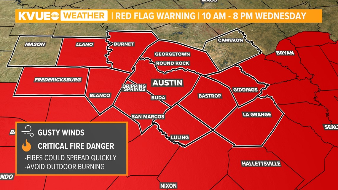
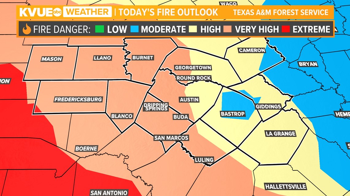
Texas A&M Forrest services show that almost all of Central Texas is in "high" to "very high" fire danger Wednesday. Please continue to avoid outdoor burning.

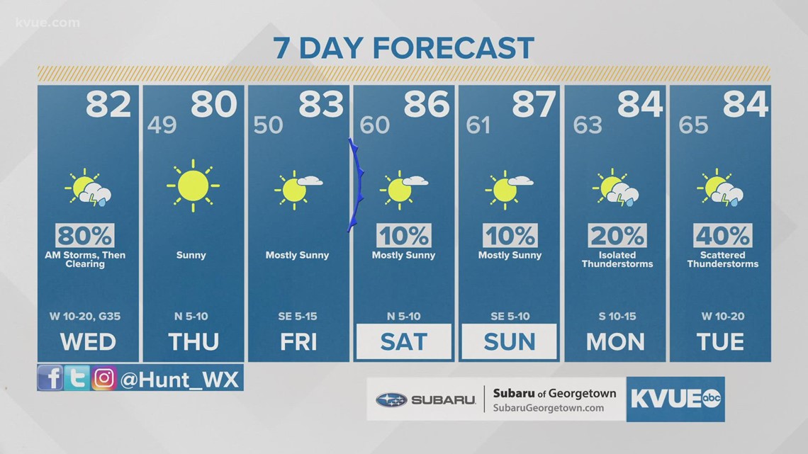
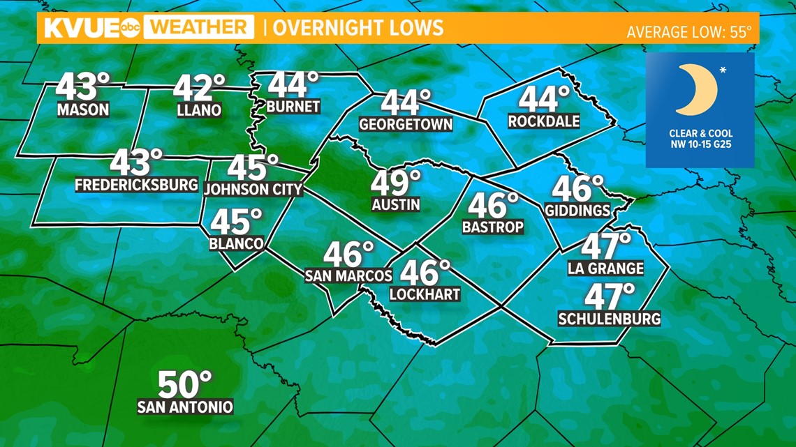
Highs this afternoon will range from the mid-70s to low-80s thanks to the warm west wind, but cooler and drier air will provide a couple of chilly mornings for the end of the workweek.
Thursday morning will begin in the low 40s for the coolest spots in the Hill Country.

The weekend is then looking warm behind a weak cold front Friday night. Plan on highs in the mid to upper 80s for Saturday and Sunday. The next chance for storms comes early next week around Monday night and Tuesday. It's possible some of these storms could be strong to severe so we'll keep a close eye on things over the next several days.
The KVUE Storm Team will continue to closely monitor this developing forecast. Download KVUE's app for updates: kvue.com/app.
In the meantime, the extended forecast can be found below:

