AUSTIN, Texas — This story is no longer being updated. For the latest forecast, visit here.
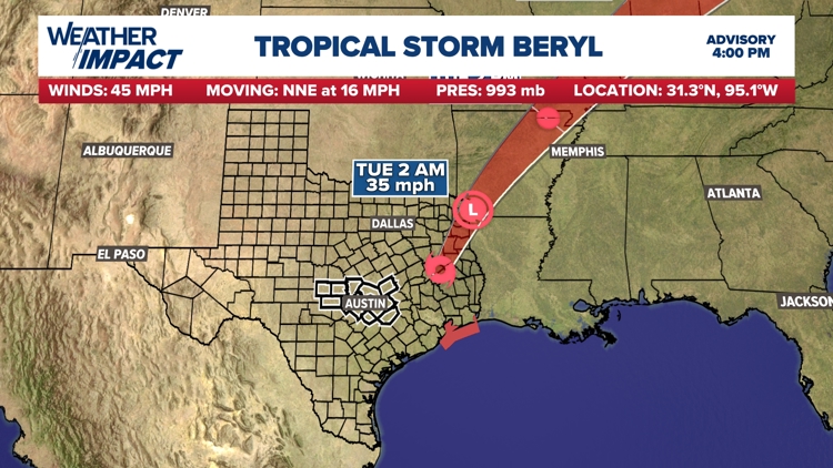
Beryl made landfall near Matagorda, Texas, as a Category 1 hurricane just before 4 a.m. Monday. Beryl is now a tropical depression moving into Arkansas Tuesday morning.
Unfortunately, the areas that desperately needed the rain in Texas missed out entirely. A sharp gradient on the dry side of the storm mean Austin and the Interstate 35 corridor haven't been impacted by the meaningful rainfall. Likewise, we expect little to no rain in drought-impacted areas in the Hill Country.
The western side of the storm is what’s known as the dry, or "clean," side. Below, you can see this is the side Central Texas ended up on, according to the latest forecast cone from the National Hurricane Center.


Ahead of Beryl, a Tropical Storm Warning was issued for Fayette County, but that has since been canceled. This was the only KVUE area county included.
Timing: Remainder of Monday
A Weather Impact Alert Day for Milam, Lee and Fayette counties began at 4 a.m. Monday and will continue through 5 p.m. Monday.
The outer core of Beryl started moving into Fayette County early Monday by 4 a.m. From there, tropical impacts ramped up and spread northward along Highway 77 through the early morning into the mid-morning as Beryl paralleled our area just to the east.
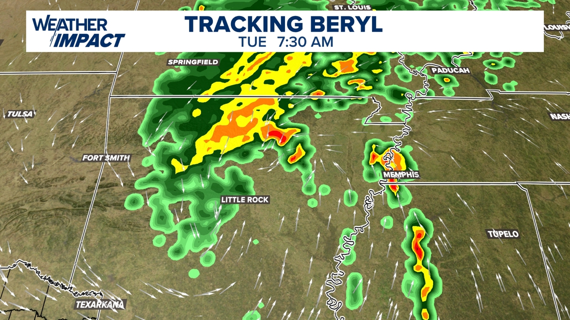
For Milam County, the core of Beryl will be pulling away by the late afternoon. This is when rain and wind impacts will start to end. By Tuesday morning, the storm will have already left the Lone Star State and will be bringing heavy rainfall to portions of Arkansas and Missouri.

Rainfall totals: How much rain to expect?
The continued eastward track shifts have reduced rainfall potential for the vast majority of the KVUE area. What once looked like the potential for several inches of rain areawide will now only provide grazing heavy rain for our eastern most locations.
The Austin metro and Hill Country will be lucky to get any meaningful rain at all. A few tropical downpours could produce an isolated half-inch or more totals for parts of the I-35 corridor, but most will be completely dry.
A very sharp gradient will set up over the Highway 77 corridors. Even for these areas, the rain totals are now looking quite marginal, but there could some periods of heavy tropical rain through Monday. We’re talking about places like La Grange, Warda, Round Top, Dime Box, Lexington and Gause.
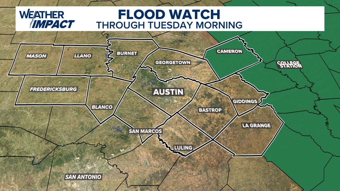
A Flood Watch was issued for Fayette, Lee and Milam counties until 7 a.m. Tuesday, but Fayette and Lee counties were dropped from it Monday afternoon and it's likely that Milam may be dropped soon as well.

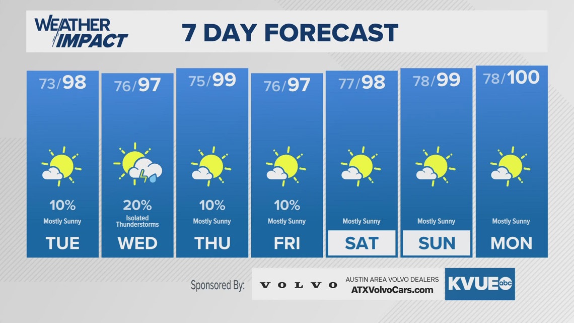
Remainder of the week
We expect most of the upcoming week to remain dry, although there is a slight chance of a stray shower or storm on Wednesday afternoon.
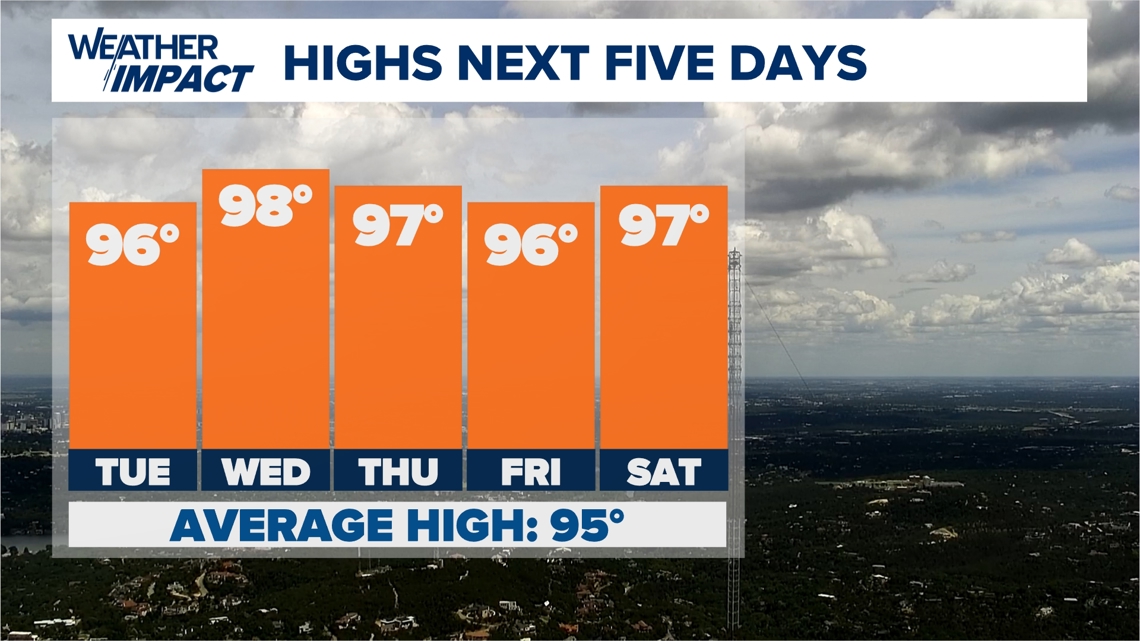
Additionally, we're right back to the summer heat pattern in Central Texas, with highs in the mid- to upper 90s throughout, with a few outside shots at triple-digit air temperatures. "Feels like" temperatures could hit the lower triple-digits. Although this is shy of Heat Advisory criteria, you still should take all necessary heat precautions.

The KVUE Weather Team will continue to closely monitor this developing forecast.
In the meantime, the extended forecast can be found below: