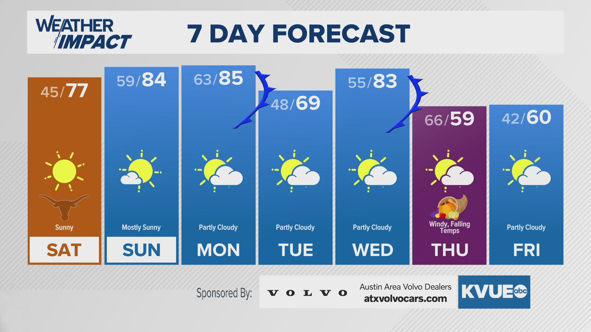
AUSTIN, Texas — A strong cold front pushed through Central Texas Friday night and brought a big cooldown and elevated fire weather concerns for Saturday. Ahead of this front, Austin saw nearly record-breaking temperatures on Friday afternoon in the upper 70s, but highs on Saturday will struggle to get out of the 40s.
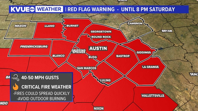
This front will bring a significant chill, but the main story will be the wind. Because of the winds and low relative humidity, there is a Red Flag Warning for the KVUE area for Saturday evening. Please avoid any outdoor burning on Saturday during these conditions.


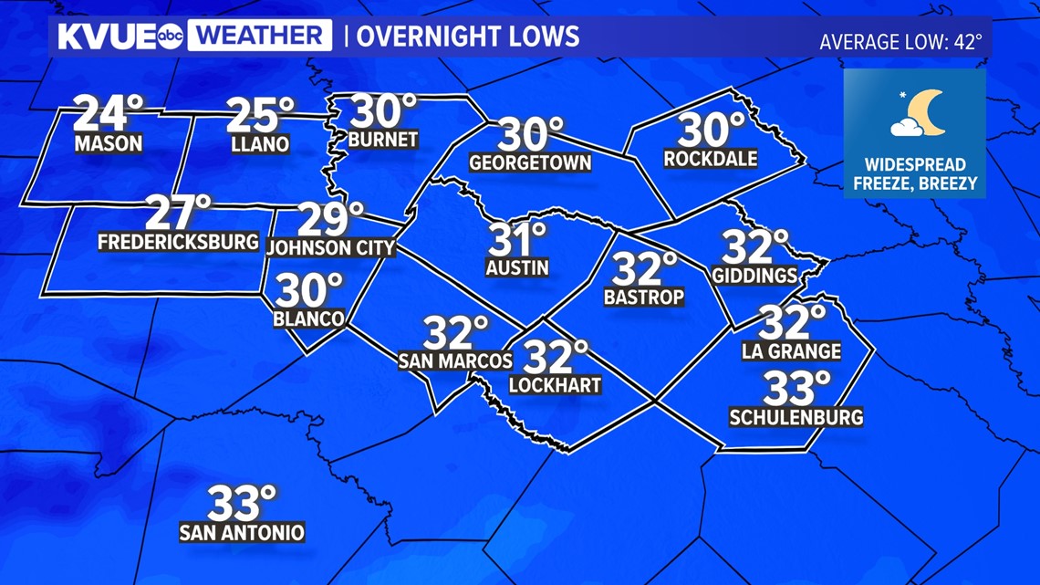
The wind speeds will gradually diminish through Saturday evening and will be light enough for temperatures to drop down below freezing under a clear sky by Sunday morning.
We're expecting this to be a widespread freeze, with Austin dropping down to about 31 degrees in the city. Although not as windy as Saturday, wind chills could still drop well into the 20s Sunday morning.

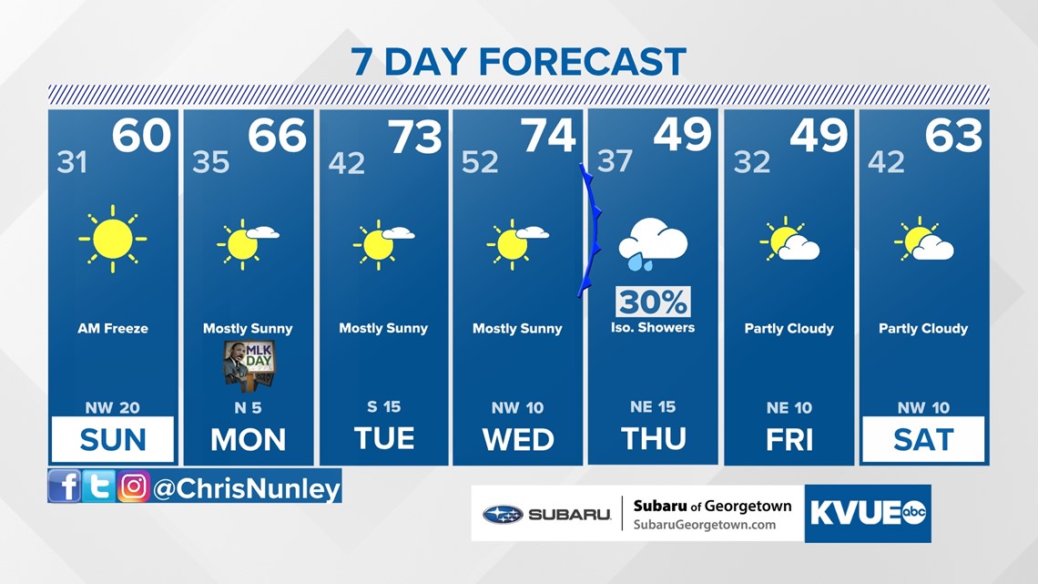
Temperatures will trend warmer through the first half of next week, with low to mid-70s by Tuesday and Wednesday. A system around Thursday and Friday could bring another cooldown and a chance for some rain, but we'll have to iron out those details over the next few days.
The KVUE Weather Team will continue to closely monitor this developing forecast.
In the meantime, the extended forecast can be found below:

PEOPLE ARE ALSO READING: