AUSTIN, Texas — After wrapping up the 10th-hottest September on record for Austin, we've been in desperate search for some signs of fall. And so far, October has not delivered.
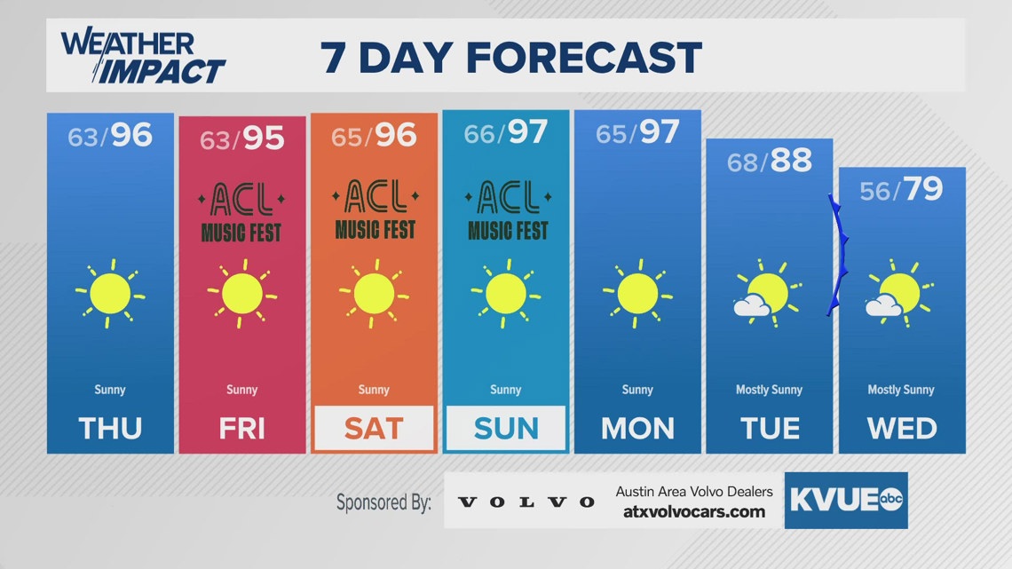
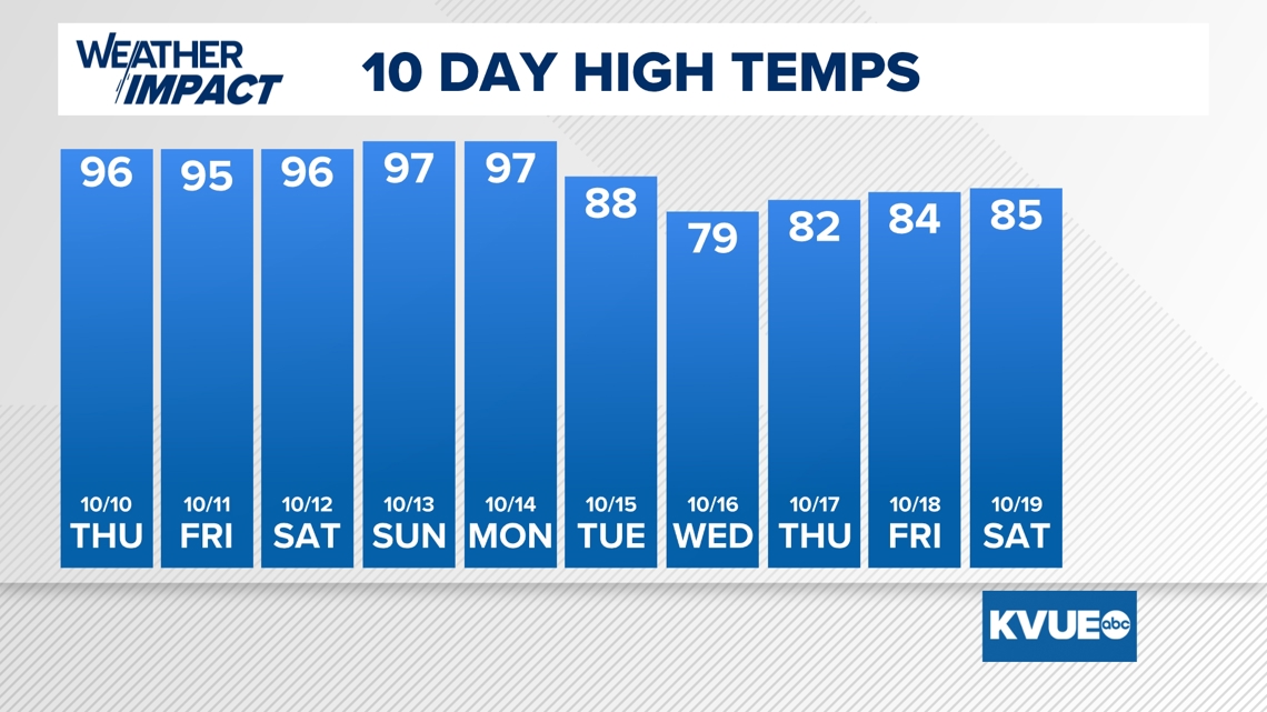
Through the first nine days of the month, the "coolest" afternoon high temperature has been 93 degrees, and highs will remain in the mid to upper 90s each afternoon through this weekend.
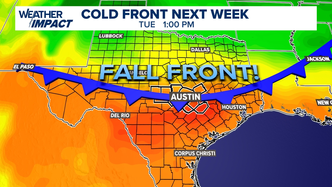
However, we're now looking ahead to some very welcome changes in our weather pattern for next week! We're seeing promising signs in our computer models that our first legitimate fall cold front will move through Central on Tuesday of next week, and behind it we could see a nearly 20 degree drop in high temperatures! We're talking about afternoon high temperatures in the upper 70s to low 80s, and morning temperatures in the 40s and 50s.

Still feeling the heat this weekend
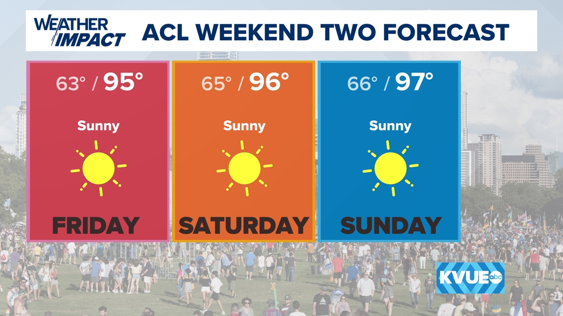
Okay let's pump the breaks for a second. Before any cool down arrives, we're tracking more hot weather through this weekend. For anyone heading to weekend 2 of ACL, make sure to stay hydrated with high temperatures in the mid to even upper 90s.
As of now, we have 97 in the forecast for Sunday. This would tie the daily record high temperature for that date. While not in the forecast, in the off chance that the temperature over achieves and hits 100 it would be the latest triple digit temperature on record for Austin.

Cold front arrives Tuesday
Ahead of the front, Monday of next week will still be very hot in the mid to upper 90s, but Tuesday is the day that our cold front should move through. We'll have to fine tune the timing in the models as we get closer, but it looks like Tuesday could be one of those odd transition days where Austin and areas to the south reach the upper 80s and low 90s just ahead of the front as temperatures already start dropping north of Austin and across the Hill Country. We currently have a high of 88 in the forecast for Austin.
By Wednesday morning we expect a refreshing and much more seasonally appropriate air mass to be in place over Central Texas. Morning temperatures will likely be in the low to mid 50s, and the afternoon on Wednesday will see high temperatures only in the upper 70s to low 80s!

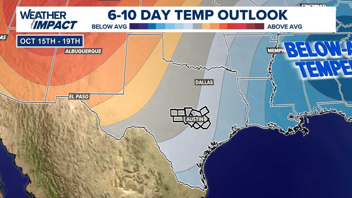
While Wednesday will likely be the coolest day, temperatures will likely stay at or below average for this time of the year through the back half of next week as is outlined in the 6 to 10 day temperature outlook from the Climate Prediction Center.

The bad news: Still no rain
.For those keeping track, it's now been over a month since the last measurable rainfall in Austin. You have the go back to September 5th. While we do have cooler temperatures on the way, they will not be accompanied by any rain. This means that our dry streak could extend well into the 40s, perhaps even approaching the top 10 longest dry streaks on record for Austin. Drought will likely continue to rapidly expand in the coming weeks unless something changes.
The KVUE Weather Team will continue to closely monitor this developing forecast.
In the meantime, the extended forecast can be found below: